Labor Day appears to be a wet one. A tropical wave over Hispaniola is aiming for South Florida and if it does not fall apart or weaken, it is set to dump a lot of rain.

The satellite image shows an area of clouds and rain over Eastern Cuba, Haiti, Dominican Republic, and the Turks and Caicos. This is the wave. The Dominican Republic has flash flood warnings for some areas being affected by the rain.
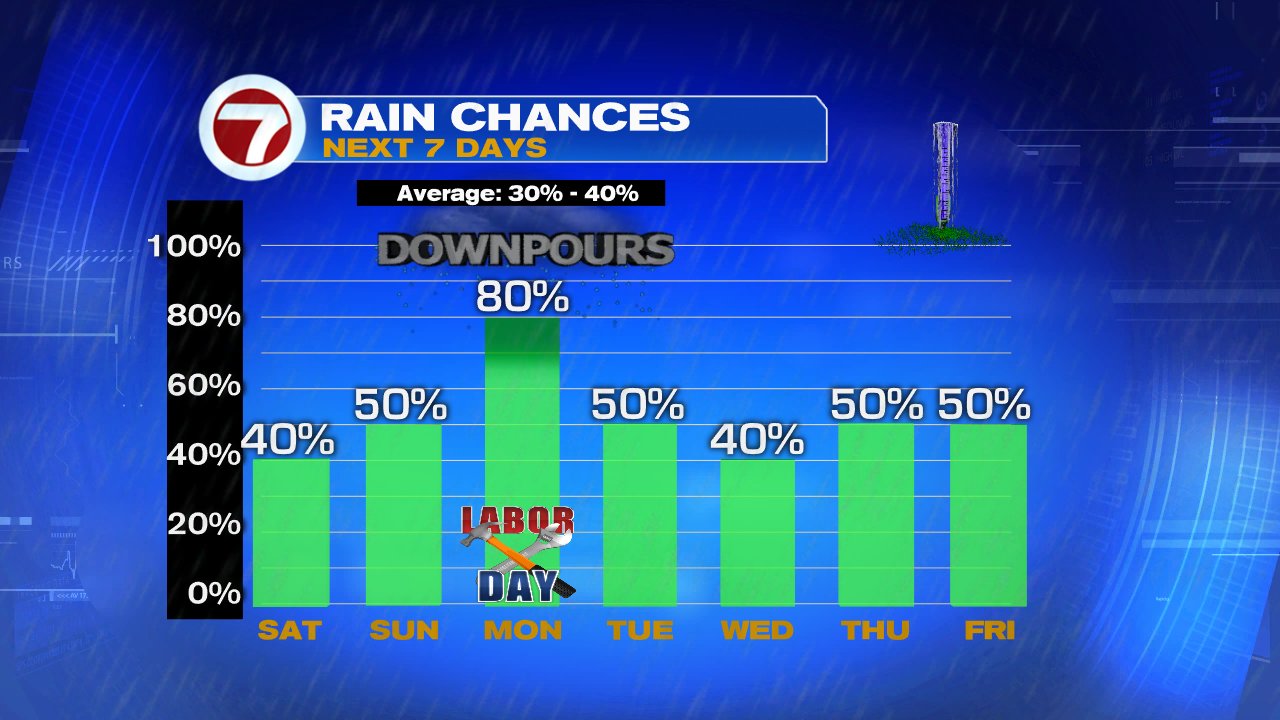
What is next?
Sunday: If it does not fall apart, it will gradually move northwest over the SE & Central Bahamas on Sunday. The winds across South Florida will pick up turning breezy along the coast, along with an increase in fast moving showers and storms. If the wave does not slow down or speed up, it appears that higher chances for rain should start to move in by Sunday afternoon.
Sunday night: This is the time frame when the wave is expected to start dropping much of its rain. The breeze could kick up to around 20 mph with possible higher gusts.
Labor Day: Unfortunately the models suggest the rain will still be around for the holiday.
A reminder, these waves/disturbances can be highly disorganized causing only a few downpours to widespread rain that could lead to street flooding.
For the moment, it seems the worst it can do is bring us heavy rain. It is surrounded by strong upper winds known as shear that will keep it in check until it reaches the Gulf of Mexico. Once there, the shear weakens and it will have some breathing room to grow.

The National Hurricane center has raised the chances for organization from 20% Friday night, to 40% as of Saturday morning. This means it has a 40% chance to become a depression or a tropical storm over a period of 5 days in the area highlighted in orange.
Once in the Gulf we should have a better idea of what is next for this wave.
No comments:
Post a Comment