Saturday, May 31, 2014

Early Tropical Development?

The hurricane season kicks off Sunday and already there is something to watch for us.  Many tropical junkies have been texting me wondering about a possible soaking next week from what may be the season's first tropical system.

This is what we know:

  • Models keep insisting on development of some sort in the Bay of Campeche.
  • Two reliable models show, whatever develops, moving towards Florida
  • Both suggest late next week/weekend potential arrival


The local weather office is keeping their eyes on this scenario as well.  The forecasters there say that between Tuesday and Friday we may get a better idea of what is to come.

LONG TERM...(TUESDAY-FRIDAY)

ALTHOUGH A CONSIDERABLE AMOUNT OF UNCERTAINTY EXISTS BEYOND THE MID-WEEK TIME FRAME DUE TO NOTABLE MODEL DIFFERENCES BETWEEN THE GFS AND ECMWF SOLUTIONS...BOTH INDICATE THE WET PATTERN CONTINUING ACROSS THE REGION.

THE GFS REMAINS BULLISH AND CONTINUES TO DEVELOP A LOW
AROUND THE YUCATAN PENINSULA/BAY OF CAMPECHE THROUGH THE MID-WEEK
PERIOD WITH A SFC TROUGH EXTENDING NEWD ACROSS SOUTH FLORIDA.

GFS Model Animation

THE ECMWF SOLUTION IS SIMILAR...HOWEVER...NOT AS AGGRESSIVE AS THE
GFS WITH THE LOW OVER THE BAY OF CAMPECHE. TEMPERATURES WILL
REMAIN AROUND AND ABOVE AVERAGE THROUGH THE PERIOD.

ECMWF Model Animation

The links above take you straight to each model's animation. All the areas shaded red are representative of high pressure systems (good), while the green tend to represent areas of low pressure (not good).
On the extreme right of the page, you should press on the forward button - this will start the animation. Some runs go out 120 hours, other more.

Towards the end of each run you will notice an area shaded green coming together in the Gulf of Mexico and aiming for Florida. This could be a possible tropical system.

The reason why we are watching this is because it could develop in an area very favorable for growth.

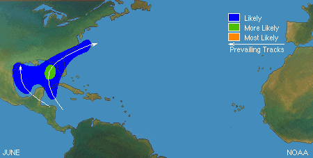
June systems usually occur either in the NW Caribbean Sea or in the Gulf of Mexico, and tend to travel north or northeast.

These bodies of water tend to heat up the fastest as we approach summer and thus can provide fuel for growth.

Pacific Connection?
This possible activity could be from an area the National Hurricane Center is watching in the Eastern Pacific.  This is what they are saying:

Showers and thunderstorms associated with a broad area of low pressure located a few hundred miles south-southeast of the Gulf of
Tehuantepec are gradually becoming better organized.

Environmental conditions are expected to become more conducive for the development
of this disturbance during the next few days as it begins to drift generally northward.

Regardless of tropical cyclone formation, this
system has the potential to produce locally heavy rains over portions of western Central America and southeastern Mexico this coming week.
* Formation chance through 48 hours...medium...40 percent
* Formation chance through 5 days...high...70 percent

Possible tracks:
Some models here take it into the Gulf, where it could then develop into a tropical depression.


WORRY LEVEL:
For the time being, Very low. Nothing has developed yet. We will probably get t-storms and pockets of rain here over the next few days, but it will NOT be from this feature.

This is a great reminder to all of us that Hurricane Season does start this Sunday and we should all try and make sure our supplies are ready.


Thursday, May 22, 2014

Official Hurricane Forecast

Today the National Hurricane Center made is 2014 Seasonal Outlook public.

For the upcoming season which begins June 1st, NHC is calling for a near normal season.

Named Systems   8-13 , the average is 12
Hurricanes    3-6  ,  the average is 6
Major Hurricanes   1-2  , the average is 3

They suggest that "El Niño", which is a warming of the Equatorial waters of the Pacific, should be responsible for keeping the season near average numbers.

"El Niño" tends to disrupt marine and atmospheric currents alike around the globe and thus should make conditions a bit more hostile for systems to form over in the Atlantic Basin.

The explanation is too simplistic, since we do not know yet how strong "El Nino" will be and when it will reach its maximum potential. As of now the projections call for a better the 65% chance that "El Nino" will happen by mid Summer.

Even if it does take place, DON'T let your guard down.
1992 was an "El Nino" year and we got slammed by Hurricane Andrew a category 5 system that devastated Deep Southern Miami Dade County.  This is why everyone in the Hurricane Forecasting community will always tell you, "It only takes one".

So prepare accordingly. Many of us have been through this before and we do not panic or stress. We get things ready and when Mother Nature throws something our way, we act accordingly.

If you are new to the area, I have just the thing for you. WSVN will air a how to prepare program on May 30th at 8pm called, "Surviving a Storm".

I will have an in-depth interview with the director of the National Hurricane Center Dr. Richard Knabb who will tell you why its so critical to know your evacuation zone.

Its very important , as many advisories from now on will be water based.  More people die from storm surge and flooding than from any other threat from a hurricane.

The show is full of handy tips on what to do in case a hurricane approaches. For that matter, we should all watch and review our plans together .

I'll see you then.

Wednesday, May 21, 2014

A new meteor shower?

It could be.

The thing is, most astronomers don't know what to expect.  Back in 2004 a small and dim comet  was discovered by the Lincoln Near-Earth Asteroid Research project . They named it Comet 209P/LINEAR.
It orbits the sun roughly once every 5 years.

Experts tell us that the debris left behind by the comet on its last go around between 1803 and 1924, may be in the Earth's path. 

If this is correct we should be able to see a good meteor shower this Saturday Morning.
 
No one has ever seen this before, and if it does take place some areas could see up to 1000 meteors per hour. As usual, for us here with plenty of light pollution, we need to go away from city lights for best viewing.

So set your alarm clocks Friday night, for just before 2 o'clock Saturday morning. For you sky lovers, experts tell us many meteor bursts can happen hours before and after the scheduled event.

Keeping my fingers crossed the astronomers are right on this one.


Tuesday, May 20, 2014

Rain,rain, don't go away!

May 20th is the typical start of the rainy season in South Florida. It can run all the way through Mid-October and provide us with up to 44" of fresh water. This in turn refurbishes the aquifers across the area.

The "Rainy Season" is part of the overall South Florida weather pattern, and a very important one. Here is a list of some common questions regarding this soggy cycle.


  • This year our rainy season is running late. Why? 

We can blame it on a persistent jet stream keeping a well established dry air mass over us longer than expected.


  • Can this be blamed on "El Niño"?

No. As a matter of fact a report by NOAA released recently suggests that even though the Equatorial waters of the Pacific are warming, they remain near normal levels and so for the time being, "El Niño" remains in a neutral phase. It is forecast to emerge during late summer.


  • We had strong storms last week, doesn't that mean the start of rainy season?

Good question but, no. All that rain was due to an Out-of-Season cold front that made it all the way South into our area.


  • How can you tell when the "Rainy Season" has started?

Here is the formula for determining when it has begun.
We need three consecutive days of the following:

  1. Sea surface temps need to be at 80 degrees or above
  2. The dew points have to be over 70 degrees ( amount of moisture in air)
  3. And of course, thunderstorm activity

As of this moment, this recipe has not been met.

For many, our "Rainy Season" is a nuisance but it is vital for our way of life.
We get 70% of our yearly rainfall during this period equaling anywhere between 33 - 44 inches. This keeps our water table healthy, and nurtures our South Florida foliage.

By the way, the latest start to the "Rainy Season" since 1956 is June 9th, 2011 . The way things are going we may come close to the late start date.


Monday, May 12, 2014

If your grass needs water...

Better chance of rain from Wednesday through Friday.

It was a very nice and dry Mother's day weekend, but Mother Nature is asking for some rain here. Plenty of parched lawns and grass fires attest to that fact. It now seems we may get a good soaking by the middle to the end of this week.

I am looking at two areas that should impact South Florida in the days ahead.

  • Very, very out of season cold front
  • Patch of tropical rain

Lets begin with the front draped across the nation's mid section.

On the map you can see the blue line with small triangles attached, this is the leading edge of cold air.

This push of cold air flying South out of Canada, is making its way into the Mississippi River Valley, and running into warm moist air out of the Gulf of Mexico. This clash may lead to severe weather across Tornado Alley from Texas North through the Great Lakes.

This front is expected to get pushed Southeast by the jet stream and by Wednesday it should be somewhere across Florida's Panhandle. It will trap some moisture ahead of it giving us a better chance for rain.

The chance will increase through Friday when the front itself moves over South Florida.

Typically these fronts so out of season do not make it all the way here, but models are being very persistent so I'll keep a chance of rain through the end of the week.

Now lets look at the tropics for the area of clouds and rain.

This satellite picture is an enhanced infrared version. The darker greens, yellows and reds represent heavier rains.

The view is centered over Hispaniola. Cuba is to the left and South Florida in the Upper left corner.

This area of clouds and rain is by no means organized as you can see cloud movement in all directions.

For the moment its causing pesky rains for Puerto Rico, Haiti and the Dominican Republic.

Even though most of the heavy rain is moving northeast, there is some approaching the Southeastern Bahamas.

Models suggest this rain should be near the NW Bahamas and South Florida by Wednesday or Thursday. This added moisture could make a soggy scenario for us even wetter.

Sunday, May 11, 2014

Puerto Rico Rain

While our rainy season is on the verge of firing up, it is already underway throughout the islands.

Tropical moisture is moving in for our friends in Puerto Rico. The potential is there for heavy rain over the next few days.  Because of this, the Puerto Rico Weather Office has issued a flood advisory until Monday night.
* FLASH FLOOD WATCH FOR PORTIONS OF PUERTO RICO AND ALL OF THE
  U.S. VIRGIN ISLANDS...INCLUDING THE FOLLOWING AREAS...IN PUERTO
  RICO...CENTRAL INTERIOR...CULEBRA...EASTERN INTERIOR...
  NORTHEAST...PONCE AND VICINITY...SAN JUAN AND VICINITY...
  SOUTHEAST AND VIEQUES. IN VIRGIN ISLANDS...ST CROIX AND ST.
  THOMAS/ST. JOHN/ADJACENT ISLANDS.


This tropical moisture will continue to make its way West and eventually arrive in South Florida by midweek.

Short term:
Heavy rain possible for Puerto Rico

Mid Term:
Some pockets of heavy rain for Hispaniola by Monday and Tuesday.

Long Term:
Wednesday through Friday a chance for rain for South Florida.

I'll keep you posted