Thursday, August 31, 2017

Troubling "Irma"

The National Hurricane Center is following closely the latest developments from Tropical Storm "Irma". This system should become a hurricane today in the Far Eastern Atlantic. Its situated roughly 600 - 700 miles west of the Cape Verde Islands. Movement shall remain almost due west for the next few days.

The satellite imagery shows a good looking healthy system with developing feeder bands.

The environment surrounding "Irma" will allow it to intensify over the next few days.

It may reach major status with winds over 111 mph as it nears the Lesser Antilles.

There is little shear in its path and water temps are warm so it has the fuel it needs to grow, free of obstacles.

In the long term, it may encounter some dry air that has a small chance at debilitating "Irma".

Where is it headed?
This is a system that needs watching by everyone down the road. It will get pushed West by High Pressure to the north.  This will keep Irma traveling more or less in a west-northwest trajectory. In about 2 - 3 days however, the high dips south aiming "Irma"towards the Islands. After that, models are not in agreement.


Lets review a few of the more detailed model outlooks:
The CMC, shows a small green dot just north of the Leeward Islands in about 5 - 7 days. The darker the color and tighter the lines, the stronger the  system. This model places an intense storm northeast of Puerto Rico. It also keeps high pressure, shown in the red blobs, split open over the East Coast of USA. This may be a path to take but it may include the Bahamas and South Florida in its route.


The European Operational Model maintains the high pressure dome closer to the East Coast keeping "Irma" on a collision course with Puerto Rico, Hispaniola, Bahamas, Cuba, So Florida and maybe the Gulf States.


The GFS Model is also buying into High Pressure holding firm and pushing "Irma" towards the Bahamas and possibly South Florida. Notice in this run there's a second little dot by Texas. This model is forecasting another system to possibly hit the Texas/Louisiana coast in the days ahead. Keeping my fingers crossed that does not happen.


The NHC official forecast cone for "Irma" is a mix between the Global and GFS models.
Everyone across the Islands to South Florida should keep monitoring this as it could turn out to be a strong system.


Friday, August 18, 2017

Harvey, a Low, and a Wave.

As we move into the weekend, there is plenty to watch. We start with an area of clouds and rain east of the Lesser Antilles. It is an area of Low pressure with a high chance at becoming a depression or a Tropical Storm over the next few days.

The area has been deemed Invest92L, as a feature NHC would like to INVESTigate further. On satellite it shows up as a red dot towards the right of the picture.

Overnight, this low showed more thunderstorm activity as it moved in a west/northwesterly component at around 20 mph.

If more thunderstorms pop up, it could quickly become  a named system. So far no recon missions have been planned.

The chances for development are at 70%.  If it organizes into a storm it would be called "Irma".


If it does develop, where would it go?
Most models agree that in the short term, 3 - 5 days out, it will move northwesterly, tracking very close to Puerto Rico, Southeastern Bahamas, and Eastern Cuba. After that, it may even reach South Florida.


What does it have working for it?
It is traveling over warm waters and that can give it the fuel it needs to form. Even warmer waters lay ahead as it reaches the Bahamas and Florida Straits.

What does it have working against it?
Now nothing, but in a day or two, strong upper winds pop up that should knock it down or at least keep it in check.

Keep your eyes on this one just in case.

Another Wave to watch:
There is also a Tropical Wave just north of Hispaniola loaded with moisture and heading our way. Waves are very fickle, they can grow quickly or fall apart just as fast. If this one does not fall apart, it could brings us some downpours this weekend.


Tropical Storm Harvey:
It is impacting the Windward Islands with top winds of 40 mph. This is not a huge wind event, but more of a rain producer. Total accumulations of 2 - 4 inches are expected that will lead to localized flooding, land and mudslides.


Once it enters the Caribbean Sea, it should move mostly in a straight line missing most of the islands. Unfortunately it appears it will strike parts of Central America and Mexico, just under Cat 1 strength.


I'll keep you posted.

Thursday, August 17, 2017

Possible Tropical System Later Today

There's plenty of activity in the Tropics, but one area is on the verge of becoming a depression or even a Tropical Storm as early as this evening .  The National Hurricane Center started issuing advisories on this system, calling it "Potential Tropical Cyclone" number 9.  They are doing this before the actual system organizes to give residents in its path an earlier chance at preparations.
The "Nine" is next in line as far as the number of storms so far this season.

The area of low pressure is roughly 350-450 miles east of the Lesser Antilles with top winds of 35 mph.

A recon mission is scheduled for this afternoon and depending on what it finds, they may upgrade its status.

A closer look at satellite imagery shows an impressive spin just East of the Bahamas, THIS IS NOT the one being tracked. This is an area of low pressure in the upper levels of the atmosphere. It may cause some rain across the SE Bahamas, but it is NOT tropical.

The area being tracked by NHC is the small spin just east of the Lesser Antilles.

Even if it does not develop, gusty winds will impact islands of the Lesser Antilles on Friday, with possible rain amounts of 2 - 4 inches for Martinique south to Grenada. This will bring along the threat of flooding, land and mudslides.

Watches and Warnings have been issued for the following areas:
A Tropical Storm Warning is in effect for...
* Martinique
* St. Lucia
* Barbados
* St. Vincent and the Grenadines

A Tropical Storm Watch is in effect for...
* Dominica

A Tropical Storm Warning means that tropical storm conditions are expected somewhere within the warning area,in this case within 24-36hrs.
A Tropical Storm Watch means tropical storm conditions are   possible within  watch area, in this case within 24-36 hours.


Where is it headed?

This Potential Tropical Storm (Will be named Harvey), will be a big worry for everyone down the road. After its run-in with the Lesser Antilles, it will shoot a straight line across the Caribbean until reaching Central America.

Intensity forecasting is very difficult and with so much hot water in this area for fuel, this system has a chance to grow strong.


We'll be watching

Wednesday, August 16, 2017

Tropics are Heating Up

Five areas to watch over the next few days, 
two of which may be headaches down the road.

As of Wednesday morning, we are looking at 5 areas in the Atlantic Basin.
The tropical activity stretches from Hurricane "Gert" in the Western Atlantic to a wave in the Caribbean, two lows in the Mid Atlantic, and another wave off the West Coast of Africa.


Lets review each:

  1. Hurricane Gert: Tied Former Hurricane "Franklin" Tuesday night, for strongest system in 2017 with top winds of 85 mph. A front will move off the East Coast of USA on Wednesday keeping "Gert" away from any land areas. This will be a "Marine Hurricane" or an open water storm.  It should die out sometime over the weekend as it moves over the "Hurricane Graveyard" or the cold waters of the Northern Atlantic.
  2. Tropical Wave in Caribbean: This is a very weak wave with little moisture. Its moving Northwest and if it can survive, the northern edge of the wave may push some added downpours to South Florida, by the end of the week. Waves are very fickle, they can grow quickly or fall apart just as fast. We'll be watching it.
  3. Broad Area of Low Pressure: This feature has a medium chance for development as it moves west. It may be a worry for the islands next week.
  4. Broad Area of Low Pressure: This is traveling North/Northwest. This too has a medium chance of becoming a depression of a tropical storm over the next 5 days.
  5. Tropical Wave: This is just coming off the West Coast of Africa today. NHC is giving it a medium chance for development through next Monday.

Lets focus on Features Three and Four

This is what the National Hurricane Center is saying about the chances each of them have to develop over the next 5 days. If they do form, it should happen somewhere over the areas highlighted. This is NOT a forecast path, but the area models think something may form.

The two Lows are the ones I am watching closely.

The nearest one to the Lesser Antilles is roughly 1000 miles to the East, traveling towards the islands at around 15 - 20 mph.

It has been deemed "Invest91L" as it is an area NHC would like to INVESTigate further.

This area of clouds and rain should navigate into the Caribbean Sea sometime on Friday,

There is a chance it could develop just before crossing over from the Atlantic.

Conditions become less favorable for organization once it enters the Eastern Caribbean Sea.

Early Model Runs on Invest91L:
Models need a good staring point in order to provide an accurate forecast track. Since nothing has organized yet, there is no center fix, therefore they are just offering an educated guess.

If something were to happen with Invest91L, it appears the most likely course will be west over the Lesser Antilles and then the Caribbean.

For you across the Islands, this is a good opportunity to review your supplies just in case Mother Nature whips up a storm.

We are hoping nothing develops, but preparation is always best.

Early Model Runs on Invest92L:
This broad low is situated a few hundred miles west/southwest of Cape Verde. Its moving west/northwest at around 15 - 20 mph. It has a short window of opportunity for development.


First, it has to battle Saharan Dust (shown in the orange shades) which is depriving it of much needed moisture to grow. The dust is encroaching the northern sector of the Low. Second, upper air conditions turn hostile by the weekend.

The models show if anything develops, it will border the Bermuda high sitting to its north and possibly aim for the Bahamas.


Why so much activity?
We are diving head first into a mini season within the hurricane season, known as "Cape Verde Season".

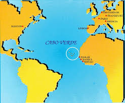
This time of year, disturbances come off the West Coast of Africa and either go over or near the Cape Verde Islands, with some developing down the road. This is why the season is named after the islands.

"Cape Verde Season" runs from Mid August thru October.

These systems tend to be stronger and last longer than most.

The good take away from all this, is that dozens and dozens of these disturbances emerge into the Atlantic, but only one or two organize and go on to become hurricanes.


By the way the peak of hurricane season is right around the corner, that being September 10th.


Saturday, August 12, 2017

New Depression #8

Tropical Depression Number 8 is forecast to become a Tropical Storm on Sunday.

As of 11pm Saturday night, NHC is tracking Depression number 8. Its sitting roughly 250-300 miles Northeast of the Southeastern Bahamas. Its top winds were clocked at 35 mph, but they should grow stronger Sunday with a chance to become a Tropical Storm. If it does intensify, it will be called Tropical Storm "Gert".


Earlier in the day satellite imagery showed the circulation had become better defined and by nighttime the system's spin had improved. This is why it was upgraded to Depression Status.

It has a chance to grow even stronger as it moves over warmer waters with a favorable shear free environment. But it may also encounter some dry air down the road limiting its potential for intensification.

NHC adds:

The statistical guidance and the HWRF favor more significant 
intensification than the global models, which generally do 
not show much deepening.  In deference to the global models, 
the NHC forecast is below the consensus, especially later in
the period. 

Later in the forecast around Wednesday, the depression will leave the tropical region and start losing its identity.

Where is it headed?:
This system should mainly be a worry for the shipping lanes as it is forecast to remain offshore and away from land areas. Even Bermuda should stay clear of this system. .


Chances Growing for Atlantic Low

As of Saturday morning an area of low pressure in the Western Atlantic has a high chance of becoming our next depression or tropical storm.  The National Hurricane Center (NHC) is giving it a 60% chance for growth in 48 hours, higher chances over five days.  If it were to develop it would do so in the area highlighted in red.

The reason for the higher chances, is that the strong upper level winds (Shear) that was keeping it disorganized have weakened. The low now has breathing room to grow.

As of this update it appears the system , if it develops, should stay away from land and over the open waters of the Atlantic.


The low is just over 100 miles northeast of the Turks & Caicos (SE Bahamas) and looking a little better organized. It will continue to move northwest at around 15 - 20 mph.

The satellite loops shows areas of oranges and reds trying to spin around a fixed center. These are globs of thunderstorms coming together.

If those areas completely close off, looking like a ring, that's an indicator a system has formed.

As of this update, Hurricane Hunters are not scheduled to investigate.

The Turks and Caicos, as well as the Southeastern Bahamas, may get some rain from this Low as it travels nearby.

Where is it Going?
The models are pretty much in unanimous agreement that this low will stay away from any land areas. They suggest the Bermuda high will move East, then a front will move from Central USA to the Coast acting as a roadblock. This will leave only one path for the low to take and thats between Bermuda and the East Coast.  Even Bermuda appears to be outside the projected path. (The black line is base line, not a track or an outlier model)


Even though there may be a track consensus among models, they are not all humming the same tune when it comes to something actually forming.

This is the Canadian Model showing a tight title circle East of Jacksonville indicating good formation by August 14th.

The European Model however, shows a small ring around the same time, suggesting a much weaker or non existent depression or storm.


How strong could it be?
The intensity of a system is one of the most difficult criteria to forecast. The graph has the wind speed on the left and the hours on the bottom.  Notice between 72 and 96 hours, the models show the system near hurricane strength, then quickly loosing steam. ((CLICK ON IMAGE FOR LATEST RUN))


Remember these forecast track projections are not set in stone. Areas even far away from the center can still get impacted by the system. Remember Tropical Storm "Emily" just last month? Even though it moved over Central Florida, our area got hit hard with heavy rain leading to street flooding.

As always this is a good opportunity to review your hurricane plans and supplies just in case Mother Nature throws us a curve ball.

We will keep monitoring and informing you if there are any changes.


Thursday, August 10, 2017

Drenching Wave

An area of disturbed weather ( tropical wave ) is moving over South Florida dumping heavy rain. As of this update,  Ft. Lauderdale has already set a record for rain accumulation and more is expected.

This wave will continue to make its way west into the Gulf. Even though the models suggest it will move into the Gulf by Friday, chances for rain will stay high as waves tend to carry more moisture on the back side.


This wave popped up yesterday afternoon across the Bahamas and has quickly moved our way. The Bahamas Meteorology Department issued this statement on Wednesday, which still stands today.

THE SYSTEM COULD TRIGGER POCKETS OF HEAVY RAIN AND THUNDERSTORMS OVER PARTS OF THE CENTRAL AND NORTHWEST BAHAMAS TODAY AND TOMORROW, RESULTING IN POSSIBLE FLOODING IN LOW LYING AREAS.

This is live radar which will keep you updated on where the rain is falling. Street flood advisories have been issued on and off in South Florida,, and more will probably be issued if the downpours continue.

In the Tropics:
NHC was following three features on Wednesday, they are down to two; The wave over Florida and a disturbance near the Leeward Islands. Hurricane Franklin made landfall overnight across Central Mexico and has rained itself out. The wave over Florida has a 10% chance for development as it moves into the Gulf, and the disturbance East of the Leeward Islands has a 40% chance.

Most models keep this away from Florida and most of the Bahamas. We'll keep you posted.


Wednesday, August 9, 2017

Watching a Pesky Wave

We've been following an area of disturbed weather in the Atlantic Ocean with the potential to develop since last week.  Its formation chances were as high as 80% on Friday, dropping as low as 20% on Monday, only to come back up to 40% on Tuesday. The cause of the downturn was a combo of drier air and strong upper level winds. This helped keep it in check.


  • The satellite image shows a swirl of clouds roughly 400 miles east of the Leeward Islands. 
  • The orange and red colors represent where the thunderstorms are developing.
  • As of this update, most of the rain is in a straight line more or less, from SW to NE.

If the rain starts to spin around a center, this is a clear sign we may have a developed system on our hands.

Some shear, or strong upper level winds, is still impacting the disturbance as it moves west/northwest across the Atlantic Ocean.

Is there a chance it could become a depression or a tropical storm?

The National Hurricane Center (NHC) does not anticipate any development over the next 48 hours due to shear, but by the weekend however, it could be a different story.

NHC is giving it a 40% chance that it could develop in the area highlighted in orange.

Those strong upper level winds should be done by then providing a calm environment for the disturbance to grow.

The Shear is expected to return by Sunday night surrounding whatever has developed near the Bahamas.

Where may it go?
Most models are keeping whatever develops, away from land. The black line you see in the graph is a persistence model. It basically means, that if the system has been moving NW for the last 24 hours, it should continue moving NW in the next 24 hours.  Its just a "general idea" type of model.

Also keep in mind that models need a good starting point in order to provide a good ending point. So far, nothing has developed, so there's no good starting point. These projections are just an educated guess by the models. Many factors can still come into play, like water temperatures, upper level winds, and tropical moisture that can impact a forecast path.

In the short term,  the Leeward Islands and Puerto Rico, will see the possibility of some showers & thunderstorms by Friday.


The Worry Meter:
As of this update, it is low. Keep checking back over the next day or two to see if anything has finally formed. Given the time of year, and placement, I wouldn't be surprised if something does organize. This is a good time to review your supplies just in case Mother Nature throws us a curveball.


kjkh