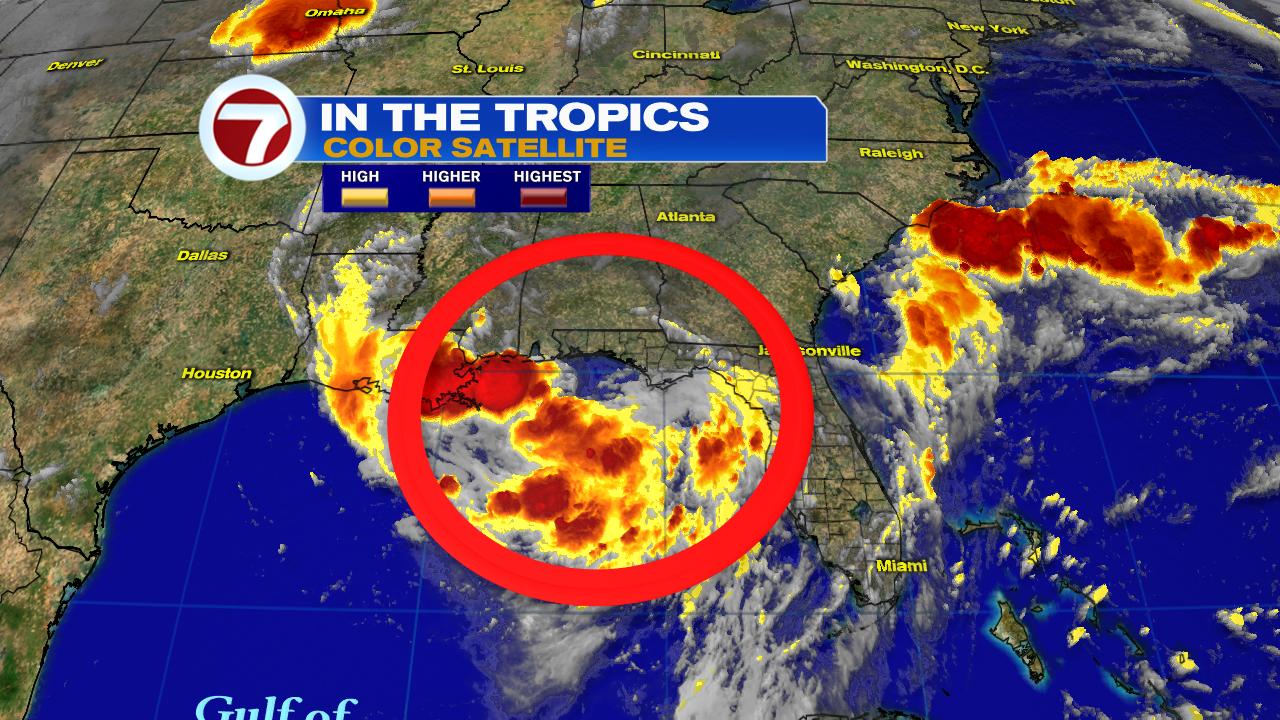
This is the view across the Atlantic Basin. One wave is sitting over the Southeastern Bahamas, with the other navigating the waters of the Eastern Atlantic. There is plenty of Saharan Dust over the ocean that typically keep these systems in check, yet the farthest away will evade most of it.
Closest Wave

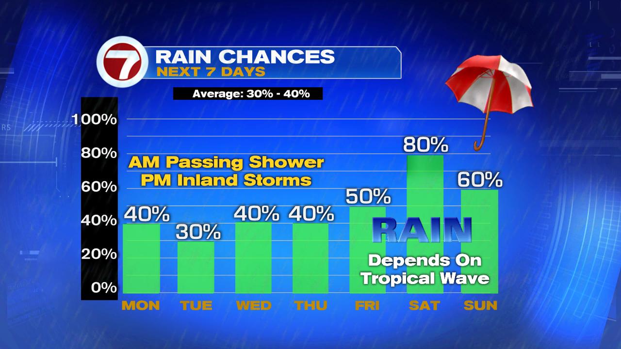
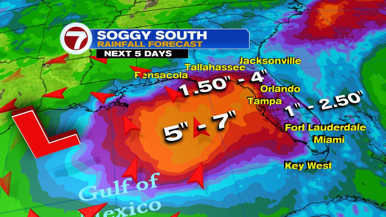
Rainy Days

Typical rain chances for South Florida this time of year is between 30% - 40%. We can expect them to go up starting on Thursday and going even higher for the weekend.
Rain Totals

Rainfall amounts over the area through Monday range anywhere between 1" to over 2.5". This wave will probably end by raining itself out.
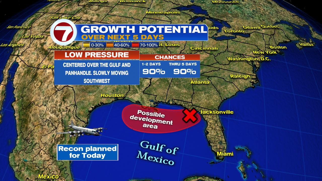
Could be Higher

NWS suggests some areas could see anywhere between 5" - 7" by the time we move into next week. This will surely lead to street flooding. On top of that, this weekend will see a new moon which will make for extra high, high tides. This will prevent the standing water from draining.
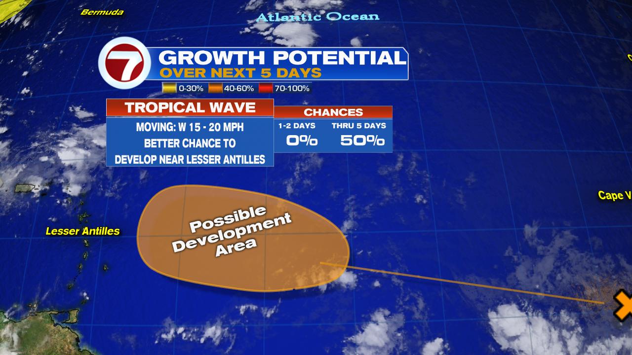
Second Wave

This wave is in the Eastern Atlantic making its way to the Lesser Antilles.NHC has deemed it Invest 96L and has a high chance of developing into a depression or a storm in the area highlighted in red.
Spaghetti Models

There are only a handful of models at this early stage of the game. High pressure will push it northwest. It is also going to evade much of the Saharan Dust, staying behind one plume and ahead of another.
Long Range Model

NOTE: Since nothing has developed as of this writing and there is no center of circulation, there is no good starting point for the models to use. Take this as an educated guess. Once something develops then we can get a real good idea of where it may end up.
The European Model suggests that after the system organizes near the Lesser Antilles it could move over Hispaniola & Puerto Rico. This interaction with land could weaken it. If it's still around by next week Thursday, high pressure will move east and a front dives out of the Nation's midsection and onto the coast. If this happens it should push the system back out over open water. This wave may end up scaring a few places if it develops. All we can do is wait and see what develops.
We'll be watching.