After almost a half season slumber, the tropics have awakened and there's activity throughout the Atlantic Basin.
We begin with "Gordon"

Unfortunately it claimed the life of a child in the Panhandle of Florida.
It will continue dumping rain across the nation's heartland for another day.
Most of the heavy rain is sitting east of the center of circulation.
Florence
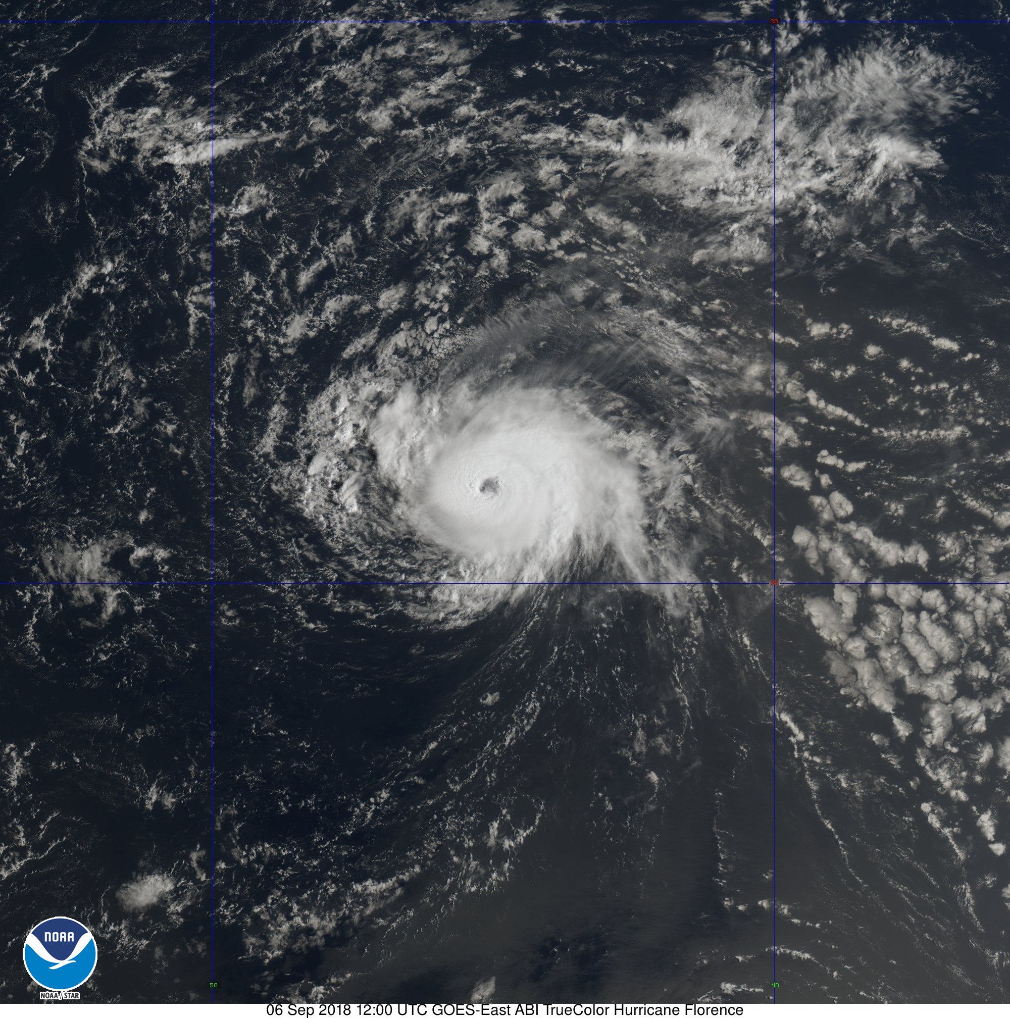
The models have not handled it's intensity well, and as of this writing it's a major hurricane, category three with 125 mph winds.
The official forecast cone from the National Hurricane Center (NHC) places it very close to Bermuda in about 5 days. They will have to keep a close eye on it.

U.S. Concerns?
There is a little bit of insecurity as we go further in time, days 6 - 10 in the outlook. During that period models fan out, which is an indicator of a bump in the road, that bump is high pressure. Hurricanes never move out of their own accord, they need something else to push it along, these are called steering winds. In this case, the steering is being performed by clockwise winds from the Bermuda high, which is a huge dome of high pressure sitting over the Atlantic.

The spaghetti models show "Florence" moving along the periphery of the high until something blocks its path. This is another area of high pressure coming out of U.S. This second high can either displace "Florence" towards the Northern Atlantic, or allow it to slip under and aim for the East Coast. This explains the divergence in the models. We'll be monitoring.
More systems developing
We are now in "Cape Verde" season, named after the islands off the west coast of Africa. From basically mid August to Mid October, most of the tropical activity develops out of waves coming off the African continent.
There are two areas worth watching.
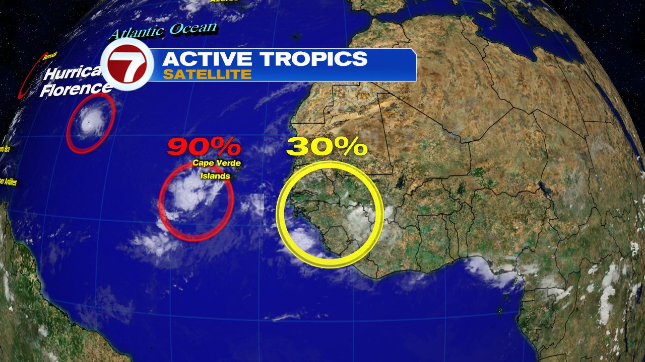
The first, circled in red, could become "Helene". NHC says it is an area of low pressure a few hundred miles SSW of the Cape Verde Islands. They are giving it a 90% chance for development.
If it does develop, where is it going?

Until something organizes and we get an actual fix on the center, the early model runs are just an educated guess. Here too, they are fanning out. We have to wait for development.
Area number 2
This is a wave, circled in yellow) that has yet to move offshore Africa. When it does, NHC is giving it a 30% chance for organization. At worst case scenario, this is almost 2 weeks away. All we can do now is monitor.
This is a great time to review your plans, and make sure you are ready in case Mother Nature throws us a curve ball.
No comments:
Post a Comment