Thursday, May 31, 2018

Hurricane Season 2018 Begins

Its our annual ritual, a 6 month season that keeps our nerves on edge until the very end.  It starts Friday June 1st. 

Will we get hit? Will we be spared? How many hurricanes will there be? Why do these monster storms even exist?

Lets start with the 2018 forecast. 


The National Hurricane Center thinks we could see 10 - 16 Named Systems, out of which 5 - 9 will turn into Hurricanes, and out of that number, 1 - 4 could become major hurricanes with winds over 111 miles per hour. Compare that with average, and we should be slightly above typical.
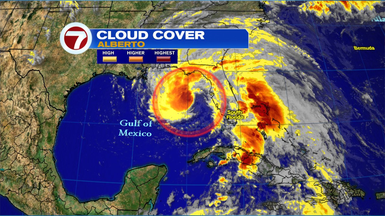
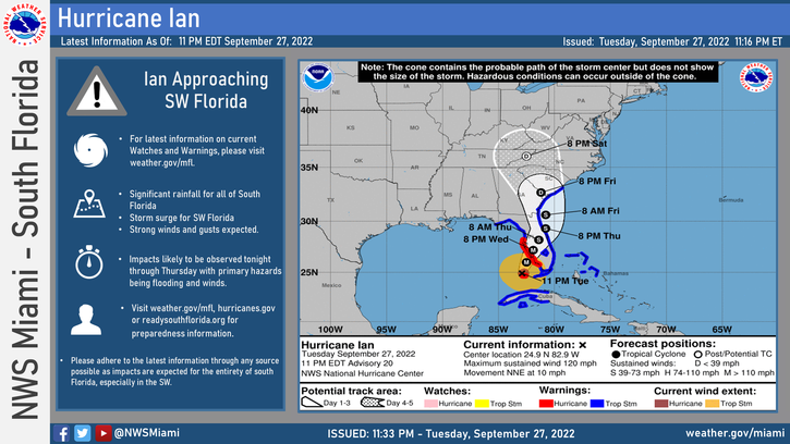
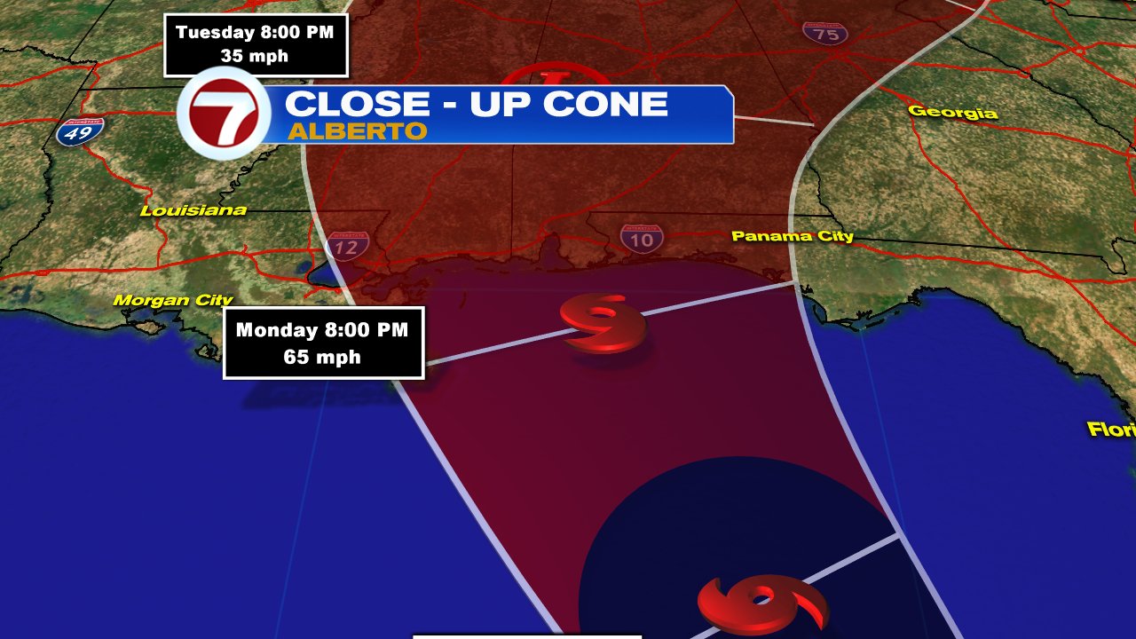
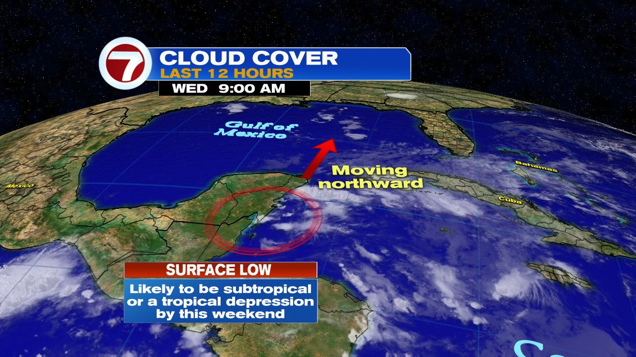
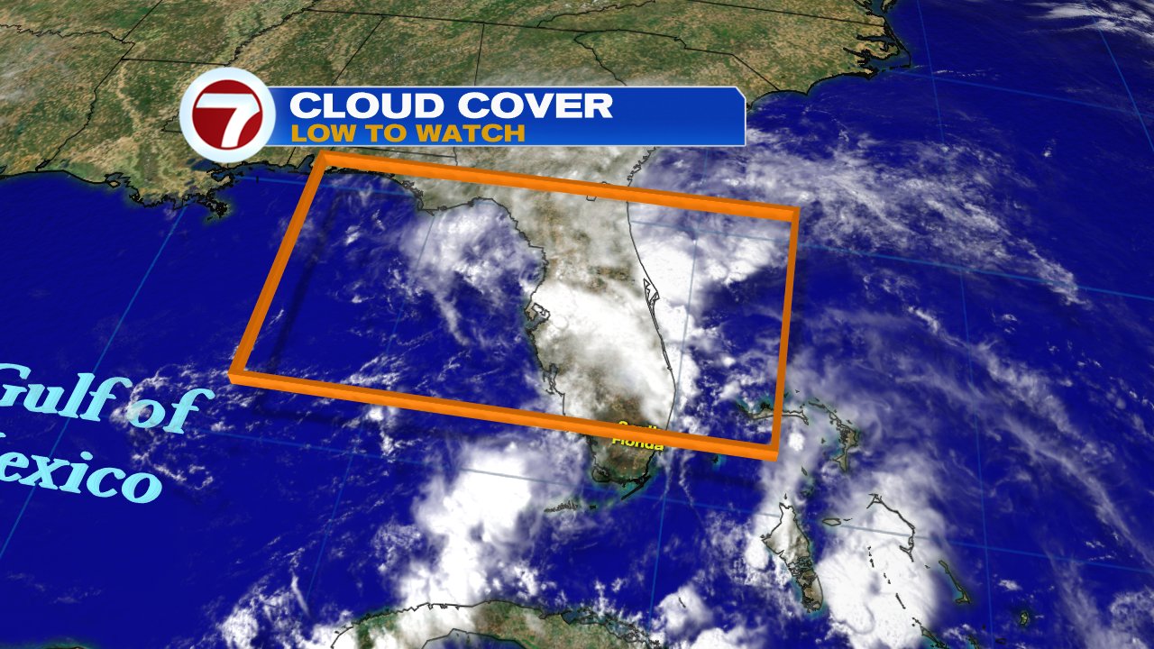
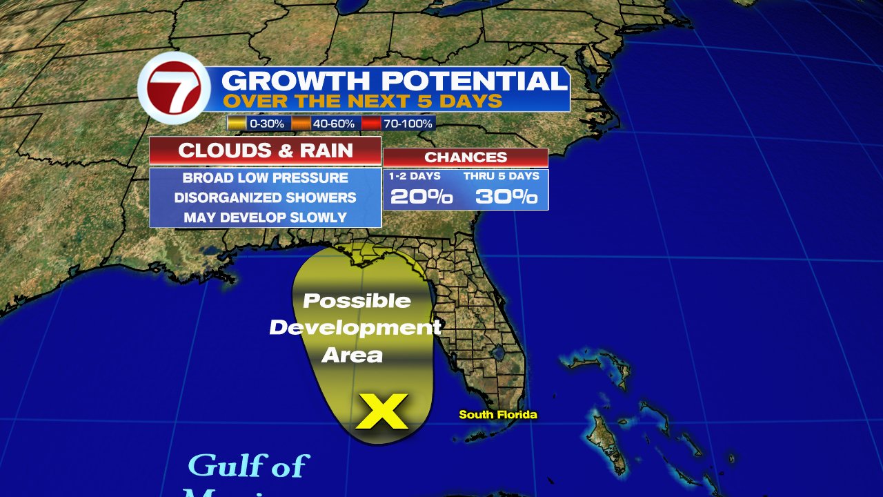
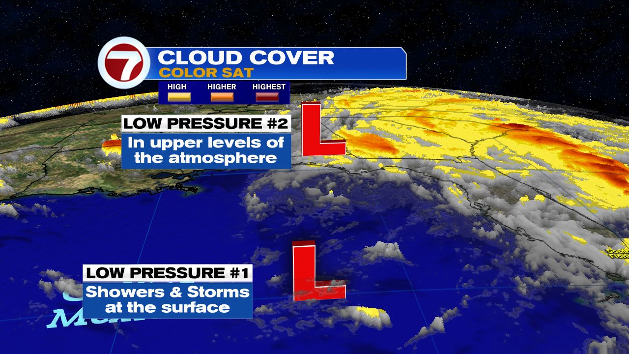
This year the season kicked off early with "Alberto" spinning in the Caribbean and Gulf of Mexico.

But what does all this mean? 
These projections are an attempt at getting you to prepare, but remember, not one seasonal forecast will tell you when and where a system will strike. If we end up with 20 hurricanes in one year and not one makes landfall, did it really matter? We could see the opposite, a forecast calling for 8 hurricanes and only 1 moves onshore right over us as Andrew did in 1992. That year we ended up with 7 named systems, 4 hurricanes and one major storm.  That's why we should always prepare as if we will get hit and we'll be ready for whatever Mother Nature sends our way.

What are the names for this year?

Alberto, Beryl, Chris, Debby, Ernesto, Florence, Gordon, Helene, Issac, Joyce, Kirk, Leslie, Michael, Nadine, Oscar, Patty, Rafael, Sara, Tony, Valerie, and William.

The names chosen have to represent the languages spoken throughout the Atlantic Basin, which include: English, Spanish, French and Dutch. They are chosen by the World Meteorological Organization. This is why you may see a Chris, an Alberto, Michael, and Beryl. 

Names are chosen 6 years in advance and are repeated every 6 years as well. If a storm becomes deadly or causes catastrophic damage, then the name is retired. This is why we will never see another "Maria" again, at least in name. 

 If you want to see the list of upcoming names through 2023 click on the following link.

More Names Here

What about El Niño?

El Niño is a warming of the Equatorial waters of the Pacific Ocean that impacts both marine and atmospheric currents worldwide. Its like shaking a snow globe. The altered currents cause weather disruptions worldwide. For us, it creates hostile conditions for hurricanes to grow.  An El Niño forecast was issued in May and it calls for typical temps, neither warmer nor colder. This is known as Neutral conditions. It should remain this way possibly through the end of November. The opposite of a hotter Pacific Ocean is called La Niña, this cooling is worse for us as it makes conditions favorable for hurricanes to grow.

Why does Hurricane Season start in June and end in November?

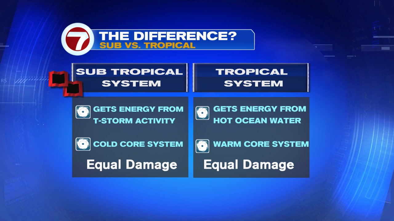
This is a man-made timeline. Hurricanes can happen any time of year as long as the ingredients for storm formation are present. 

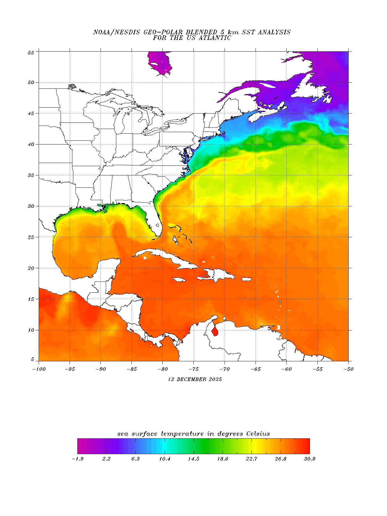
The most important ingredient is water temperature. If the sea surface temp is above 80°, you could see storms forming, anything less and the chances are very poor.  

It just so happens that waters across the Atlantic Basin are at their warmest from June thru November.  A quick search of the National Hurricane Center's archives finds the first system of 2016, Hurricane Alex, developed on January 12th.

Why do we get hurricanes?

Our planet is constantly trying to keep our temps in the "Goldie Locks" zone, not too hot and not too cold. During the summer months the Global Ocean soaks up a lot of heat energy from the sun. This heat needs to be released some how, so Mother Nature spins up the World's biggest storm... a Hurricane.

They act as a vacuum cleaner sucking up all that heat from the water and shooting up into the upper levels of the atmosphere where it gets cooled off and returned to the surface as mild temperate air.
If we didn't have hurricanes, after hundreds of years, the tropics would get so stifling hot, that neither flora, fauna, nor humans could survive. Its too bad that these temperature regulators can be so violent.

A cooler Atlantic is one of the reasons NHC thinks tropical action may not be so active this season.

But we can prepare. A hurricane will never take you by surprise, many times you will see me ad nauseam, a week in advance, telling you one is coming. You can get ready, or get out of its path. I, along with the rest of 7Weather weather team, Meteorologists Brent Cameron, Vivian Gonzalez, and Karlene Chavis, will keep you informed the entire season. Here's hoping you don't see much of us this year.

We will air a one hour program called "Surviving a Storm" Friday June 1st, at 8 pm. It will look back at the Keys to see how they are coming along after a direct hit by Irma. A review of Maria's destructive path through the Tropics, plus plenty of reminders on what to do to prepare for any threat. Please join us.


Sunday, May 27, 2018

Noah's Ark?

My next door neighbor just texted me with the following message, "I think I saw some animals walking in pairs on the side of the road... do you know something?"

I cracked a smile but knew exactly what he meant. When is this rain going to stop!


HEAVY RAIN

South Florida remains under a flood watch at least through Sunday night. I wouldn't be surprised if it gets extended until Monday as additional rain moves in.  The graphic above indicates all of the Metropolitan areas of Miami-Dade and Broward Counties could see significant flooding of roadways with a chance for that high water to penetrate buildings. If you live in an area of poor drainage be alert. So the answer to my neighbor's question is; the rain stays for a few more days.


POSSIBLE TORNADOES

If the rain wasn't enough of a worry, there's also the threat of tornadoes through Monday night as well.  All the instability in our atmosphere could produce twisters with an intensity of EF 1.
The tornado intensity scale is as follows: Named after famed Japanese Meteorologist Tetsuya Fujita, who pioneered ground breaking work into the field. If we get any tornadoes, they could have winds between 86 - 110 mph, capable of power outages, downed trees, and damages to poorly built structures.

GUSTY WINDS


From time to time the winds will also kick up to around 30 mph or stronger across much of South Florida.  A wind warning is also in place for the Keys with wind gusts up to 35 mph.  Not a good day to be out on the road, and even less out on a boat.  

SUBTROPICAL STORM ALBERTO


The reason for all this is Subtropical Storm "Alberto", which is spinning in the Gulf of Mexico a little stronger with winds up to 50 mph. It appears that it may be transitioning into a full Tropical system as the structure begins to tighten up and more thunderstorms are developing around its center. A recon plane is investigating as we speak, and "Alberto" may change its status later today.

It may make landfall across the Panhandle between Pensacola and Tallahassee by tonight or tomorrow morning.  The track took a slight shift Eastward on Saturday as the center emerged father northeast than what was being tracked. This placed the future path away from the Gulf States and over Florida.

I'll keep you posted.


Saturday, May 26, 2018

Rain Train Continues

Plenty of tropical moisture keeps aiming for South Florida and may not stop until Monday at the earliest. 

This is the LIVE radar showing where the rain is headed as well as the intensity of the downpours.


The green and yellow areas represent moderate rainfall while the redder color shows the heaviest of the rain. 

South Florida, for that matter the rest of the state, is caught between two weather features that will keep the area soggy over the next 48 - 72 hours at least.


Why so much rain?

Here's an old school weather map showing "Alberto" with the red icon in the Gulf, and two vertical lines near our state, one by SW Florida and the other near the Bahamas. 

Those represent the westernmost edge of high pressure sitting in the Western Atlantic.  

"Alberto's" winds come out of the Southwest, while the winds from the high, come from the Southeast. 

This combo acts as a straw drawing all the moisture from the Tropics here. They will conspire to keep South Florida with high rain chances through Memorial Day.

What advisories are in place for South Florida?


Many areas on Saturday had between half an inch to over an inch and a half of rain. With more expected for the rest of the holiday weekend, a flood watch is in effect at least thru Sunday across the Mainland. It may get extended by NWS Miami, if accumulations continue to go up.
The above graphic illustrates other watches and warnings in place.

What can we expect?
"Alberto's" moisture will get focused on South Florida starting Saturday night. This could lead to some strong thunderstorms and squally weather. We could also get:
  • Possible tornadoes from Saturday night through Sunday 
  • Coastal waters will be rough with possible waterspouts
  • High risk of Rip Currents
  • An additional 3 - 4 inches of rain possible through Monday
  • Some gusty winds up to 40 mph that can topple weak trees and cause power outages

The latest on Alberto
It will move northward across the Gulf on Sunday dispersing plenty of rain everywhere. The wind will pick up even more across Southwest Florida, with choppy seas and minor coastal flooding.


It is forecast to make landfall somewhere between Panama City west to the Mississippi coast sometime late on Monday.


These are the advisories in place for the west coast of Florida.
This is a great example of how even a system that is not that healthy and far away can impact our area with winds and rain.  Stay dry


"Alberto" aims for Gulf Coast, soaks South Florida

Memorial Day weekend begins with a Subtropical system in the Caribbean Sea that promises to keep us mostly indoors.

Its name is "Alberto",  and it kicks off the 2018 season almost one week ahead of schedule.


As of Friday night, "Alberto" was not a healthy system, its center sits over 100 miles SSW of Cozumel, MX , but much of the cloud cover and rain is displaced to the east of the center. To the West, drier air was filtering in and as long as this remains in play, it will not intensify.  However, as it slowly moves into the warm waters of the Gulf of Mexico, it has a chance to grow stronger as it soaks up all the heat energy.

May systems are not common but they do happen. Since the 19th century only 24 have been recorded throughout the Atlantic Basin.

What is a Subtropical System?


"Alberto" has been classified as a subtropical storm. It basically gets its energy from thunderstorms, instead of hot ocean water like regular tropical storms. It also has a cool center as opposed to the warm core found in true tropical systems. Outside of that... they look alike, rain alike. and cause the same amount of damage. "Alberto" should transition into a Tropical System over the weekend.

Where is it headed?


The official Forecast Cone from the National Hurricane Center (NHC), places it near the Gulf States by Monday evening, as a tropical storm. Some models hint at the possibility of strengthening to a category 1 hurricane with winds around 74 mph, just before going ashore.

What can we expect?


Rain, rain, and more rain is being called for by the models. There's plenty of moisture over the Caribbean Sea that "Alberto" will spin our way. Many models call for 3 - 5" inches of rain through Monday with some isolated spots getting as much as 12". With the ground already saturated from recent rainfall, we could see flooding. A flood watch is in effect for the Mainland (excludes the Keys), through Sunday night.

Thursday, May 24, 2018

Named System in Gulf?

The chances for a system to develop in the Gulf of Mexico this holiday weekend are nearing 100%. 

Conditions will become favorable for a low to become a depression or a tropical storm. If it does develop, it will be called "Alberto".


Presently, the area of low pressure is sitting over the Yucatan Peninsula, but most of the cloud cover and rain is sitting to the Northeast. This rain is what may reach us over the next few days.


As of late Thursday night, the National Hurricane Center (NHC) was giving the low a 70% chance it could organize over 48 hours, and a very high 90% chance throughout 5 days. If it does develop, it would do so somewhere in the area highlighted red. This is NOT a forecast cone, its just where NHC thinks it may organize. A recon plane is on stand-by on Friday to check out the Low.

Spaghetti Models


The models are suggesting high pressure in the Atlantic will push the Low into the Eastern Gulf through the weekend. Possibly developing and aiming anywhere between West Florida and Louisiana. Notice when the models reach the coast, they do a loop de loop, this usually happens when they do not have a good handle on the forecast. Models need a good fix on the center and without that, there is no good starting point and therefore no good ending point.

Working Against the Low


There are very strong upper levels winds over Florida and the Western Gulf of Mexico, these are like huge road blocks in the atmosphere keeping the low in check. These winds are known as shear. On Thursday night the shear was still pretty strong and bullying the Low around.


But by the weekend, the shear relaxes and gives the Low plenty of breathing room to grow.  That is why the development chances are so high as we move into Saturday and Sunday.

Plenty of Fuel

Warm water is the fuel these tropical engines need to run. Waters over 80° provide all the energy the Low needs to grow and develop.

What about Cuba, South Florida, and the Bahamas?


Even if nothing develops, there is so much moisture in the Caribbean, that it should get dragged North. This means plenty of rain for Cuba, much of the State of Florida, and even the Bahamas. Some models place as much as 3 to five inches of rain with some higher totals in isolated areas. This will lead to localized flooding in areas of poor drainage.

We'll keep you posted.


Wednesday, May 23, 2018

High Chance for Tropical Development in Gulf

The chances for a system presently in the Caribbean to develop over the next 5 days climbed Wednesday night to 70%.


From the satellite imagery, you can see a bit of a counterclockwise spin sitting near the Yucatan Peninsula, that is the low. A tail of clouds extends from there, northeast into Florida.

The National Hurricane Center (NHC) now says the Low has become better defined and is producing a large area of rain that reaches the Florida Straits.

The strong upper level winds that were keeping the low from organizing over the last few days appear to be weakening setting up the stage for possible strengthening.


The area we are looking at for possible development is highlighted in red.

This is where NHC thinks something may develop.

NOT A CONE OF CONCERN.


What will develop?
Its unclear at this point if we will get a depression or a tropical storm, or even a subtropical system.
A subtropical system is much like a hybrid storm, it acts and looks like a regular storm but lacks the well defined warm center of circulation. At times looking like a regular area of low pressure you may find over the U.S.


Where is it headed?
Its still not set in stone. The spaghetti models at this stage of the game are not that accurate. They need a good starting point to give us a good ending point. Since nothing has formed yet, they are just giving us a general idea of where the system may end up.

There is a chance, if it does organize, it could make landfall anywhere between Florida and Louisiana. At this point its just best to keep monitoring it. This will never take you by surprise. NHC can start issuing watches and warnings even before a system forms in order to keep you safe. We'll  be here to keep you informed.

Possible Heavy Rain
The kicker to all this, South Florida, parts of Cuba, and the Bahamas could see big downpours even if nothing organizes. The amount of moisture lingering in the Caribbean is large and will get pushed our way.

The local National Weather Service office suggests we may see anywhere between 3 - 5 inches of rain with potential higher amounts. This will surely lead to flooding in areas of poor drainage.

We may start to see some the downpours as early as Friday and sticking around thru the Holiday weekend.


Chances grow again for Gulf Development

The chances for a system to develop in the Gulf of Mexico are steadily rising. Its gone from a 40% chance on Monday, to 50% on Tuesday, and up to 60% this Wednesday morning.


The area that the National Hurricane Center is monitoring is presently sitting in the Northwestern Caribbean Sea. Nothing has changed as far as its health is concerned. The low is causing widespread showers that stretch across the Caribbean and into the Florida Straits.  

The long range models still insist on something developing in the Gulf as the low moves north. Where it may end up is still unclear. The models have a wide span placing a tropical or subtropical system anywhere between South Florida and Louisiana by the second half of the weekend.


Tuesday, May 22, 2018

Chances for development continue to rise for low pressure in Caribbean Sea.

The National Hurricane Center (NHC), is monitoring an area of low pressure in the Northwestern Caribbean Sea for possible organization. The low level spin remains offshore Belize with most of the cloud cover and rain situated to the east/northeast by the Caymans, Cuba, & South Florida


This low should stay close to the Yucatan, maybe even moving onshore temporarily, before it begins a move toward the Gulf of Mexico.


 NHC is giving the Low, a 0% chance for development over the next 48 hours, and then a 50% chance over 5 days. If it were to develop, it would do so in the area highlighted in orange.
This Low is now "Invest 90L". This means its an area NHC would like to INVESTigate further. The 90 is just a tracking number while the "L" stands for the Atlantic Basin. 


The above graphic shows the spaghetti models through the next 5 days. Keep in mind since nothing has developed yet, there's no good starting point and without that, there's no good ending point. At this extremely early stage, the model runs are just giving us an educated guess.

They suggest the Low will move north searching for a gap in the atmosphere. By day 5, high pressure will be over the Atlantic with a front moving into the Nation's midsection. The system will try to slide in between the two.  

Why is the forecast calling for no development in the short term and high chances for the long?


As we speak, there are some strong upper level winds working against the Low, this is called wind shear. Those winds are responsible for keeping the low in check. It is shown in the graphic above as orange/brown areas marked as roadblocks.
 

As we go into the weekend, that shear weakens and give the low some breathing room as it glides over the warm water of the Gulf. This should give it enough energy to develop.

 Lets take a look at the two long range models


Scenario 1: Looks at the European Model, which develops either a tropical or subtropical system late in the week, moving across the Central Gulf of Mexico before eventually moving on-shore by Louisiana.
The model places heavy rain all across Florida.


The second scenario: Looks at the American model, the GFS. This has a system developing in the Gulf over the weekend and moving somewhere across Western Florida. This also gives us rounds of rain.

Stay with us for the very latest..


Monday, May 21, 2018

Tropical Trouble Close to Home?

The National Hurricane Center (NHC) has upped the chances for development for a disturbance in the Caribbean from 20% to 40% as of 8 pm Monday night.


NHC now says it is a broad area of low pressure dumping plenty of rain across Cuba, the Caribbean Sea, and the Caymans. Models show some of that rain moving in our direction in the days ahead.


From the satellite picture above one can see very few clouds where the low is situated, a couple of hundred miles East of Belize. Most of the clouds extend in a tail across Western Cuba north into South Florida. Monday saw heavy rain across the Lower Keys with totals as much as 3 inches. Conditions are not conducive for any development now, but that may change in the days ahead.


The low should get pushed into the Gulf in about 48 hours and by then atmospheric conditions will become favorable for gradual development of a subtropical or tropical system. Even if nothing forms, there is so much moisture near us, that we could get another soaking thru the Holiday Weekend. We are hoping this area of rain falls apart.

Models

NHC has deemed this "Invest 90L". Which means this is an area that needs to be INVESTigated further, 90 is a tracking number, and "L" stands for Atlantic Basin. We have two models to look at. We begin with the European
 

This scenario shows system organizing early Friday morning in the middle of the Gulf of Mexico, and then aiming for the Louisiana-Pensacola area. It places heavy rain over us.

The American model


In this scenario, a system develops much later in the time-line, by Saturday,  but it aims for the Keys, South Florida, & maybe the Bahamas. It too pushes heavy rain our way.


The bottom line is that Cuba, South Florida, and the Bahamas could see copious amounts of rain from Wednesday thru the Holiday weekend.  Please monitor the situation. The ground is near saturation in many areas and drenched in others.


Rainy Memorial Day weekend?

Its been very soggy across South Florida since last weekend, it'll be wet on and off this week, and Memorial Day weekend promises to be stormy as well.


We have deep tropical moisture moving across the state keeping us with a chance for downpours throughout the next few days. In the satellite loop above, its hard to see the state of Florida from space as it is obstructed by cloud cover. By the end of the work week, chances may turn even higher as tropical trouble could spin up in the Gulf of Mexico.

The National Hurricane Center (NHC) says the cloudiness is due to a large area of low pressure in the upper levels of the atmosphere which covers the area from Florida south over Cuba and into the Northwestern Caribbean Sea. 


Add to this a disturbance at the surface  in the Caribbean and you have plenty of instability in the atmosphere to keep us rainy in the days ahead. This same combination should PREVENT anything tropical from forming, but NHC says that in the long run, possibly by the weekend,  things may change. As the disturbance moves into the Eastern Gulf of Mexico, conditions may improve for organization. They are giving it a 20% chance for formations.  Even if it doesn't develop, heavy rain could be the norm for South Florida, NW Bahamas, & Western Cuba.

This is a good time to check your hurricane season supplies. The season officially starts June 1st.


Friday, May 18, 2018

It could be a very wet weekend

Conditions are setting up for South Florida to get heavy rain both Saturday and Sunday. 
If nothing changes, the first half of the weekend could be the wettest. 
Mother Nature gave us a nice and mostly dry day on Friday, but it appears its came at a price.

Our tropical moisture-pipeline is still intact and models are suggesting it will continue to drag rain here.


The wind flow over the Gulf of Mexico is from the southwest, while in the Atlantic its from the southeast.  This combo will draw moisture from the Tropics and bring us a good chance for heavy rainfall.  

If all the ingredients fall in place, chances for rain will stay very high over the next 48 hours. The National Weather Service says, that we could see anywhere between 3 - 5 inches of rain with higher amounts possible. Despite the ongoing drought conditions, it may flood if the heavy rain materializes.  
 Because of this potential for heavy downpours, a Flood Watch may be issued for South Florida this weekend.  Stay tuned to WSVN, for the latest updates.  


Notice next week is also being forecast to end up wet, that's because the models are picking up additional mositure from the Western Caribbean invading South Florida by then.


Tuesday, May 15, 2018

Recon on Stand-by for Gulf Low

A Hurricane Hunter is set to investigate the Gulf of Mexico disturbance on Tuesday if needed.


Over the last few days the National Hurricane Center has been giving this feature anywhere between a 20% to a 40% chance for development. If it does organize, it can do it anywhere in the area highlighted below as it slowly moves northward.

NHC added: Although the low could acquire subtropical characteristics over the next few days, it has shown little signs of organization. A subtropical system has a cold center while a tropical low has a warm core.


The disturbance is made up of two low pressure systems. The first is at the surface. Its trying to get organized, but the second low in the upper levels of the atmosphere is interfering with it and not letting it get its act together. While this may be good news, it will keep South Florida on the wet side for days.


On top of the rain we had over the weekend, many areas across South Florida had big downpours on Monday. While Marathon remained mostly dry, other cities got soaked with over an inch of rain.


This disturbance is capable of producing widespread downpours over South Florida that may lead to street flooding. We've seen some standing water in low-lying areas, and the local National Weather office suggests an additional 3 - 5 inches is possible in total rainfall through the upcoming weekend.