Florence is a hurricane again, and likely to be a very POWERFUL system as it moves over the western Atlantic toward the southeastern United States.
That's the message Sunday morning from the National Hurricane Center (NHC).
The satellite loop from today shows a more symmetrical Florence, better organized, with increased thunderstorm activity around its center. It even appears to have an eye with an eyewall already in place.
A NOAA recon mission reported that Florence had hurricane force winds and the pressure was at 984 mb.
Its only weakness at the moment are the frail feeder bands. These are the outer bands of clouds that feed moisture to the center. They need to be unbroken to provide a steady stream of fuel. They are looking patchy. Once they turn into good uninterrupted banding, then we'll have a monster.
Status Report on Florence
- Good Outflow: While the spin at the surface is counterclockwise, a healthy system needs the opposite motion in the upper levels of the atmosphere. Florence has it which means it's starting to fire on all cylinders. Notice the satellite loop, the center is spinning inwards. Now look at the upper left hand corner, here the clouds are moving in the opposite direction. This is not happening near the surface like the lower level spin, but way high up in the atmosphere. This is the outflow. It helps carry warm moist air from the surface up into the system turning it into thunderstorms. It then gets spit out similar to your car's exhaust pipe.
- Sea Surface temps: Check. Here too it will be traversing some of the warmest waters of the Atlantic. Plenty of tropical fuel for it to grow.
Where's it headed?
A look at the models:
Most of the model runs are all in agreement the system will move Northwest over the next few days but around Wednesday, they start to fan out.
- The GFS model, (The Global Forecast System provided by the National Weather Service (NWS) is among those predicting a more northwesterly track.
- The HWRF, (Hurricane Weather Research and Forecasting Model-used to forecast track and intensity) and the ECMWF, (European Center for Medium-Range Weather Forecasts) both keep Florence on a more southwesterly route.
The official forecast cone from NHC is in the middle of the above extremes.
This is why NHC is telling residents along the U.S. East Coast from Northern Florida to the Carolinas, to review their hurricane supplies, action plan, and if told to evacuate, do so. Florence can have life threatening impacts!
The cone just shows where the eye of the storm might be located. Florence's feeder bands extend outward hundreds of miles so its impacts will be felt far away from the center.
Even large ocean swells could make it across the Bahamas and parts of South Florida.
Florence's influence go far beyond the East Coast, it may also impact the future of Isaac.
Tropical Storm Isaac looks much healthier Sunday morning
It has plenty of thunderstorm activity with good feeder banding, except for the northwestern sector. A little shear and dry air is impacting it. Regardless, it's getting stronger and winds are up to 65 mph as of 11 am Sunday morning.
The question is "How strong will it be as it nears the Lesser Antilles?"
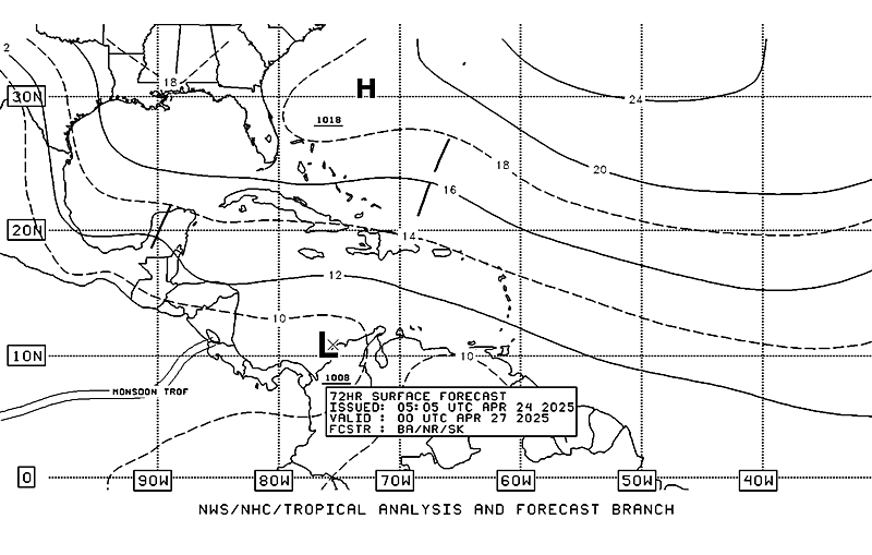
Most of the solutions maintain Isaac on a steady westerly course. Only a handful turn it north in a couple of days. The reason why it is expected to stay on a westerly track is high pressure sitting to its north.
Notice on the map the lines with the number 14,18, 20. They represent the leading edge of a huge dome of high pressure. The winds here rotate clockwise and will continue to push Isaac west through September 12. After that it appears the high weakens just a bit, but how much is uncertain.
The official forecast cone from NHC keeps it due west as a hurricane. By the time it reaches the islands it could be as strong as a category 2 with 100 mph winds. This intensity could fluctuate over the next few days as the outflow from Florence could actually impact it. The outflow could provide some shear helping to weaken Isaac. We are hoping that it does.
Everyone from Trinidad and Tobago to Puerto Rico should keep an eye on Isaac and start preparing now.
We'll be monitoring


No comments:
Post a Comment