This weekend is a perfect opportunity for residents along the Lesser Antilles and U.S. East Coast to check their hurricane supplies and ready for an eventual impact.

This spectacular satellite view shows the four areas in the tropics the National Hurricane Center (NHC) is following. Starting from upper left to lower right.
- The first area of clouds and rain is a disturbance just west of Bermuda
- The next swirl to the southeast is Tropical Storm Florence
- A spin between Cape Verde and the Lesser Antilles in Depression 9
- The clouds off the West Coast of Africa is Tropical Storm Helene
Our focus starts with Florence.

It's a storm now, but it has the potential to get very strong in the days ahead. Little Shear and warmer sea surface temps will provide all the fuel it needs.
As of 5 am Saturday morning NHC's thinking is as follows:
"The risk of a direct impact associated with Florence along the U.S. East Coast has increased."
They add, "However, there is still very large uncertainty in model forecasts of Florences's track beyond day 5, making it too soon to determine the exact location, magnitude, and timing of these impacts."
The latest forecast cone places a category 4 system with winds of 145 mph near the Southeast by late next week. Remember the cone shows where the eye is forecast to be by Thursday. The impacts of Florence can be felt hundreds of miles outside of that cone. North Florida please remain vigilant until Florence decides on it's course. NOAA aircraft recon missions began today.
Tropical Depression # 9

This system also has the potential for headaches down the road. NHC says it could be upgraded to tropical storm status later today and take the name "Isaac". This colorized satellite view illustrates where most of the thunderstorms are located. The yellows represent moderate rain while the reds and browns signify heavy downpours. Most of the activity is located somewhat south of the center due to drier air to the north and shear (strong upper level winds). This is significant because it may keep Depression 9 from growing too strong.
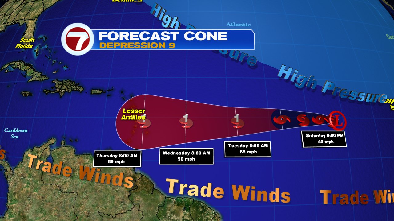
UPDATED FORECAST CONE 11:00 am Sat
Friday night NHC had the system as a possible category 2 near the Lesser Antilles, as of Saturday morning, they're suggesting a category 1. Don't let the intensity forecast fool you. This is still capable of strong winds, storm surge, and heavy rain that may lead to flash flooding, land and mudslides. Everyone across the islands should be getting ready.
Other Tropical Action

Off the West Coast of Africa is Tropical Storm Helene. This is set to brush the Southernmost Cape Verde Islands. Watches and Warnings are already in place there.
Where is it going?
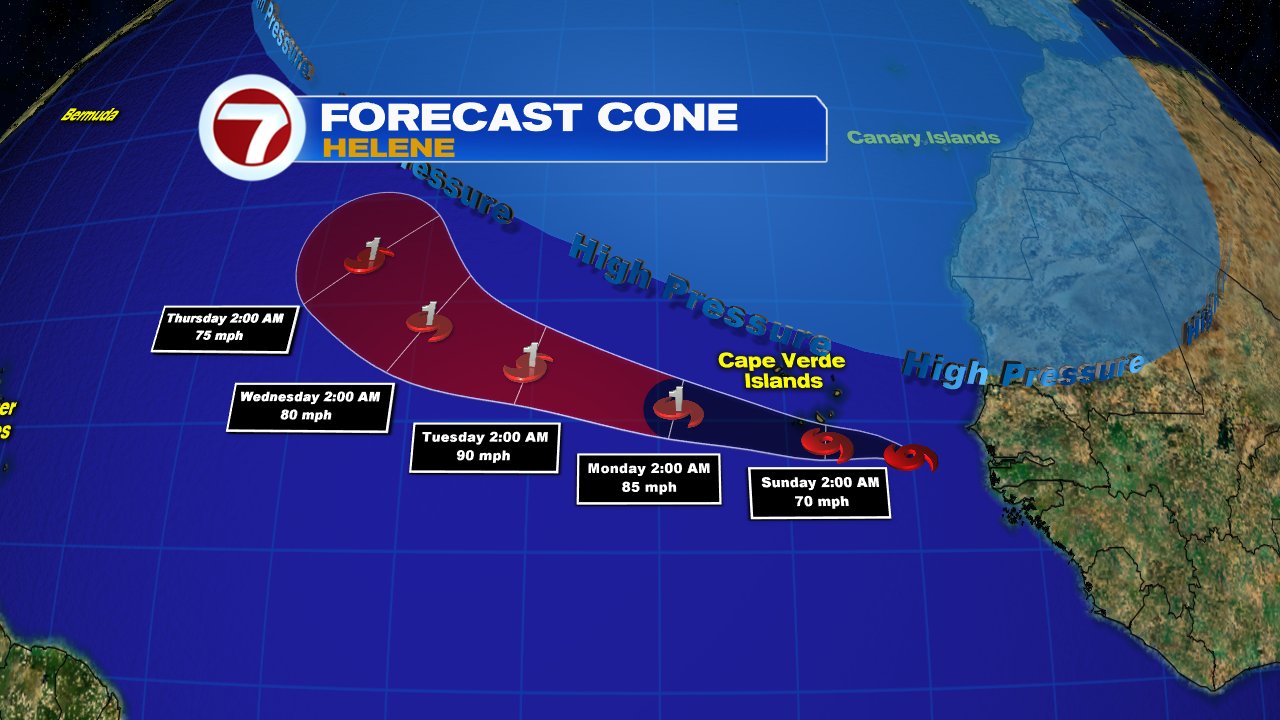
It's expected to become a hurricane down the road, but this system will turn out to the Middle of the Atlantic and be a worry only for the shipping lanes.
Disturbance
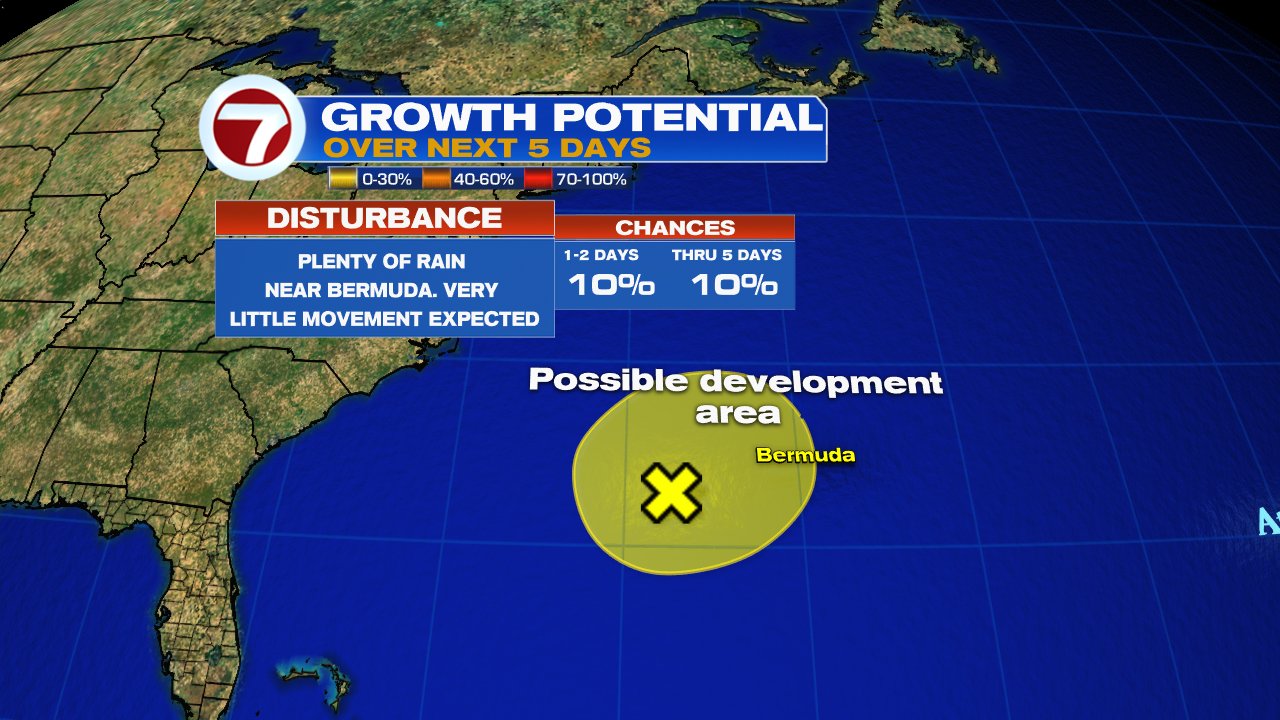
An area of clouds and rain near Bermuda has a ten percent chance for development over the next 5 days in the area highlighted in yellow. This appears to dissolve in that timeframe.
We'll be monitoring
No comments:
Post a Comment