Temps expected to dip this upcoming week into the 40s over many areas, 50s for the Keys.
High pressure has been dominating our weather over the last few days, keeping us warm with serene conditions, but that is about to change.
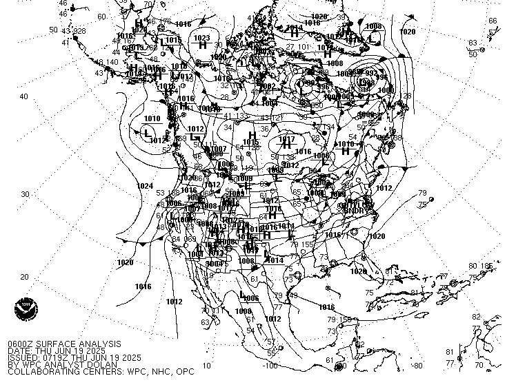
The surface weather map shows a line with triangles sitting across Northern Florida, this is a cold front and it marks the leading edge of the cold air.
The front is moving in our direction and could be very near Naples Sunday evening and possibly across the rest of South Florida by Monday morning.
Radar
The radar imagery shows where the rain associated with the front is located. Some of those showers may reach us overnight, but the activity is falling apart. The chance for thunderstorms is diminishing but we could still see a downpour here or there before the actual cold air moves in.
Timing:
The front should clear South Florida by late afternoon or early evening on MLK day. You will notice a sharp drop in humidity along with cooler temps, and clearing skies.
How Cold?
Models are calling for temps in the 40s across Metropolitan Miami-Dade & Broward Counties, with lows dipping into the 50s for the Keys. But it may feel even colder.
Hour by Hour Forecast:
The red line in the panel shows the expected lows. Follow it to the right into Wednesday between 3am - 6 am. The readings should bottom out around 49 to 46 degrees. But the wind will be picking up, shown in the lower panel, gusting at times 25 - 28 mph. This will make the temperatures feel even colder. Its known as the wind chill factor. The temps could feel as cold as 41 to 45 degrees.
It will be a cold start on Tuesday by South Florida standards so a reminder to bundle up the little ones on their way to school. Also, bring your pets indoors specially Tuesday night when those overnight temps will really drop.
Be careful with space heaters. DO NOT place them near curtains or furniture which may catch on fire. Stay warm and safe during this cold snap.
We'll keep you posted