The 2019 Hurricane Season is upon us.
We'll look at what to expect and the latest on El Nińo.
2019 Seasonal Outlook
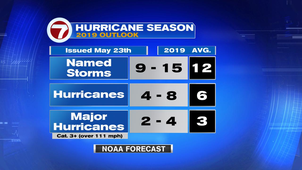
Seasonal Forecast: For this year, the outlook is calling for 9 to 15 named systems, out of which 4 to 8 could become hurricanes, and out of that number, 2 to 4 could be category 3 or stronger.
None of these long range forecasts will ever tell you where and when a storm will strike. It's best to be ready for whatever Mother Nature throws our way. It only takes one to make landfall and cause heavy damages.

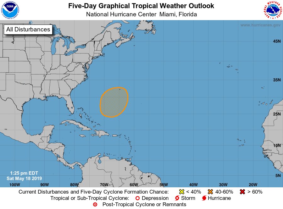
As of May 31st, NHC was keeping their eyes on an area of clouds and rain over the Yucatan for possible development. There is a 30% chance it could organize in the area highlighted in yellow over the next 5 days.
It may end up drenching Mexico throughout the weekend.
If you think this is an early start... we've already had a named system in the Atlantic. It was a very short lived system in mid May. Subtropical Storm Andrea, lasted for only 19 hours between May
20-21st. It marked the fifth year in a row we see tropical activity
before the start of June.
Hurricane season runs from the first of June through the end of November.
Hurricane season runs from the first of June through the end of November.
The Monkey Wrench: The National Oceanic and Atmospheric Administration (NOAA), has published reports saying that hurricanes are growing stronger in the Atlantic Basin due to Climate Change.
Harvey intensified in a short period of time before striking Texas a few years back , while Hurricane Michael transformed from a category 1 to 5 in a mere 24 hours. Keep this is mind as you plan.
Research also shows that of the four category five systems that have impacted the U.S. in recent history, each was only a tropical storm just three days away from land. This means, we need to pay attention to every system as they can rapidly grow and cause major damage.
Research also shows that of the four category five systems that have impacted the U.S. in recent history, each was only a tropical storm just three days away from land. This means, we need to pay attention to every system as they can rapidly grow and cause major damage.
Preparing:
The National Hurricane Center and its partners, has been getting ready all off season for 2019, ending with their Hurricane Awareness tour just last month.

NOAA & the U.S. Air force took their hurricane hunter air crafts to 5 U.S. cities and 6 Mexican and Caribbean ports.
Among the crafts were the Hercules C-130 which flies into storms and the NOAA P-3 which usually performs recon over a hurricane.
This helped explain the role hurricane hunters have in gathering information to bring you the most accurate forecast possible.
El Niño's 2019 forecast
El Niño is a warming of the equatorial waters of the Pacific Ocean. It impacts marine and atmospheric currents alike. Typically when there is a strong El Niño, it creates upper winds that help cut down storm formation in the Atlantic Basin. This is very good for us.
This year the forecasts calls for El Niño, lasting through summer and weakening as we move into fall. The outlook suggests a 70% chance of El Niño through September, with chances dropping to 55-60% by October We will monitor its progress closely since the peak of hurricane season is in November.
This year the forecasts calls for El Niño, lasting through summer and weakening as we move into fall. The outlook suggests a 70% chance of El Niño through September, with chances dropping to 55-60% by October We will monitor its progress closely since the peak of hurricane season is in November.
 |
| This is what a strong El Niño event looks like with hot water stretching from Central/South America west into the Western Pacific Ocean |
Last Year
2018 was a a horrific season ending with 15 named systems, out of which 8 became hurricanes, and out of that number 3 were major storms, (category threes or above). One of those major systems was hurricane Michael, impacting Florida's Panhandle as the most intense storm to ever hit the area.
- It went ashore near Mexico Beach, as a category 5 system with 160 mph winds. The National Hurricane Center says the system claimed 16 lives and caused so far 16 Billion dollars in damages. This is the first category 5 hurricane to hit the U.S. since Andrew in 1992. In March, Hurricane Michael, was retired from the list of names. This happens when a storm is way too deadly and/or destructive for the name to be reused, and this one certainly fits the bill.
 |
| Aerial view of Mexico Beach Florida on October 11th |
- Hurricane Florence was another disastrous storm. It smacked the Carolinas as one of the deadliest and costliest systems making landfall in Wrightsville Beach, North Carolina as a category 1 system. It slowly traveled inland dumping lots of flood-inducing rain claiming at least 52 lives. It too has been retired from the list of names.
As mentioned above, 2 names from last year's list were retired. The names Francine and Milton will replace the deletions. Hurricane names are reused every 6 years, with last year's crop reappearing in 2024. The agency responsible for coming up with the names is the World Meteorological Organization. It chooses male and female names that must represent all the languages spoken throughout the Atlantic Basin. That's why you may see Dutch names, French, English and Spanish. Get all the names for this year and beyond at the link below.
We'll be watching