We continue to monitor the progress of Florence and Isaac, two systems that threaten landfall by the middle or late part of next week.

It is a crowded Atlantic Ocean with many features to analyze. We will start with Florence, which could be a major hurricane making landfall somewhere along the U.S. Eastern Seaboard.
Florence

The color satellite is showing a classic swirl developing again, recouping after a few days of being battered by shear.
These are very strong upper level winds that tend to weaken storms. It's now free of it, and will begin a steady climb in overall strength. It may be a hurricane by 11pm Saturday night.
The colors represent where you can find the heaviest rainfall within the system. The blues and greens are light rain, while the yellows, oranges, browns represent heavy downpours.
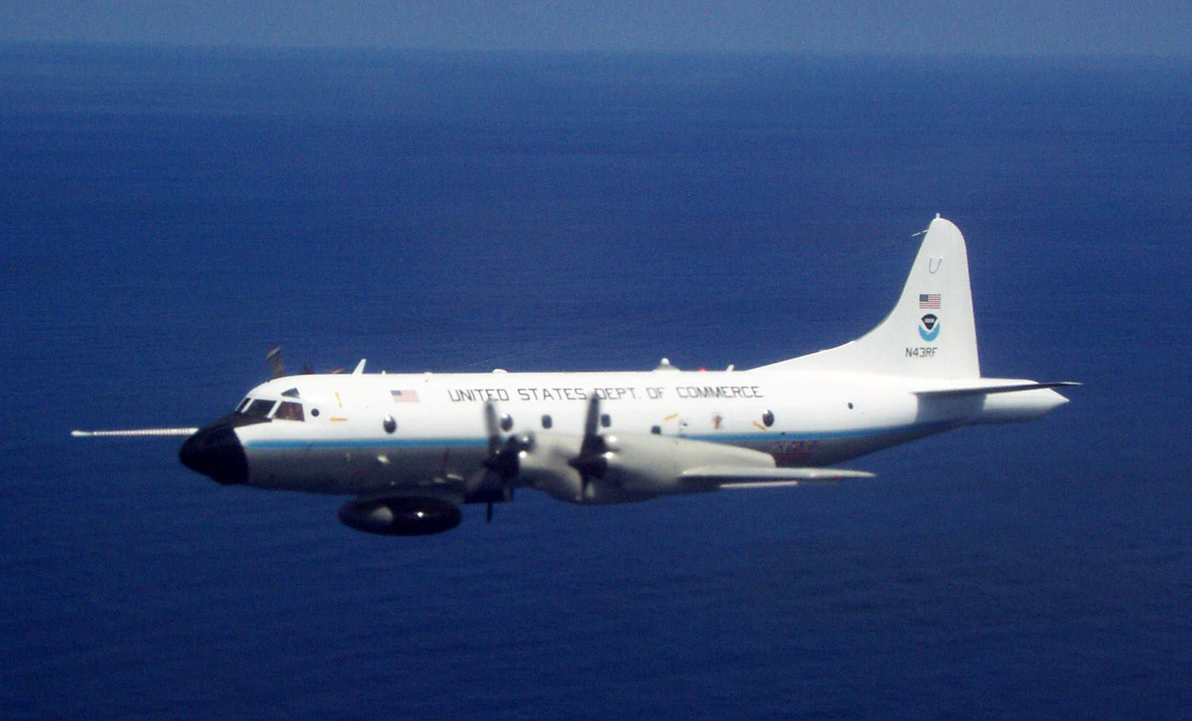
A NOAA recon aircraft performed a mission Saturday afternoon. It detected a stronger wind field and lower pressure readings.
Those are clear indications that Florence is on the comeback.
It may reach major hurricane status of winds of 111 mph in the upcoming days.
Residents in its path should start taking this threat seriously and begin reviewing their supplies and action plan.
Where is Florence Now?

The map above shows what is happening over the Atlantic Ocean. Find Florida and move right until you find the red swirl (tropical storm icon). Notice there is a big blue "H", to its north. This is high pressure and this is responsible for pushing it west. There is another blue "H" over Canada. It is forecast to move into the Atlantic. Florence is looking for the gap between the two so it can travel north. What the models are trying to figure out is the timing of those two highs and where the gap will set up. To the East, and the system stays over water, to the west and it makes landfall .
Where is Florence Headed?
The Spaghetti Models

Most of the models are calling for a gradual turn northwest over 5 days.
They are all looking for the gap, but have yet to reach a good solution on where and when.
Some take it as far south as Central Florida and others into New England.
This is a nail biter and will remain so for a few more days until the atmosphere decides on where the highs will move to.
 There's plenty of warm water ahead of Florence. Tropical systems need sea surface temperatures of 80 degrees and above to grow. There is plenty ahead in its path. It will be going over the Gulf Stream Current which is some of the warmest water in the Atlantic. This is one of the reasons why Florence will intensify.
The forecast cone will change over the next few days, as it aims for the U.S. The National Hurricane Center is advising the following:
- Florence is forecast to become a dangerous major hurricane near the southeast coast by late next week
- Where exactly it will make landfall, at what time and strength, is still unknown
- Residents from North Florida thru the Carolinas should be watching the forecasts closely
- Large ocean swells will impact Bermuda and parts of the East Coast next week
The following tweet was made public at 8:33 pm. It gives you an idea of how serious a threat, Florence will be. Hampton Roads is a body of water in Virginia.
UPDATE: @USFleetForces orders all #USNavy ships in Hampton Roads area to set Sortie Condition Bravo ahead of #Florence. Condition Bravo is set when onset of destructive weather conditions to the port are within approximately 48 hours - https://www.navy.mil/submit/display.asp?story_id=106990&utm_source=twitter&utm_medium=social&utm_content=100000320273031&utm_campaign=Misc … #NavyReadiness
The next system to threaten land is Tropical Storm Isaac

Isaac is over 1600 miles east of the Lesser Antilles. It's encountering some shear and should remain as a storm for a few days. In the long run that shear will weaken, giving it the opportunity to reach Category 1 status with winds over 74 mph.
Where is it Headed?

It's being steered west by high pressure and should remain on a westerly path for 48 hours.
After that, a handful of models veer the system north and away from any land, but the majority insist on keeping it west. There is some shear forecast to move in just as it nears the islands. It's still unclear if it will weaken Isaac.
Detailed models
 The NAVGEM model is one of those that intensifies the system, but turns it north at the last minute in about 150 hours or roughly 6 days. Notice the tight green swirls. It shows Isaac to the north of the Leeward Islands. (You can also see Florence impacting the Carolinas in this solution).
 The GFS model on the other hand, places a weaker system right over the island chain in about 117 hours or around 5 days. Keep in mind that while it may not be a hurricane, it is still capable of gusty winds, storm surge, and heavy downpours, that could lead to flash flooding, land and mudslides.
 The European Model has the same thinking of a weaker system across the islands also in 5 days. Please be alert and get your supplies and action plan ready now. Keeping fingers crossed it does weaken before reaching shore.
It is curious to note that on all of these model runs, the path of Florence shows either a direct hit or a glancing blow to the Carolinas.
Lastly, Tropical Storm Helene

This storm may intensify as it moves away from the Cape Verde Islands, but the best news is that it will stay over open waters.
Thank you Phil. I always look for your updates.
ReplyDeleteThanks, I appreciate the kind words.
ReplyDelete