Thursday, June 27, 2019

Weekend Rain?

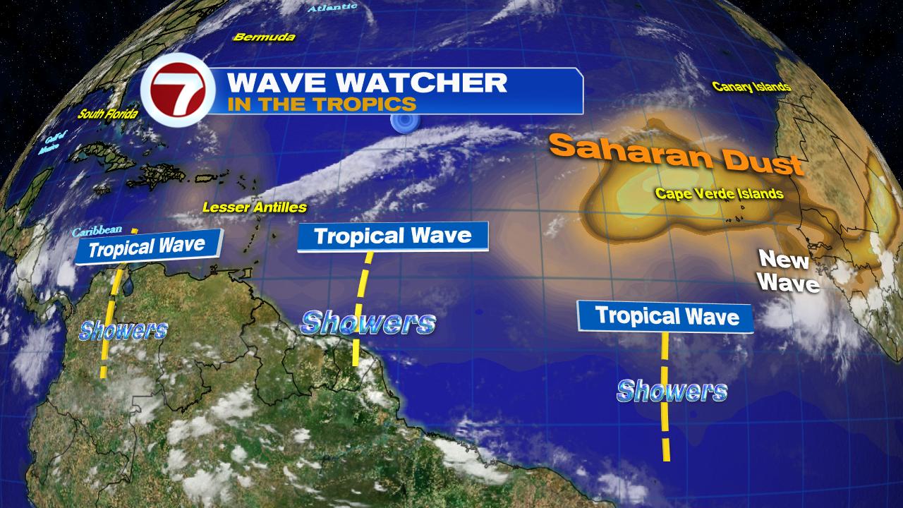
Weak Tropical Wave may bring us a soggy weekend.


Waves are difficult to forecast, they can grow quickly or fall apart just as fast. We've been following a weak wave centered over Eastern Cuba that promises to bring us a good chance of downpours as we head into Saturday & Sunday. Keep in mind that waves are fickle, so if this one does not fall apart, a rainy weekend is on tap.
 

Color satellite image shows a line of clouds over Eastern Cuba. This is the western-most edge of the wave.  The reason we use the color infrared image is to detect where most of the heavy rain is located. We give the highest cloud tops the red colors. The higher the cloud top, the heavier the rain tends to be. This tool is very useful over areas that lack radar technology.


Water vapor imagery over the same area illustrates how much moisture is in those same high clouds, but not at the surface as falling rain, but at higher elevations. It's like trying to look into a sponge and seeing how much water it is holding. The green areas show high concentrations of water vapor which can lead to more downpours.

Friday Forecast
European Model


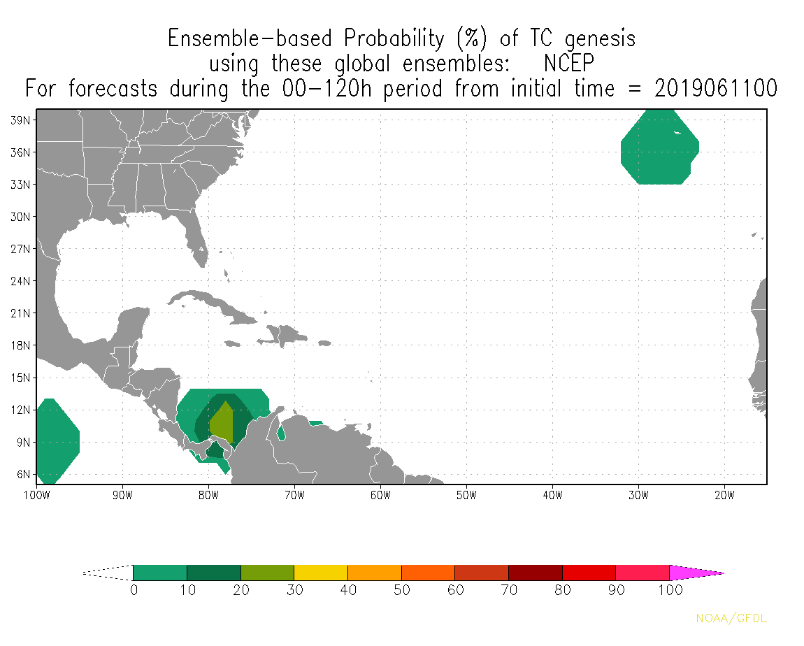
If this wave holds, high pressure to the northeast will help drag in the moisture, shown in green. This means by Friday some storminess can be expected over Cuba, the Bahamas, South Florida

Saturday Forecast


 The first half of the weekend may prove to be the wettest with possible downpours over much of the peninsula, NW Bahamas and Cuba.


 Sunday Forecast


As the wave moves west, we could still see lingering moisture causing some showers and storms through the second half of the weekend.The rain may stick around over the NW Bahamas and Western Cuba as well.


Wednesday, June 12, 2019

Hurricane Forecasting Improved today

Storm model improvement

Weather lovers have come to know the two most relied-upon models for storm forecasting, the European model and the Global Forecast System (GFS). The latter is operated by NOAA here in the US.


There has always been a concern that the GFS was lacking a bit in its forecasting capabilities, specially when we are tracking hurricanes.


Today this model is getting a huge shot in the arm to help improve its forecasting muscle. It is being upgraded to contain, what NOAA is calling, the Finite-Volume Cubed-Sphere (FV3).  This will help it deliver better forecasts for hurricanes, severe storms, and even winter weather. The new GFS will utilize a combo of short and long range modeling to deliver a more precise forecast.  This is welcomed news when we talk about hurricane tracking.


Hoping we won't get a chance to use it this year. Info Courtesy NOAA


Tuesday, June 11, 2019

Anything in the Tropics?

Its been a relatively quiet start to hurricane season 2019. Outside of Subtropical storm "Andrea" which barely lasted a day in mid May, we have not seen much activity.


The satellite imagery shows cloudiness over much of the Atlantic Basin but nothing to worry about. In fact if you look to the right side of the image, you'll notice an orange tint to the clouds by Africa. This is Saharan dust blowing off the continent by huge storms there. This dust should help keep any tropical action from developing in the Eastern Atlantic.


The surface map illustrates where the highest concentration of Saharan dust can be found. A light dusting can be seen as far west as Puerto Rico.

Possible Development
Some folks are asking me if there is something developing in the Caribbean Sea. They are citing some web pages that show this possibility. 

There are models that try and look ahead to see if anything will develop. This following graphic is a combination of three of them. They suggest that over the next 5 days, something may try to get its act together next to Panama with another area in the Atlantic Ocean.  


Word of caution, these models are speculative and they merely suggest the possibility of something trying to develop. NHC officially says, nothing is expected to develop during the same time frame. I trust the experts at the hurricane center.


Saturday, June 8, 2019

Hot & Stormy

This weekend will see South Florida flirting with record heat, only to be cooled by possible strong storms.


Satellite View


On this screen grab, you see a line of clouds by Eastern Cuba and out into the Atlantic. This is a dying front moving away.  Then there is a huge canopy of clouds over Florida and the Southeastern US. This is due to a low pressure system.

Surface Map


On this map the low is sitting over Mississippi with winds flowing out of the Gulf of Mexico. Not seen, but very much a huge player, is high pressure in the Western Atlantic. Both of these features are dragging tropical heat and humidity from the Gulf of Mexico towards South Florida and the NW Bahamas.

How Hot?


We could be flirting with record heat from Key West north to Ft. Lauderdale. The heat index could well top off between 100 and 110 degrees.

What is the heat index?
When the humidity is really high, your sweat cannot evaporate off your skin and cool you down. This lack of evaporation makes the temps feel hotter than they really are. This is your Heat Index or Feels Like temps.

Radar


With all the heat around, and with plenty of moisture coming off the Gulf, this combo is part of the recipe for rain. We should see it both days. Model runs are shifting back and forth on which day will be the wettest. Yesterday they were hinting at Sunday, today hints at this afternoon. Nonetheless, storms will be around, some strong, for the weekend.

Remember, if you hear thunder, it means lightning is very close to you. Head indoors right away and avoid being struck.

We'll keep watching.


Saturday, June 1, 2019

Chances higher for Gulf Storm

The National Hurricane Center (NHC) is raising the chances for organization for an area of low pressure in the Southwestern Gulf of Mexico. A recon plane is on stand-by for tomorrow if needed to check out the would-be system.

As of the early afternoon update from NHC, the low looks better defined as it spins in the Bay of Campeche. The lack of organized thunderstorms is keeping it from being upgraded to a depression or a tropical storm, but that may change early next week.


NHC is upping the chances for growth from 50% to 60% over 5 days in the area highlighted orange. Even if it doesn't develop, it will surely dump plenty of rain over Coastal Mexico. This will in turn cause flooding, land, and mudslides.

NHC is now calling this low, Invest 91L. Invest for an area they want to INVESTigate further, "91" is just a tracking number used until it organizes, and "L" stands for the Atlantic Basin. Invest 90L was used by Andrea in mid May. The next Invest will be 92L. When the sequence reaches 99L, it'll start at 90L again and repeat.

Where is it headed?


You are looking at the spaghetti models (their nickname comes from all the tracks looking like cooked spaghetti) and they do not show much movement in the days ahead. Most agree whatever develops will move inland across Mexico's Gulf Coast. Keep in mind since nothing has developed yet, the models are purely guesstimating. Once there is a well organized center, then the models will have a good starting point in which to base their forecast tracks.

Euro vs GFS Models


The European model suggests the low will continue tracking into Mexico possibly moving on shore by Sunday.

This model places the system across the central Gulf Coast of Mexico.


The GFS model is a bit slower in forward speed. It keeps the low in the Bay of Campeche thru Sunday.

The GFS then dissipates it quickly as it moves inland.


Rain Maker


By Sunday, even if nothing develops, the Low will have enough moisture to provide heavy rain over much of the Mexican coast. The GFS rain model suggests big downpours over a 2-3 day period.

NO Impacts are expected across Florida, or the Bahamas from this low. Cuba may get some scattered downpours over the Western part of the island.

We'll keep watching.

Watching a Low in the Gulf

Hurricane Season is underway and the National Hurricane Center (NHC) is already busy. They are watching a broad area of low pressure in the Southwestern Gulf of Mexico.  

This Morning's Satellite Loop


The loop runs from the overnight hours to early Saturday morning.  You can see a small spin of clouds in the Bay of Campeche, or the SW Gulf of Mexico. This is what NHC is monitoring.


NHC says it has a 50% chance of growing into a depression or storm over the next 5 days in the area highlighted. Even if it doesn't develop, it will drop plenty of rain over coastal Mexico, leading to flooding and mudslides.

This system is sitting right over an area that we monitor closely this time of year.

Early in the season, we look to the Caribbean Sea, Gulf of Mexico and Florida's Coastal waters for storm formation. These bodies tend to warm up the fastest, and thus systems can develop quickly.  Storms need at least 80 degrees of water temp to organize, so we pay close attention to these areas. Today we are looking at scattered clouds under very nice conditions. No worries here.


Over the first 10 days of June, no storms organize in the Eastern Atlantic, more form closer to us, with the bulk of activity in the Eastern Pacific Ocean. Their season started May 15th, because water there heats up the fastest.


If anything were to develop this month, these are the favored tracks by tropical systems.


SEA SURFACE TEMPS
Water temperatures displayed in Celsius
Speaking of hot water, look at the area west of Central America and Mexico. Plenty of heat energy for anything to develop. There however, most tracks move out over the Pacific.

For us, temps are warming up, specially in the area where formation is more typical this week.

While everything is quiet now, I suggest you get ready and prepare.

Take one day to get your supplies out of the way. Invest one day into a season that lasts 6 months and you'll be ready for whatever Mother Nature throws our way..

No worries anywhere now, so enjoy, we'll keep monitoring.