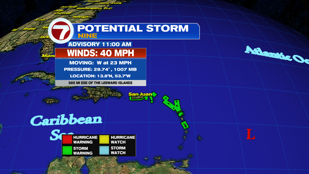
The National Hurricane Center (NHC) is issuing advisories on NEW Potential Storm 9.
Stats:
- Winds: 40 mph. They extend out from the center of circulation up to 230 miles.
- Located: Just under 600 miles ESE of the Leeward Islands
- Moving W rather fast at 23 mph
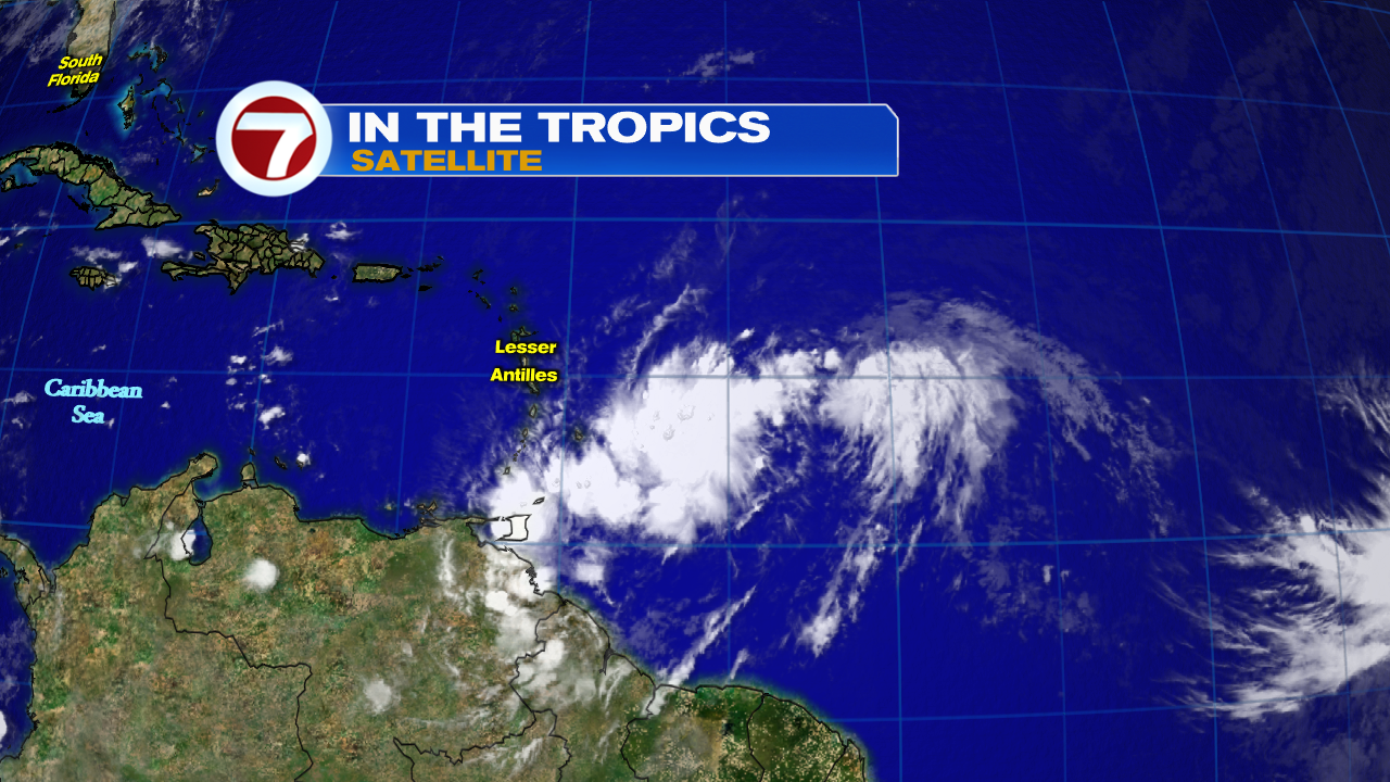
- Clouds from PS 9 already moving across the Windward Islands
Tropical Storm Warnings now in Place:
* Puerto Rico, Vieques, Culebra
* U.S. Virgin Islands
* British Virgin Islands
* Antigua, Barbuda, Montserrat, St. Kitts, and Nevis
* Guadeloupe, Martinique, and St. Martin
* Saba and St. Eustatius
* St. Maartin
A Tropical Storm Warning means that tropical storm conditions are
expected somewhere within the warning area within 36 hours.
What is a Potential Storm?
This is a term used by NHC that allows them to start issuing advisories even before an actual system is classified. It affords residents in the path of the developing system a chance to get advance notice to prepare.
If Potential Tropical Storm 9 intensifies, it will be called Isaias. That is Spanish for Isaiah.
Present Concerns:
Potential Storm 9 can dump heavy rain. Forecasts call for 3 - 6 inches with some spots up to 10" across the Northern Leeward Islands, Virgin Islands, and Puerto Rico in the upcoming days. That could lead to flooding, land and mudslides.
Wind will also be an issue. Forty plus, mile per hour winds will be possible over the same area from Wednesday through Thursday.
Cone of Concern
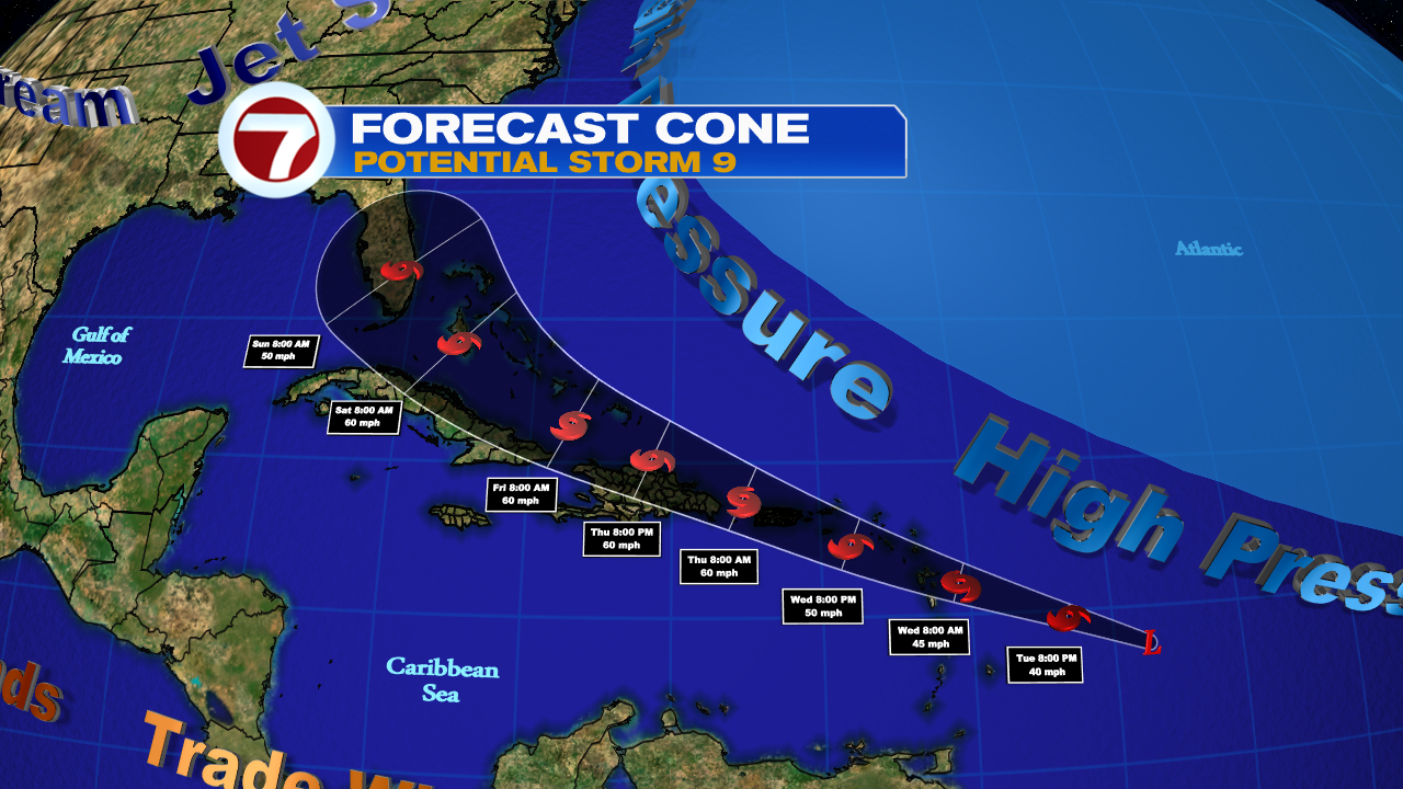
Models suggest this system should become Tropical Storm Isaias as early as Tuesday Night. High pressure steers it in a northwesterly direction across the Leeward Islands, Puerto Rico, Dominican Republic, all of the Bahamas and eventually South Florida.
The issue with the cone and the intensity is that the system does not have a well organized center. If that center develops a bit further north or south of its present location it will change the forecast track.
Worry meter is elevated for the islands under the watches.
The Bahamas and south Florida. Now is the time to review your plans and supplies. There is still a lot of uncertainty with this system as it may fluctuate in strength and track. You should review review your needs and be prepared to act if advisories are issued for us.
We'll be watching
No comments:
Post a Comment