A big tropical mess is moving over the Caribbean Islands and it may eventually travel to South Florida.

This spin of clouds and rain is known as Potential Storm 9. There is a spin in this feature but the actual low pressure center has been elusive.
Hurricane Hunters could not find it on Tuesday. They will try again on Wednesday.
If it can be found, it will be classified as a Tropical Storm and be called Isaias.
Health Status
A few things are working against this system. There is dry air to the north with some Saharan Dust. Also strong upper level winds known as Shear are helping to keep it in check and of course land interaction. Still, it seems to hang on.
The Forecast Cone
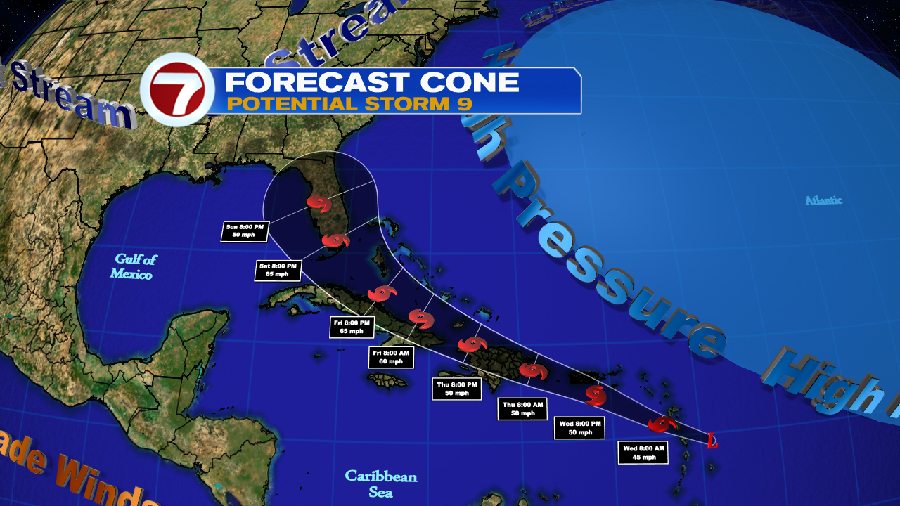
The track will be a bit challenging. Models base their forecasts on a good starting fix. Because there's no closed center of circulation, the cone and intensity forecasts will remain iffy until the center is found.
We know the system will move over the Leeward Islands early on Wednesday with heavy rain and gusty winds.Then travel over the Virgin Islands and Puerto Rico Wednesday evening. It could reach Dominican Republic and Haiti the next day. Cuba will get the rain and wind by Friday.
In the long run, it may even reach South Florida and the Bahamas. All that may change if the center is found in a different location than presently estimated. The system will be pushed NW by high pressure and will look for the gap between the high and the approaching jet stream as its route north.
Hazards
Rain will be the biggest concern. Large amounts will lead to a flooding threat along with land and mudslides.
The forecast calls for:
- Leeward Islands & Virgin Islands: 3" - 6"
- Puerto Rico: 3" - 6" with up to 10 in spots
- Dominican Republic: 3" - 6" with some areas as much as 8"
- Haiti: 2" - 4"
- Windward Islands: 1" - 3"
South Florida and the Bahamas should monitor closely. Many things can change in the next 24-48 hrs. with the forecast track.
We'll be watching
Thank you!
ReplyDeleteYou are welcome!
ReplyDelete