Sunday, July 7, 2019

Higher Chances for Gulf Development

The National Hurricane Center (NHC) has raised the chances for a low to develop in the Northeastern Gulf of Mexico.

At the moment, we are keeping our eyes across the Southeast, where atmospheric conditions are conducive for an area of low pressure to form.


The low could form anywhere between Tennessee and the Florida Panhandle over the next few days.  This is not where we normally look for storm formation, but this low may spin up in such a way that it may ultimately slip into the warm waters of the Gulf.

Latest Chances from NHC


As of Sunday afternoon, an elongated area of low pressure was meandering southward. NHC expects a low to form once it gets in the Gulf (Maybe earlier). It could form anywhere in the area highlighted in orange over a 5 day period. They're giving it a 60% chance of actually developing, up from 20% late Saturday night.  Waters in the NE Gulf of Mexico are in the upper 80s. Tropical systems need at least 80 degrees of water temps to grow. There is plenty of fuel there for this one to take advantage.

What are the models suggesting.
Here are three of the ones I look at:
The European model places a well defined low at the mouth of the Mississippi River with the Bermuda high stretching from the Mid Atlantic all the way to Florida.


The GFS, shows a broad area of low pressure south of Florida's Panhandle. Florida would still be under the influence of the Bermuda high but showing up a bit weaker.


The GEM model has the low developing near Florida's Big Bend, with the Bermuda high at its weakest over Florida. Model runs courtesy : Tropical Tidbits

Bottom line: It appears that something is set to develop across the Northeast Gulf that could stick around the area through Friday.

Where will it go?
Since nothing has developed yet, models do not have a starting point so an ending point is just an educated guess. As of this writing, this is the thinking.


High pressure moves west taking the low with it. Eventually another front comes out of the Nation's mid section approaching the Southeast. Notice the gap between the blue arrows (western extent of the high) and the front. This is a road developing in the atmosphere that the low would end up taking.

Again CAUTION, nothing has developed yet. Once it does we will have a better understanding of its structure, surroundings, and possible future path. Keep monitoring for the latest. Everyone from Louisiana to Florida's Panhandle should be cautious. If we are lucky and nothing develops, expect heavy rain across the Panhandle through Central Florida, and even South Florida could get downpours from the Tropical Moisture.

We'll be watching.


Saturday, July 6, 2019

National Hurricane Center Watching Gulf

An uncommon path may lead to tropical development in the Gulf over the next 5 days. It doesn't happen that often but it's not rare. Sometimes we get lows moving off the Eastern Seaboard that turn into storms. This one may actually spin up across Kentucky / Tennessee.


The National Hurricane Center (NHC), says a front moving across the Southeast could spin up an area of low pressure. It should then drop into the Gulf, where very warm waters there could give it the energy it needs to grow.


Once in the northeastern Gulf, NHC is giving it a 20% chance that it could develop into a depression or tropical storm. We will be following this carefully. It was just last year that powerful hurricane Michael struck the Panhandle.

 Forecast

For Sunday and Monday, the general wind flow will be out of the south, then southwest. This will drag in moisture from the Caribbean. You can expect anytime downpours, higher chances on Monday.


Low develops
The forecast suggests a low will develop over the southeast from a stalling front.  The front will slowly sag south and start falling apart.The low will sink into the Gulf maybe by Wednesday.

Where will it go?

High pressure sitting to our East will build and move west (the western edge of the high represented by the blue arrows). This is like a big bully pushing the fledgling low west. Eventually another front dives south creating a nice path for the low to take. It could just head northeast across the southeastern US and moving offshore by the Mid Atlantic.

Nothing has developed yet, and at this point models are giving us educated guesses. All we can do is wait and see if anything organizes in the days ahead. We'll keep you posed.


Friday, July 5, 2019

Tropical Development in the Gulf?

Something interesting may happen over the next few days that may lead to tropical organization in the Gulf of Mexico.


Instead of looking out into the Gulf for an area of disturbed weather or even across into the Caribbean, we will be looking over the Heartland. Yes, a front coming out of the Midwest may spin up an area of low pressure and then push it into the northeastern Gulf.


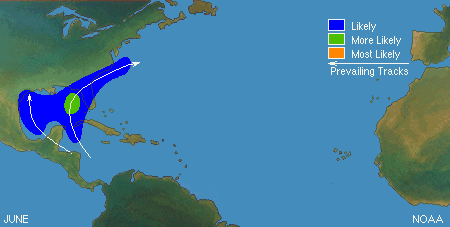
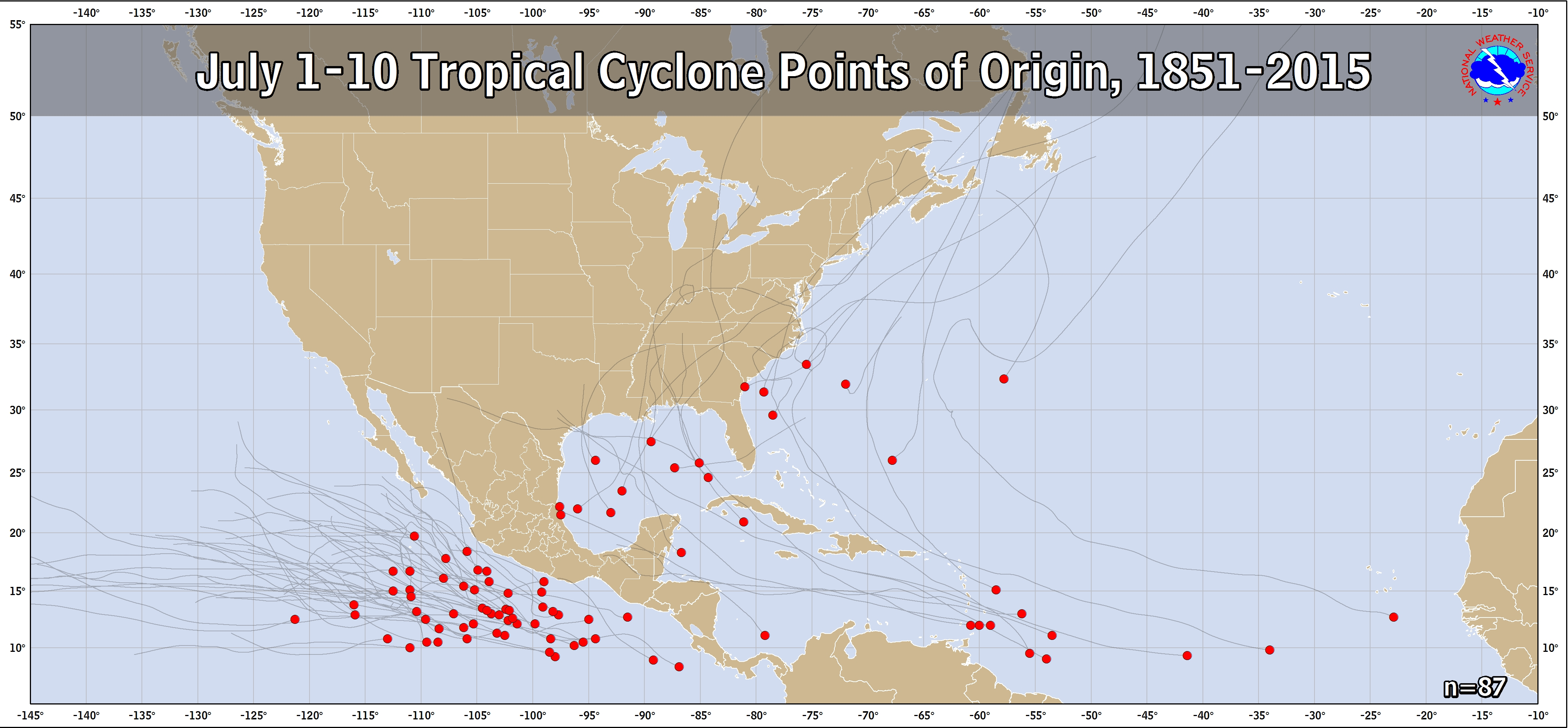
It's worth noting because if it does dip into the Gulf, it will travel into one of three areas that tend to spawn storms during the month of July. Historically if anything were to develop this time of year, it would do so in the areas highlighted blue. The arrows indicate the favored routes.

Model Data
European


This model places a possible low just south of the Panhandle by the middle of next week. Even if nothing develops, the wind flow will be out of the southwest and will push along lots of moisture. This could lead to a wet scenario for much of the state.

GFS


This is an almost identical model, with the sole exception of not looking so wet for South Florida.

Fuel to Grow


If indeed the Low does drop into the Gulf, there will be plenty of fuel for it to grow. Tropical systems need at least 80 degrees of water temperature to develop, and as of the latest observation from buoy data, temps are in the upper 80s.  Plenty to monitor in the days ahead. We'll be watching.


Thursday, June 27, 2019

Weekend Rain?

Weak Tropical Wave may bring us a soggy weekend.


Waves are difficult to forecast, they can grow quickly or fall apart just as fast. We've been following a weak wave centered over Eastern Cuba that promises to bring us a good chance of downpours as we head into Saturday & Sunday. Keep in mind that waves are fickle, so if this one does not fall apart, a rainy weekend is on tap.
 

Color satellite image shows a line of clouds over Eastern Cuba. This is the western-most edge of the wave.  The reason we use the color infrared image is to detect where most of the heavy rain is located. We give the highest cloud tops the red colors. The higher the cloud top, the heavier the rain tends to be. This tool is very useful over areas that lack radar technology.


Water vapor imagery over the same area illustrates how much moisture is in those same high clouds, but not at the surface as falling rain, but at higher elevations. It's like trying to look into a sponge and seeing how much water it is holding. The green areas show high concentrations of water vapor which can lead to more downpours.

Friday Forecast
European Model


If this wave holds, high pressure to the northeast will help drag in the moisture, shown in green. This means by Friday some storminess can be expected over Cuba, the Bahamas, South Florida

Saturday Forecast


 The first half of the weekend may prove to be the wettest with possible downpours over much of the peninsula, NW Bahamas and Cuba.


 Sunday Forecast


As the wave moves west, we could still see lingering moisture causing some showers and storms through the second half of the weekend.The rain may stick around over the NW Bahamas and Western Cuba as well.


Wednesday, June 12, 2019

Hurricane Forecasting Improved today

Storm model improvement

Weather lovers have come to know the two most relied-upon models for storm forecasting, the European model and the Global Forecast System (GFS). The latter is operated by NOAA here in the US.


There has always been a concern that the GFS was lacking a bit in its forecasting capabilities, specially when we are tracking hurricanes.


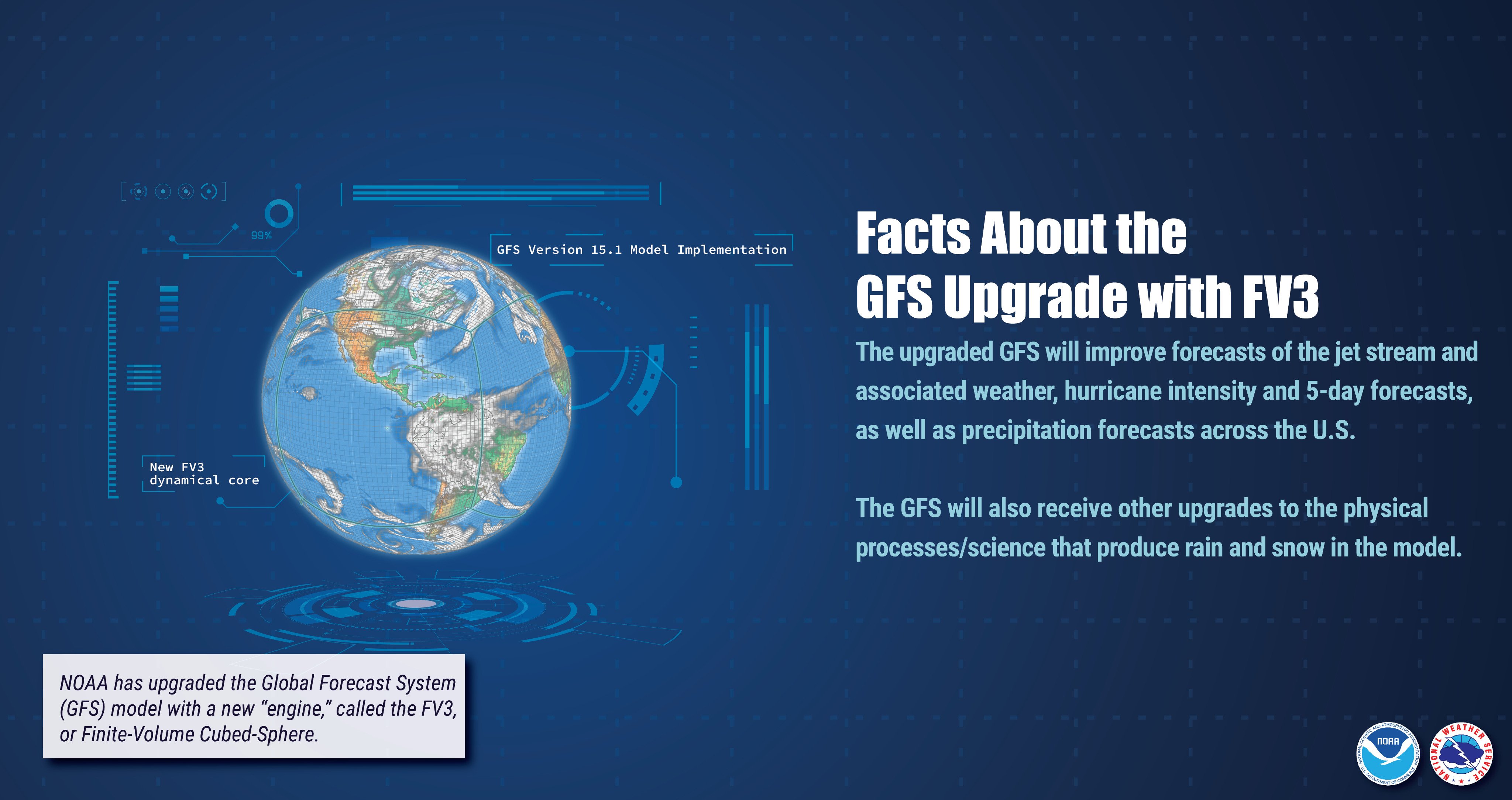
Today this model is getting a huge shot in the arm to help improve its forecasting muscle. It is being upgraded to contain, what NOAA is calling, the Finite-Volume Cubed-Sphere (FV3).  This will help it deliver better forecasts for hurricanes, severe storms, and even winter weather. The new GFS will utilize a combo of short and long range modeling to deliver a more precise forecast.  This is welcomed news when we talk about hurricane tracking.


Hoping we won't get a chance to use it this year. Info Courtesy NOAA


Tuesday, June 11, 2019

Anything in the Tropics?

Its been a relatively quiet start to hurricane season 2019. Outside of Subtropical storm "Andrea" which barely lasted a day in mid May, we have not seen much activity.


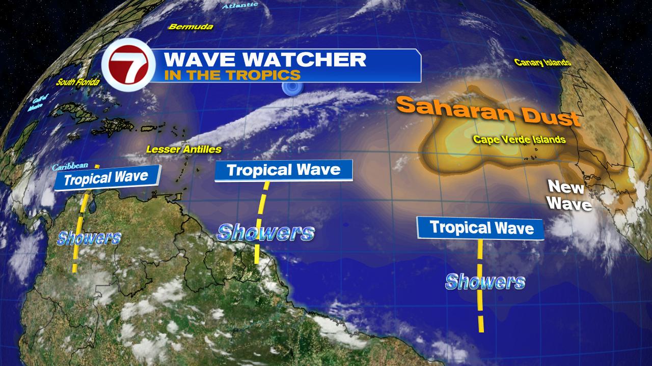
The satellite imagery shows cloudiness over much of the Atlantic Basin but nothing to worry about. In fact if you look to the right side of the image, you'll notice an orange tint to the clouds by Africa. This is Saharan dust blowing off the continent by huge storms there. This dust should help keep any tropical action from developing in the Eastern Atlantic.


The surface map illustrates where the highest concentration of Saharan dust can be found. A light dusting can be seen as far west as Puerto Rico.

Possible Development
Some folks are asking me if there is something developing in the Caribbean Sea. They are citing some web pages that show this possibility. 

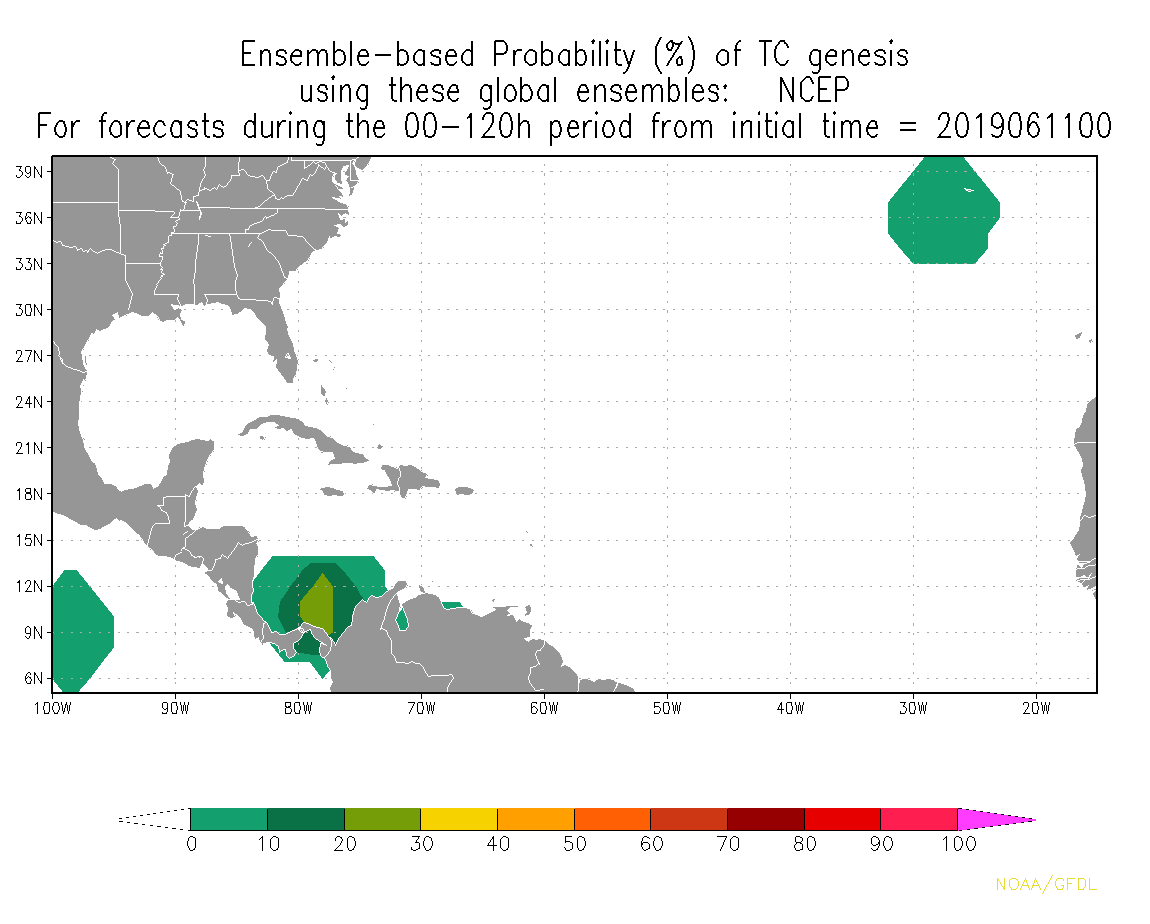
There are models that try and look ahead to see if anything will develop. This following graphic is a combination of three of them. They suggest that over the next 5 days, something may try to get its act together next to Panama with another area in the Atlantic Ocean.  


Word of caution, these models are speculative and they merely suggest the possibility of something trying to develop. NHC officially says, nothing is expected to develop during the same time frame. I trust the experts at the hurricane center.


Saturday, June 8, 2019

Hot & Stormy

This weekend will see South Florida flirting with record heat, only to be cooled by possible strong storms.


Satellite View


On this screen grab, you see a line of clouds by Eastern Cuba and out into the Atlantic. This is a dying front moving away.  Then there is a huge canopy of clouds over Florida and the Southeastern US. This is due to a low pressure system.

Surface Map


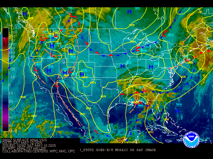
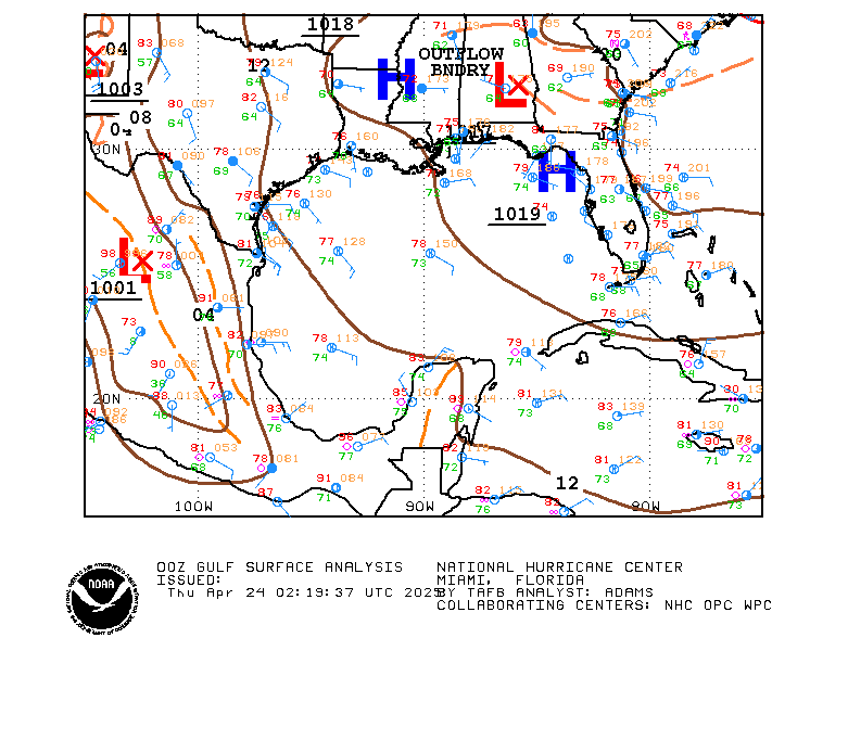
On this map the low is sitting over Mississippi with winds flowing out of the Gulf of Mexico. Not seen, but very much a huge player, is high pressure in the Western Atlantic. Both of these features are dragging tropical heat and humidity from the Gulf of Mexico towards South Florida and the NW Bahamas.

How Hot?


We could be flirting with record heat from Key West north to Ft. Lauderdale. The heat index could well top off between 100 and 110 degrees.

What is the heat index?
When the humidity is really high, your sweat cannot evaporate off your skin and cool you down. This lack of evaporation makes the temps feel hotter than they really are. This is your Heat Index or Feels Like temps.

Radar


With all the heat around, and with plenty of moisture coming off the Gulf, this combo is part of the recipe for rain. We should see it both days. Model runs are shifting back and forth on which day will be the wettest. Yesterday they were hinting at Sunday, today hints at this afternoon. Nonetheless, storms will be around, some strong, for the weekend.

Remember, if you hear thunder, it means lightning is very close to you. Head indoors right away and avoid being struck.

We'll keep watching.


Saturday, June 1, 2019

Chances higher for Gulf Storm

The National Hurricane Center (NHC) is raising the chances for organization for an area of low pressure in the Southwestern Gulf of Mexico. A recon plane is on stand-by for tomorrow if needed to check out the would-be system.

As of the early afternoon update from NHC, the low looks better defined as it spins in the Bay of Campeche. The lack of organized thunderstorms is keeping it from being upgraded to a depression or a tropical storm, but that may change early next week.


NHC is upping the chances for growth from 50% to 60% over 5 days in the area highlighted orange. Even if it doesn't develop, it will surely dump plenty of rain over Coastal Mexico. This will in turn cause flooding, land, and mudslides.

NHC is now calling this low, Invest 91L. Invest for an area they want to INVESTigate further, "91" is just a tracking number used until it organizes, and "L" stands for the Atlantic Basin. Invest 90L was used by Andrea in mid May. The next Invest will be 92L. When the sequence reaches 99L, it'll start at 90L again and repeat.

Where is it headed?


You are looking at the spaghetti models (their nickname comes from all the tracks looking like cooked spaghetti) and they do not show much movement in the days ahead. Most agree whatever develops will move inland across Mexico's Gulf Coast. Keep in mind since nothing has developed yet, the models are purely guesstimating. Once there is a well organized center, then the models will have a good starting point in which to base their forecast tracks.

Euro vs GFS Models


The European model suggests the low will continue tracking into Mexico possibly moving on shore by Sunday.

This model places the system across the central Gulf Coast of Mexico.


The GFS model is a bit slower in forward speed. It keeps the low in the Bay of Campeche thru Sunday.

The GFS then dissipates it quickly as it moves inland.


Rain Maker


By Sunday, even if nothing develops, the Low will have enough moisture to provide heavy rain over much of the Mexican coast. The GFS rain model suggests big downpours over a 2-3 day period.

NO Impacts are expected across Florida, or the Bahamas from this low. Cuba may get some scattered downpours over the Western part of the island.

We'll keep watching.
Watching a Low in the Gulf

Hurricane Season is underway and the National Hurricane Center (NHC) is already busy. They are watching a broad area of low pressure in the Southwestern Gulf of Mexico.  

This Morning's Satellite Loop


The loop runs from the overnight hours to early Saturday morning.  You can see a small spin of clouds in the Bay of Campeche, or the SW Gulf of Mexico. This is what NHC is monitoring.


NHC says it has a 50% chance of growing into a depression or storm over the next 5 days in the area highlighted. Even if it doesn't develop, it will drop plenty of rain over coastal Mexico, leading to flooding and mudslides.

This system is sitting right over an area that we monitor closely this time of year.

Early in the season, we look to the Caribbean Sea, Gulf of Mexico and Florida's Coastal waters for storm formation. These bodies tend to warm up the fastest, and thus systems can develop quickly.  Storms need at least 80 degrees of water temp to organize, so we pay close attention to these areas. Today we are looking at scattered clouds under very nice conditions. No worries here.


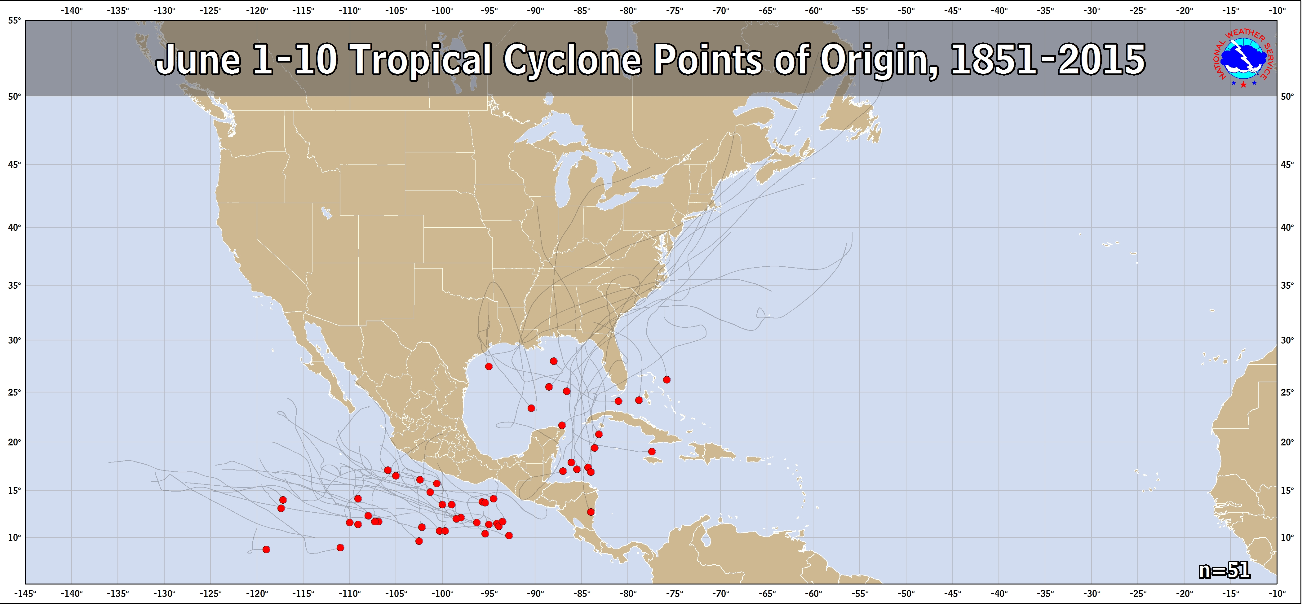
Over the first 10 days of June, no storms organize in the Eastern Atlantic, more form closer to us, with the bulk of activity in the Eastern Pacific Ocean. Their season started May 15th, because water there heats up the fastest.


If anything were to develop this month, these are the favored tracks by tropical systems.


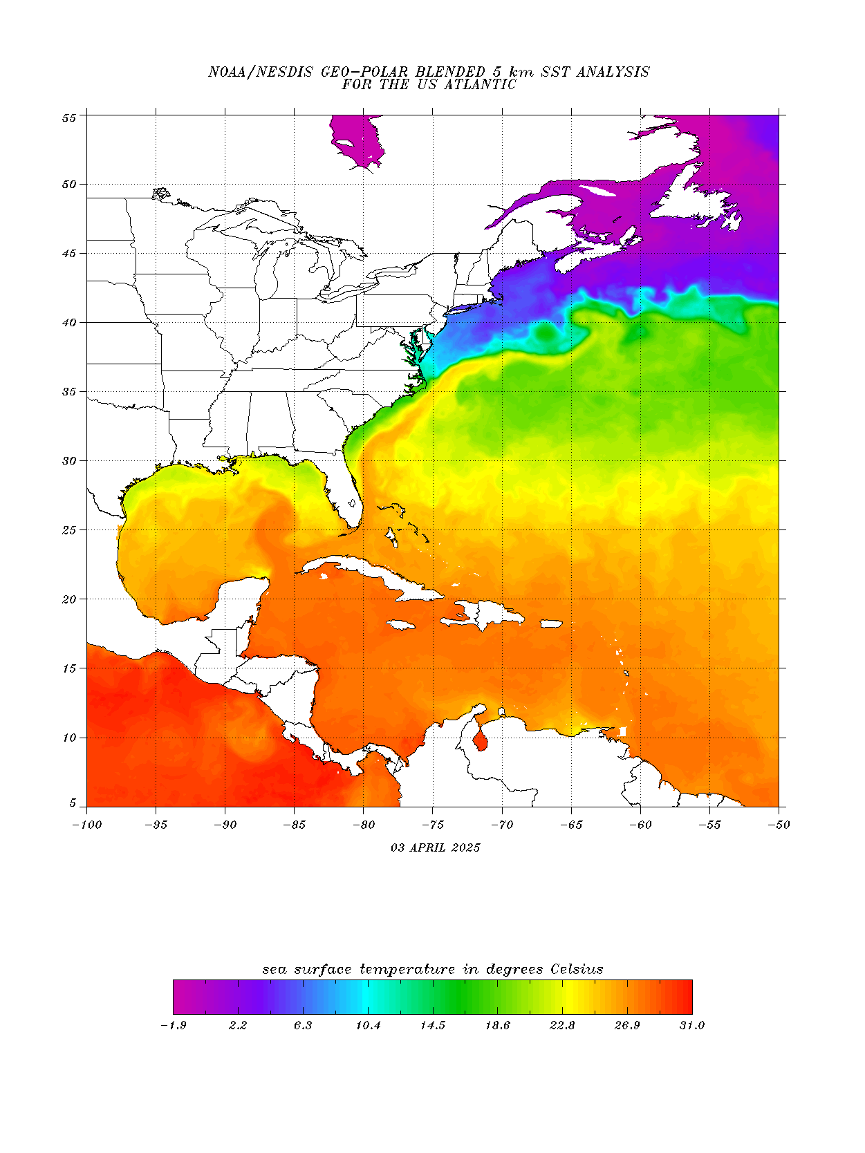
SEA SURFACE TEMPS
Water temperatures displayed in Celsius
Speaking of hot water, look at the area west of Central America and Mexico. Plenty of heat energy for anything to develop. There however, most tracks move out over the Pacific.

For us, temps are warming up, specially in the area where formation is more typical this week.

While everything is quiet now, I suggest you get ready and prepare.

Take one day to get your supplies out of the way. Invest one day into a season that lasts 6 months and you'll be ready for whatever Mother Nature throws our way..

No worries anywhere now, so enjoy, we'll keep monitoring. 


Friday, May 31, 2019

Hurricane Season has arrived

The 2019 Hurricane Season is upon us. 
We'll look at what to expect and the latest on El Nińo.

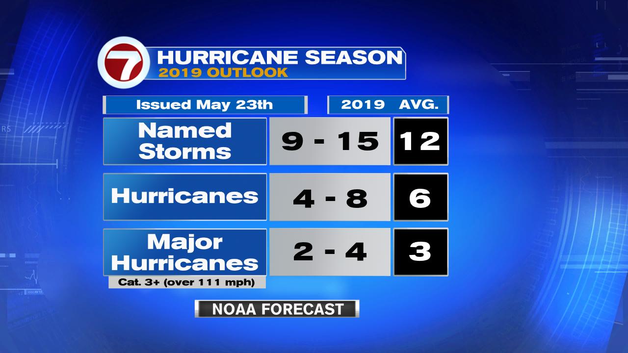
 2019 Seasonal Outlook


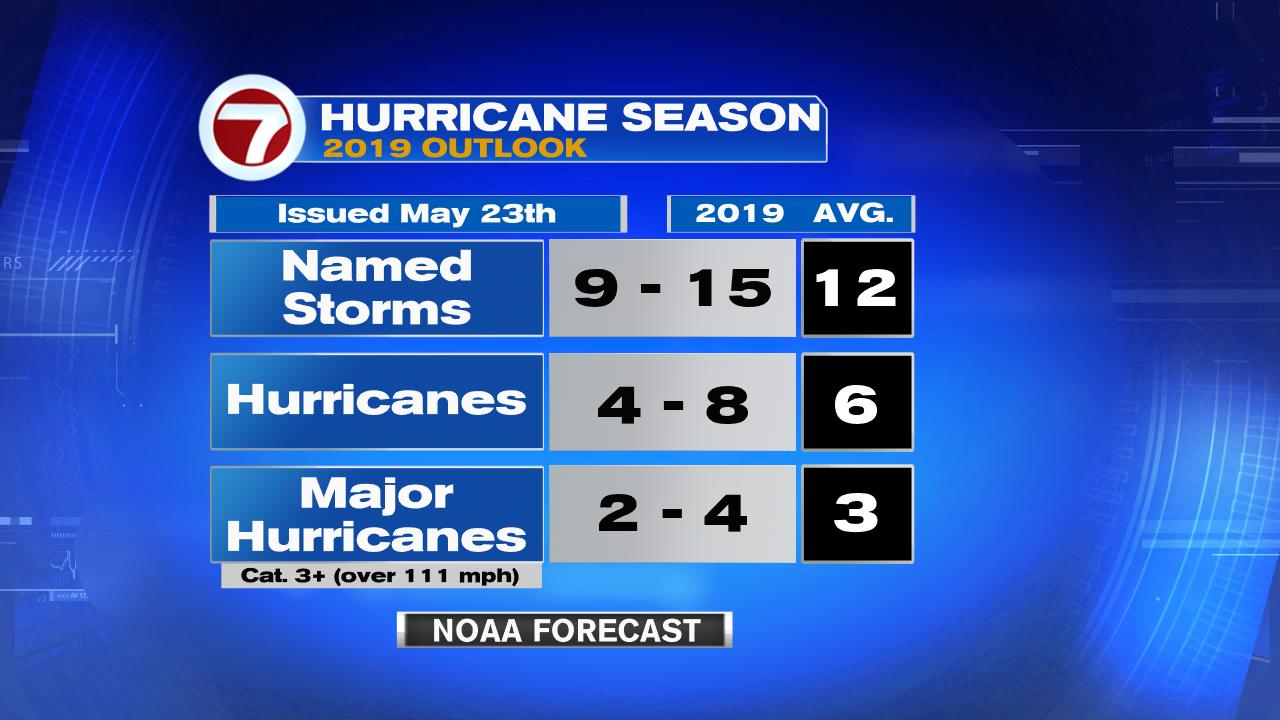
Seasonal Forecast:  For this year, the outlook is calling for 9 to 15 named systems, out of which 4 to 8 could become hurricanes, and out of that number, 2 to 4 could be category 3 or stronger.

None of these long range forecasts will ever tell you where and when a storm will strike. It's best to be ready for whatever Mother Nature throws our way. It only takes one to make landfall and cause heavy damages.


As of May 31st, NHC was keeping their eyes on an area of clouds and rain over the Yucatan for possible development. There is a 30% chance it could organize in the area highlighted in yellow over the next 5 days. 
It may end up drenching Mexico throughout the weekend. 

If you think this is an early start... we've  already had a named system in the Atlantic. It was a very short lived system in mid May. Subtropical Storm Andrea, lasted for only 19 hours between May 20-21st. It marked the fifth year in a row we see tropical activity before the start of June.

Hurricane season runs from the first of June through the end of November.


The Monkey Wrench: The National Oceanic and Atmospheric Administration (NOAA), has published reports saying that hurricanes are growing stronger in the Atlantic Basin due to Climate Change.

Harvey intensified in a short period of time before striking Texas a few years back , while Hurricane Michael transformed from a category 1 to 5 in a mere 24 hours. Keep this is mind as you plan.

Research also shows that of the four category five systems that have impacted the U.S. in recent history, each was only a tropical storm just three days away from land. This means, we need to pay attention to every system as they can rapidly grow and cause major damage. 

Preparing:
The National Hurricane Center and its partners, has been getting ready all off season for 2019, ending with their Hurricane Awareness tour just last month.  

NOAA & the U.S. Air force took their hurricane hunter air crafts to 5 U.S. cities and 6 Mexican and Caribbean ports. 

Among the crafts were the Hercules C-130 which flies into storms and the NOAA P-3 which usually performs recon over a hurricane.

This helped explain the role hurricane hunters have in gathering information to bring you the most accurate forecast possible.


El Niño's 2019 forecast

El Niño is a warming of the equatorial waters of the Pacific Ocean. It impacts marine and atmospheric currents alike. Typically when there is a strong El Niño, it creates upper winds that help cut down storm formation in the Atlantic Basin. This is very good for us.

This year the forecasts calls for El Niño, lasting through summer and weakening as we move into fall. The outlook suggests a 70% chance of  El Niño through September, with chances dropping to 55-60% by October We will monitor its progress closely since the peak of hurricane season is in November. 

This is what a strong El Niño event looks like with hot water stretching from Central/South America west into the Western Pacific Ocean

Last Year

2018 was a a horrific season ending with 15 named systems, out of which 8 became hurricanes, and out of that number 3 were major storms, (category threes or above).  One of those major systems was hurricane Michael, impacting Florida's Panhandle as the most intense storm to ever hit the area.

  • It went ashore near Mexico Beach, as a category 5 system with 160 mph winds. The National Hurricane Center says the system claimed 16 lives and caused so far 16 Billion dollars in damages. This is the first category 5 hurricane to hit the U.S. since Andrew in 1992. In March, Hurricane Michael, was retired from the list of names.  This happens when a storm is way too deadly and/or destructive for the name to be reused, and this one certainly fits the bill.
Aerial view of Mexico Beach Florida on October 11th

  • Hurricane Florence was another disastrous storm. It smacked the Carolinas as one of the deadliest and costliest systems making landfall in Wrightsville Beach, North Carolina as a category 1 system. It slowly traveled inland dumping lots of flood-inducing rain claiming at least 52 lives.  It too has been retired from the list of names.

As mentioned above, 2 names from last year's list were retired. The names Francine and Milton will replace the deletions. Hurricane names are reused every 6 years, with last year's crop reappearing in 2024. The agency responsible for coming up with the names is the World Meteorological Organization. It chooses male and female names that must represent all the languages spoken throughout the Atlantic Basin.  That's why you may see Dutch names, French, English and Spanish.  Get all the names for this year and beyond at the link below. 


We'll be watching


Thursday, May 23, 2019

2019 Hurricane Season Forecast

2019 Seasonal Outlook

We began the season with Subtropical Storm Andrea.It lasted for only 19 hours between between May 20-21st. This marks the fifth year in a row with tropical activity before the start of June.


The forecast is calling for 9 to 15 named systems to develop, out of which 4 to 8 could become hurricanes, and out of that number, 2 to 4 could reach major hurricane strength.

The Monkey Wrench: The National Oceanic and Atmospheric Administration (NOAA), has published reports saying that hurricanes are growing stronger in the Atlantic Basin due to Climate Change.

For example, Harvey intensified in a short period of time before striking Texas a few years back , and Hurricane Michael transformed from a category 1 to 5 in a mere 24 hours. Keep this is mind as you plan.

Research also shows that of the four category five systems that have impacted the U.S. in recent history, each had an intensity of a tropical storm just three days away from land. This means, we need to pay attention to every system as they can rapidly grow and cause major damage.

El Niño's 2019 forecast

El Niño is a warming of the equatorial waters of the Pacific Ocean. It impacts marine and atmospheric currents alike. Typically when there is a strong El Niño, it creates upper winds that help cut down storm formation in the Atlantic Basin. This is very good for us.

This year the forecasts calls for El Niño, lasting through summer and weakening as we move into fall. The outlook suggests a 70% chance of  El Niño through September, with chances dropping to 55-60% by October We will monitor its progress closely since the peak of hurricane season is in November.


Stay with us though out the season as we track any and all threats across the Atlantic.

Friday, May 17, 2019

Watching an area in the Atlantic

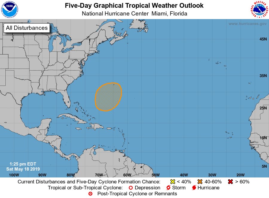
The National Hurricane Center (NHC) is keeping their eyes on an area of disturbed weather several hundred miles Southwest of Bermuda. They think it has a 40% chance of developing into something stronger over the next 5 days.


Satellite View:
Notice the line of clouds that stretches over Cuba, through the Bahamas, and then curls north into the Atlantic Ocean. This is a stalled out front. NHC thinks that just south of Bermuda, conditions could become favorable for a system to form within this deck of clouds.


The highlighted portion in orange shows where a low, depression, subtropical, or tropical system may form in the days ahead.


If it forms, where could it go?
Lets look at two models, the GFS and the Euro.


The big blue "H" in the middle of the Atlantic represents high pressure, while the "L" near Newfoundland Canada, stands for Low pressure.  The small circle to the left of the "H" is where the disturbance may be come Tuesday. It does not have a lot of breathing room and in the long term both the high and the low should squeeze it out of existence.


The European model is almost in fair agreement, with the only exception being a slightly weaker High.  Neither keep the disturbance around much after midweek.


The Bottom Line:
South Florida is NOT at risk of any impact from this area of disturbed weather. However, this is a great reminder that hurricane season is around the corner, it starts June 1st. This is a great time to review your supply list and get what you need now when all is calm and quiet.

Thursday, February 14, 2019

The Sun's Heartbeat on Valentine's Day

Just in time for Valentine's Day, our home star has given off a very potent heart beat. It has come in the form of a huge plasma eruption about 12 times bigger than our planet earth.


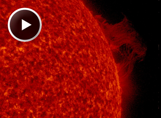
According to Spaceweather.com, this plasma shoot, is basically a combo of very hot positively and negatively charged particles. The picture shows the plasma blast on the northwestern rim of the sun. 


The plasma is shooting over 93 million miles into space. Experts call this a, "hedgerow prominence". 

But what is holding this string of plasma up so high? 

An unstable magnetic field is responsible for shooting it up at such a distance, but it can collapse it just as fast. If that support fails, the plasma can slam right back on to the sun causing a solar flare. This would be unlike a typical flare which is normally caused by a sunspot.

Neat little bit of info to impress your date tonight!  Happy Valentine's Day