
The satellite imagery shows cloudiness over much of the Atlantic Basin but nothing to worry about. In fact if you look to the right side of the image, you'll notice an orange tint to the clouds by Africa. This is Saharan dust blowing off the continent by huge storms there. This dust should help keep any tropical action from developing in the Eastern Atlantic.
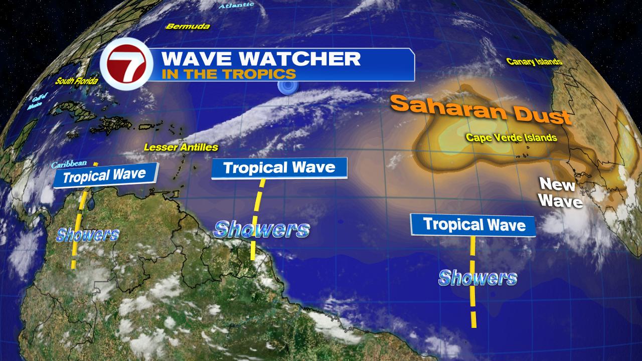
The surface map illustrates where the highest concentration of Saharan dust can be found. A light dusting can be seen as far west as Puerto Rico.
Possible Development
Some folks are asking me if there is something developing in the Caribbean Sea. They are citing some web pages that show this possibility. There are models that try and look ahead to see if anything will develop. This following graphic is a combination of three of them. They suggest that over the next 5 days, something may try to get its act together next to Panama with another area in the Atlantic Ocean.
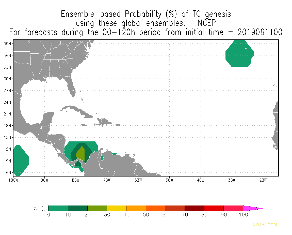
Word of caution, these models are speculative and they merely suggest the possibility of something trying to develop. NHC officially says, nothing is expected to develop during the same time frame. I trust the experts at the hurricane center.
No comments:
Post a Comment