The National Hurricane Center (NHC) is keeping their eyes on an area of disturbed weather several hundred miles Southwest of Bermuda. They think it has a 40% chance of developing into something stronger over the next 5 days.

Satellite View:
Notice the line of clouds that stretches over Cuba, through the Bahamas, and then curls north into the Atlantic Ocean. This is a stalled out front. NHC thinks that just south of Bermuda, conditions could become favorable for a system to form within this deck of clouds.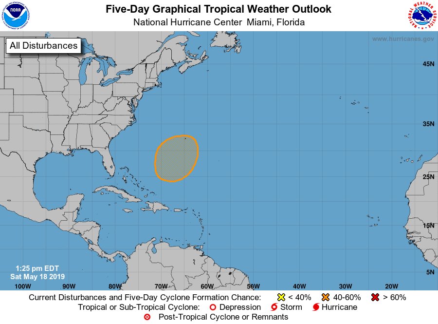
The highlighted portion in orange shows where a low, depression, subtropical, or tropical system may form in the days ahead.
If it forms, where could it go?
Lets look at two models, the GFS and the Euro.
The big blue "H" in the middle of the Atlantic represents high pressure, while the "L" near Newfoundland Canada, stands for Low pressure. The small circle to the left of the "H" is where the disturbance may be come Tuesday. It does not have a lot of breathing room and in the long term both the high and the low should squeeze it out of existence.

The European model is almost in fair agreement, with the only exception being a slightly weaker High. Neither keep the disturbance around much after midweek.
The Bottom Line:
South Florida is NOT at risk of any impact from this area of disturbed weather. However, this is a great reminder that hurricane season is around the corner, it starts June 1st. This is a great time to review your supply list and get what you need now when all is calm and quiet.
Thank you Phil.
ReplyDeleteYou are welcome.
ReplyDelete