 Maria is looking extremely ill with an elongated shape to it.
It has a weak center of circulation exposed to the elements on the western semicircle and what gusty winds remain are far removed from it.
The only reason NHC is keeping it as a Tropical Storm is because, at least for now, there is still a weak circulation center.
This is what early recon had to say about Maria:
THE INITIAL INTENSITY IS GENEROUSLY
KEPT AT 35 KT...WITH THE ASSUMPTION THAT TROPICAL-STORM-FORCE WINDS
ARE OCCURRING IN THE CONVECTION WELL TO THE NORTHEAST OF THE
CENTER.  BECAUSE THESE WINDS ARE SO FAR REMOVED FROM THE
CENTER...AND NOT EXPECTED TO IMPACT THE LESSER ANTILLES...ALL
TROPICAL STORM WARNINGS HAVE BEEN DISCONTINUED.
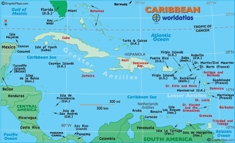
That weak center of Maria is over Antigua. You can see Antigua highlighted in red on the map below on center-right. Most of the rain and wind is to the Northeast of the Leeward Islands. About the only effects they may feel are breezy conditions and choppy seas, with an occasional t-storm.
Here you can see the cloud cover over the Lesser Antilles belonging to Maria. You will also notice a dark inverted comma shape pattern just to its northwest. This is an upper low and it's responsible for shearing Maria apart. This feature should remain for another 48 hours, if Maria can survive until then, it could restrengthen.

Most models now keep Maria as Tropical Storm over the weekend as it moves North of the Leewards and Puerto Rico. It should then be pushed away from Florida and the Southeast by strong upper winds coming off the Continental US. After that, it may be a worry for Bermuda.

Now we check up on Nate:
 This is a beautiful looking storm with plenty of banding and typical circular shape. It lacks however, a well organized inner core.
 Models hint at slow intensification as it moves west toward Mexico. Even though the forecast cone shows Nate as a storm throughout its duration, it may have just enough punch to reach hurricane status before landfall.
The biggest threat will be rain as it could cause flash floods, land and mudslides from the coast to far inland locations.

Phil we know maria is headed away from us but what about Ophelia (that wave behind maria)?
ReplyDeleteSo far nothing on Ophelia, hopefully it will stay that way.
ReplyDelete