The National Hurricane Center (NHC) is following two tropical waves that may develop in the days ahead. There's a vigorous wave in the Far Eastern Atlantic and a disorganized wave by Puerto Rico.

We begin with the closest to home:

This wave, while disorganized, has dropped a lot of rain across Puerto Rico and the Virgin Islands. It still has the potential for further downpours as it travels northwest over the next 5 days.

Over a period of 24 hours starting Monday at 8 am, the eastern side of Puerto Rico accumulated between 8 - 10" of rain. This has caused plenty of problems with standing water in many areas. San Juan set a daily rain record with 2.35". A Flash Flood Watch is in effect for Puerto Rico and Dominican Republic. Haiti should monitor closely in case the heavy rain travels their way on Wednesday.
What next?

If it does not fall apart, the wave will travel north of the Northwestern Bahamas, dropping more rain there. Once it reaches the area highlighted in yellow, NHC gives it a 10% chance that it could grow into a depression or a storm.

Even if it doesn't develop, the wave will drag tropical moisture our way. It will be steered by high pressure to the East, and an upper low in the Gulf. The moisture will only be able to go north and then northeast.
Here's what South Florida can expect:

Waves can be very fickle, growing quickly or falling apart just as fast. Be ready in case this one packs a wet punch.
Another Wave
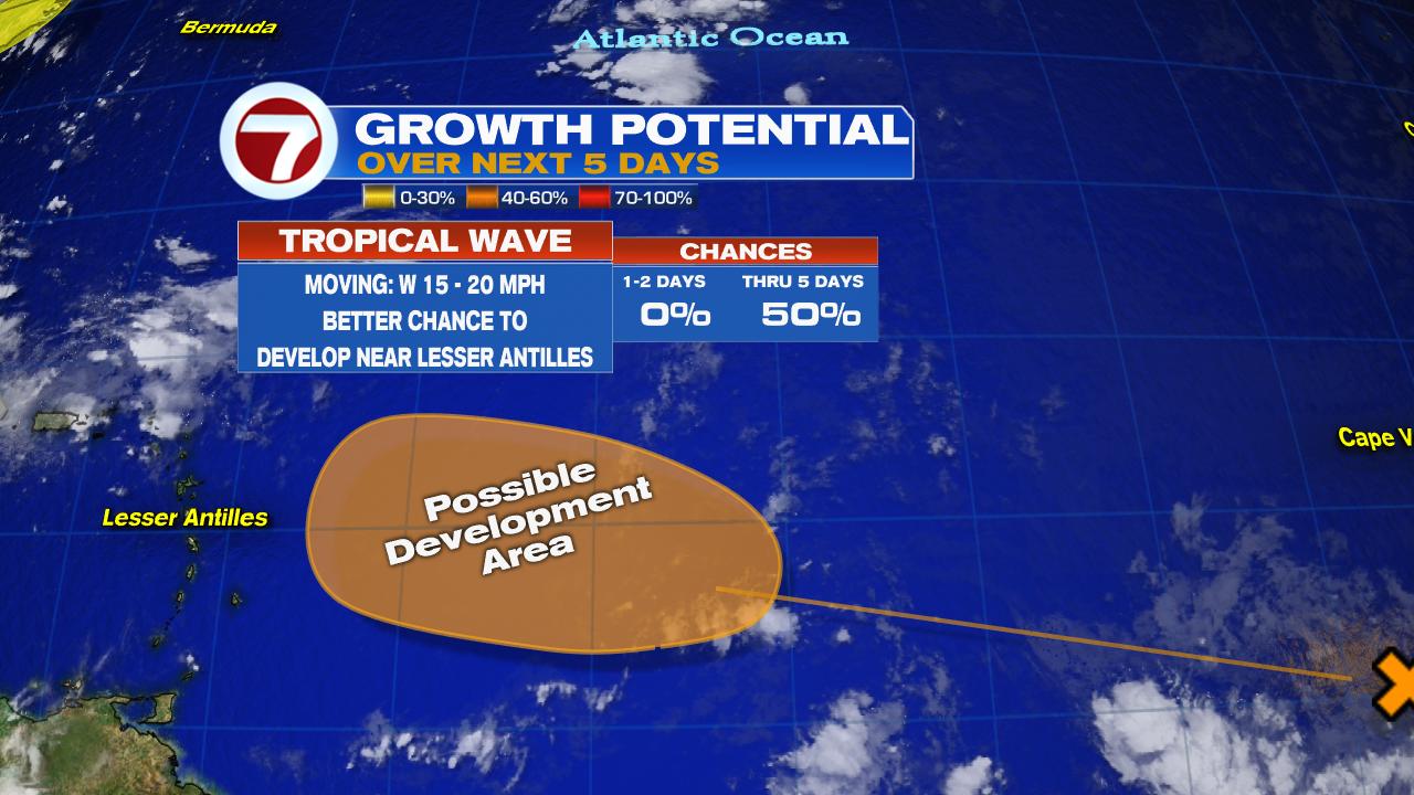
This wave is near the Cape Verde Islands. It will continue to move west over the next few days. Once it nears the Lesser Antilles, NHC gives it a 50% chance to organize in the area highlighted in orange. After that, it could make a trek towards the Greater Antilles. If its still around by early next week, South Florida will have to monitor it.
We'll be watching.
Does your station have a weather map I can download to my computer.
ReplyDeleteWe have a 7weather hurricane tracker app you can download. But if you are like me who like to track storms on old fashioned paper maps, the National Hurricane Center has them for free. Here's the link, you can download and print. https://www.nhc.noaa.gov/tracking_charts.shtml
ReplyDelete