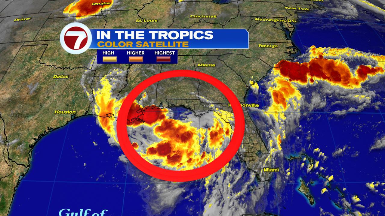
As of Wednesday morning a broad area of low pressure is spinning roughly 100 miles SSW of Apalachicola, Florida in the NE Gulf of Mexico. If it develops, it could produce up to hurricane force winds and a storm surge across parts of Mississippi, Louisiana, and Texas over the next few days. Major rainfall amounts can be expected from Florida's Panhandle thru Texas.
Chances for Development
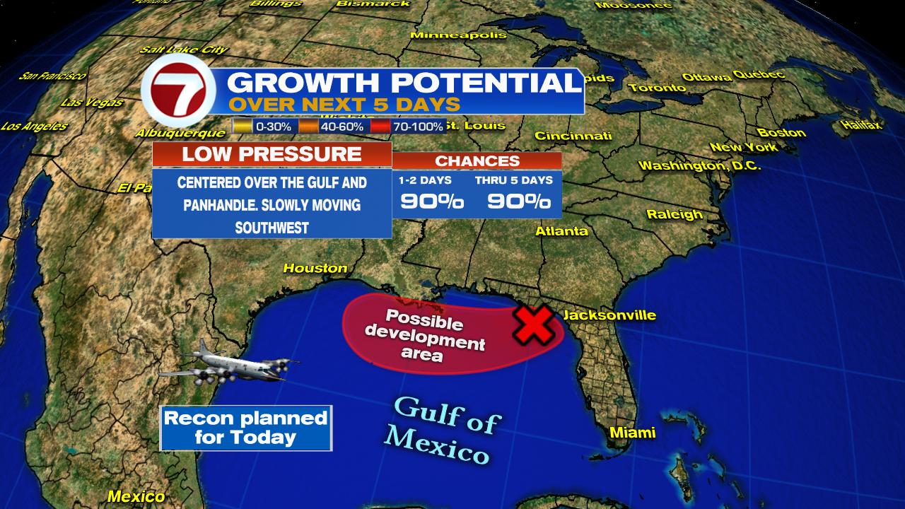
NHC is giving this feature a 90% chance that it could develop into a depression or a storm over the highlighted area in as little as 48 hours. This will NOT impact South Florida.
If it develops, where is it headed?

Most models agree that whatever blossoms in the Gulf will drag its feet along the Gulf Coast as it moves west. This could be a major rain event for some areas.
How much rain?

While much of the Southeast will get rain, it appears that the bulls eye for heavy downpours will be Mississippi and Louisiana. New Orleans could get as much as 12 inches of rain or more through Sunday evening. This will surely lead to flooding problems.
Active Tropics

Aside from the possible system in the Gulf, there are 5 tropical waves in the Atlantic Basin. Only a few have any rain as the Saharan Air Layer is keeping them mostly dry.
In the long run, some of that dust could reach South Florida, drying us out and making for hazy skies by the end of the week.

We'll keep watching
No comments:
Post a Comment