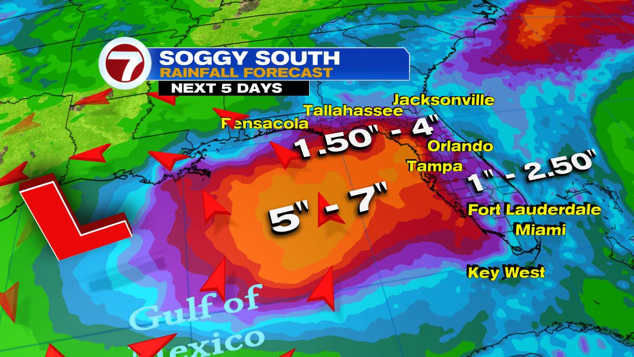
The National Hurricane Center (NHC) has raised the chances for a system to develop in the northeastern Gulf of Mexico.
The chances are now at 80% over a period of 5 days. They have been steadily rising since Saturday afternoon when they began at 20%. NHC has now deemed it Invest92L. This means it's an area they would like to INVESTigate further, 92 is just a tracking number, and "L" stands for the Atlantic Basin.
Satellite View
It does not look that impressive right now, but a broad counter clockwise spin is starting to come together between Alabama & Georgia. It continues to be pushed south by a thin line of clouds just to its north. That is a front meandering towards northern Florida. Once the front pushes the developing low into the warm waters of the Gulf, that's where we can get a tropical system.
Where could it form?
A system could organize anywhere in the area highlighted in red over the next 5 days. Everyone from Florida's Big Bend west to Louisiana should monitor closely.
Where will it go?
Invest92L will be a bit tricky to forecast. Surrounding it, is the Bermuda high to the east, another high in the Gulf of Mexico, and another front moving south across the Heartland. It appears it may get trapped along the Gulf Coast. This could mean heavy rain across the entire region.These are very early model runs, and as of this moment they do not have a good handle on the system. Some take it east and others west. We'll have to wait until new environmental data comes in.
Rain Worry
This is a great reminder for South Floridians, that we are in hurricane season. Review your supplies and get what you need now. This way if a threat approaches us, you will be ready to meet head on whatever Mother Nature throws our way.
We'll be watching


No comments:
Post a Comment