A Hurricane Hunter is set to investigate the Gulf of Mexico disturbance on Tuesday if needed.
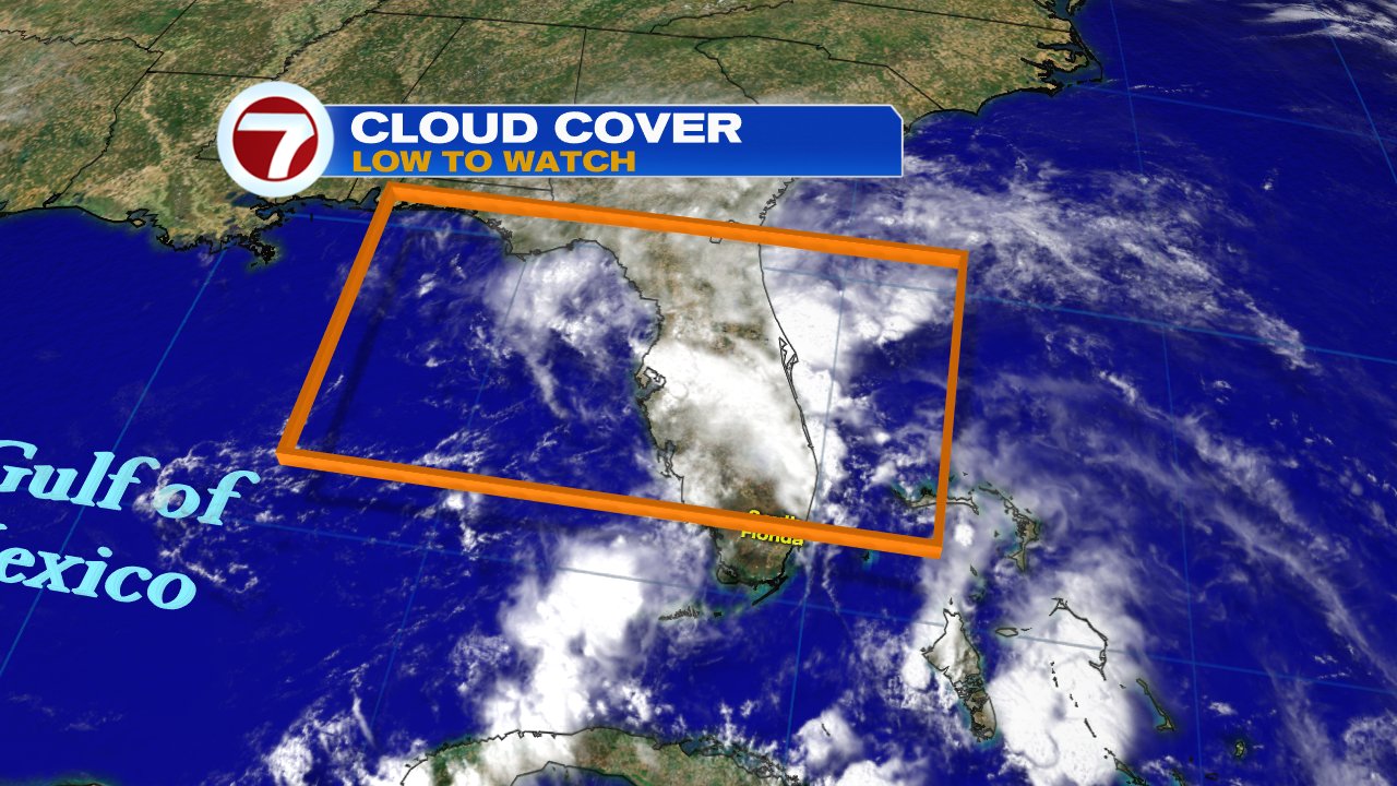
Over the last few days the National Hurricane Center has been giving this feature anywhere between a 20% to a 40% chance for development. If it does organize, it can do it anywhere in the area highlighted below as it slowly moves northward.
NHC added: Although the low could acquire subtropical characteristics over the next few days, it has shown little signs of organization. A subtropical system has a cold center while a tropical low has a warm core.
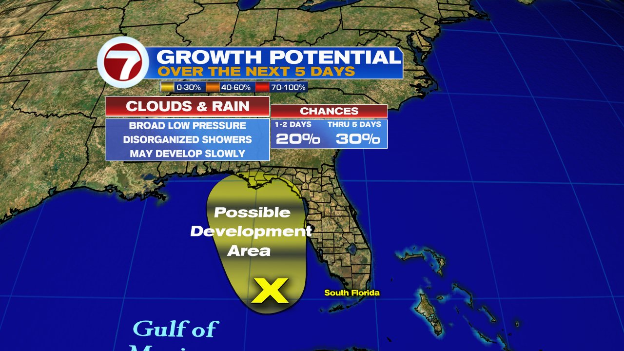
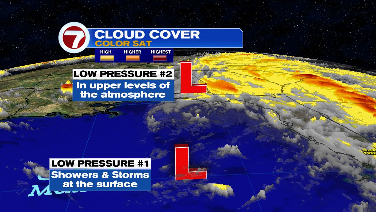
The disturbance is made up of two low pressure systems. The first is at the surface. Its trying to get organized, but the second low in the upper levels of the atmosphere is interfering with it and not letting it get its act together. While this may be good news, it will keep South Florida on the wet side for days.
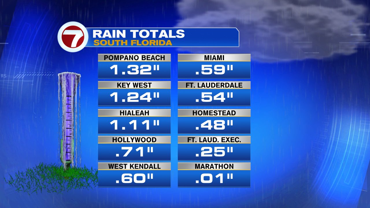
On top of the rain we had over the weekend, many areas across South Florida had big downpours on Monday. While Marathon remained mostly dry, other cities got soaked with over an inch of rain.
This disturbance is capable of producing widespread downpours over South Florida that may lead to street flooding. We've seen some standing water in low-lying areas, and the local National Weather office suggests an additional 3 - 5 inches is possible in total rainfall through the upcoming weekend.
No comments:
Post a Comment