The chances for a system presently in the Caribbean to develop over the next 5 days climbed Wednesday night to 70%.
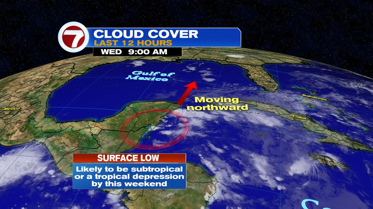
 From the satellite imagery, you can see a bit of a counterclockwise spin sitting near the Yucatan Peninsula, that is the low. A tail of clouds extends from there, northeast into Florida.
The National Hurricane Center (NHC) now says the Low has become better defined and is producing a large area of rain that reaches the Florida Straits.
The strong upper level winds that were keeping the low from organizing over the last few days appear to be weakening setting up the stage for possible strengthening.

The area we are looking at for possible development is highlighted in red.
This is where NHC thinks something may develop.
NOT A CONE OF CONCERN.
What will develop?
Its unclear at this point if we will get a depression or a tropical storm, or even a subtropical system.
A subtropical system is much like a hybrid storm, it acts and looks like a regular storm but lacks the well defined warm center of circulation. At times looking like a regular area of low pressure you may find over the U.S.

Where is it headed?
Its still not set in stone. The spaghetti models at this stage of the game are not that accurate. They need a good starting point to give us a good ending point. Since nothing has formed yet, they are just giving us a general idea of where the system may end up.
There is a chance, if it does organize, it could make landfall anywhere between Florida and Louisiana. At this point its just best to keep monitoring it. This will never take you by surprise. NHC can start issuing watches and warnings even before a system forms in order to keep you safe. We'll be here to keep you informed.
Possible Heavy Rain
The kicker to all this, South Florida, parts of Cuba, and the Bahamas could see big downpours even if nothing organizes. The amount of moisture lingering in the Caribbean is large and will get pushed our way.
The local National Weather Service office suggests we may see anywhere between 3 - 5 inches of rain with potential higher amounts. This will surely lead to flooding in areas of poor drainage.
We may start to see some the downpours as early as Friday and sticking around thru the Holiday weekend.
No comments:
Post a Comment