My next door neighbor just texted me with the following message, "I think I saw some animals walking in pairs on the side of the road... do you know something?"
I cracked a smile but knew exactly what he meant. When is this rain going to stop!
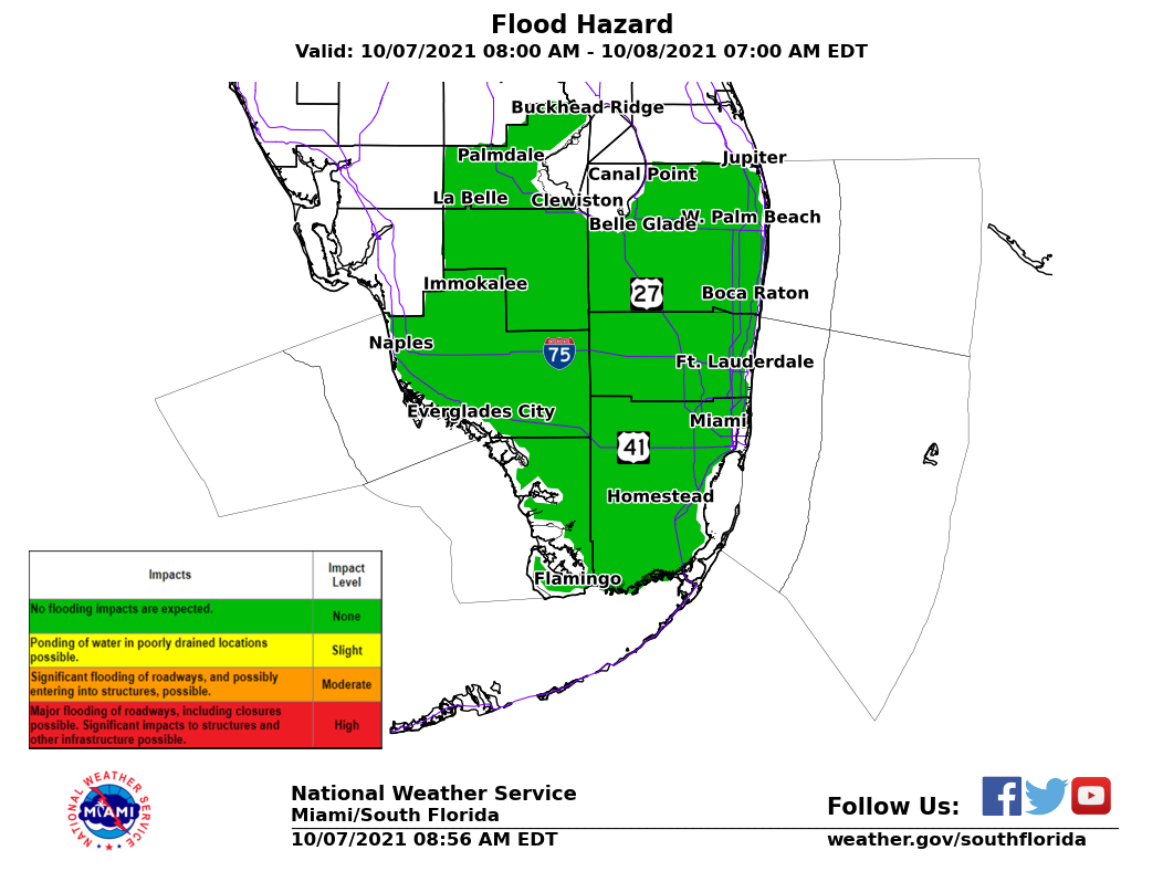
HEAVY RAIN
South Florida remains under a flood watch at least through Sunday night. I wouldn't be surprised if it gets extended until Monday as additional rain moves in. The graphic above indicates all of the Metropolitan areas of Miami-Dade and Broward Counties could see significant flooding of roadways with a chance for that high water to penetrate buildings. If you live in an area of poor drainage be alert. So the answer to my neighbor's question is; the rain stays for a few more days.

POSSIBLE TORNADOES
If the rain wasn't enough of a worry, there's also the threat of tornadoes through Monday night as well. All the instability in our atmosphere could produce twisters with an intensity of EF 1.
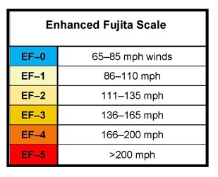
The tornado intensity scale is as follows: Named after famed Japanese Meteorologist Tetsuya Fujita, who pioneered ground breaking work into the field. If we get any tornadoes, they could have winds between 86 - 110 mph, capable of power outages, downed trees, and damages to poorly built structures.
GUSTY WINDS
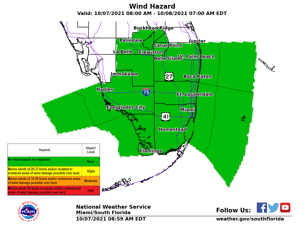
From time to time the winds will also kick up to around 30 mph or stronger across much of South Florida. A wind warning is also in place for the Keys with wind gusts up to 35 mph. Not a good day to be out on the road, and even less out on a boat.
SUBTROPICAL STORM ALBERTO
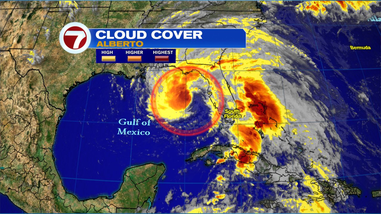
The reason for all this is Subtropical Storm "Alberto", which is spinning in the Gulf of Mexico a little stronger with winds up to 50 mph. It appears that it may be transitioning into a full Tropical system as the structure begins to tighten up and more thunderstorms are developing around its center. A recon plane is investigating as we speak, and "Alberto" may change its status later today.
It may make landfall across the Panhandle between Pensacola and Tallahassee by tonight or tomorrow morning. The track took a slight shift Eastward on Saturday as the center emerged father northeast than what was being tracked. This placed the future path away from the Gulf States and over Florida.
I'll keep you posted.
No comments:
Post a Comment