Memorial Day weekend begins with a Subtropical system in the Caribbean Sea that promises to keep us mostly indoors.
Its name is "Alberto", and it kicks off the 2018 season almost one week ahead of schedule.

As of Friday night, "Alberto" was not a healthy system, its center sits over 100 miles SSW of Cozumel, MX , but much of the cloud cover and rain is displaced to the east of the center. To the West, drier air was filtering in and as long as this remains in play, it will not intensify. However, as it slowly moves into the warm waters of the Gulf of Mexico, it has a chance to grow stronger as it soaks up all the heat energy.
May systems are not common but they do happen. Since the 19th century only 24 have been recorded throughout the Atlantic Basin.
What is a Subtropical System?
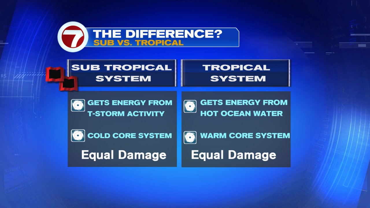
"Alberto" has been classified as a subtropical storm. It basically gets its energy from thunderstorms, instead of hot ocean water like regular tropical storms. It also has a cool center as opposed to the warm core found in true tropical systems. Outside of that... they look alike, rain alike. and cause the same amount of damage. "Alberto" should transition into a Tropical System over the weekend.
Where is it headed?
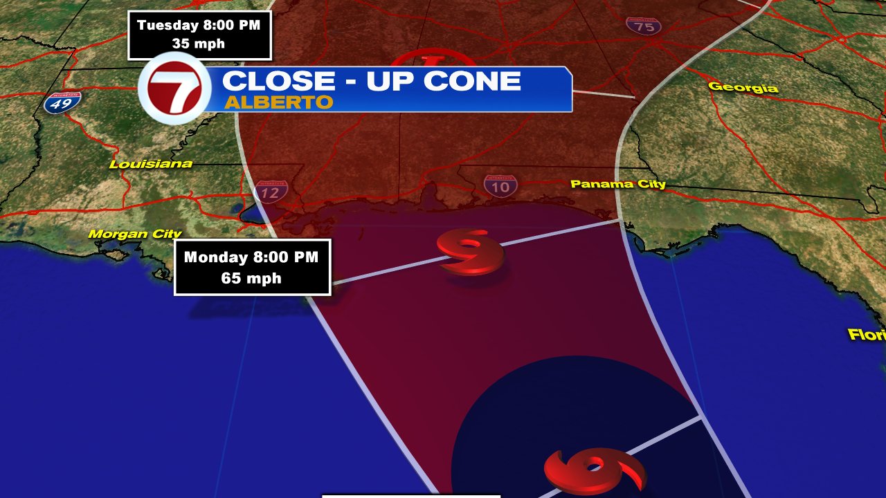
The official Forecast Cone from the National Hurricane Center (NHC), places it near the Gulf States by Monday evening, as a tropical storm. Some models hint at the possibility of strengthening to a category 1 hurricane with winds around 74 mph, just before going ashore.
What can we expect?
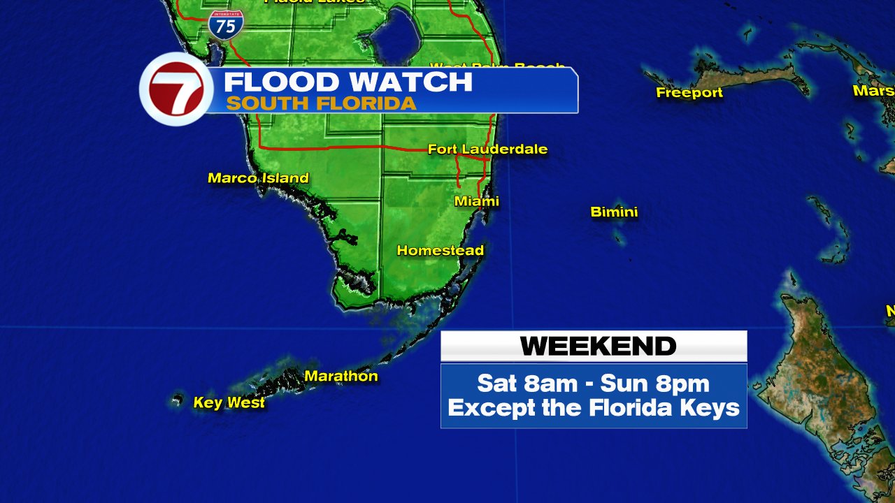
Rain, rain, and more rain is being called for by the models. There's plenty of moisture over the Caribbean Sea that "Alberto" will spin our way. Many models call for 3 - 5" inches of rain through Monday with some isolated spots getting as much as 12". With the ground already saturated from recent rainfall, we could see flooding. A flood watch is in effect for the Mainland (excludes the Keys), through Sunday night.
No comments:
Post a Comment