The National Hurricane Center (NHC) began issuing advisories on Tropical Depression 13, Wednesday night.

It organized from Invest98L, a low pressure system spinning in the middle of the Atlantic Ocean. NHC says it is already developing feeder bands as it moves west northwest.
The system should become Tropical Storm Laura on Thursday evening. This would set a record for the earliest "L" storm. The current record holder is Luis from August 29th, 1995.
Where is it headed?
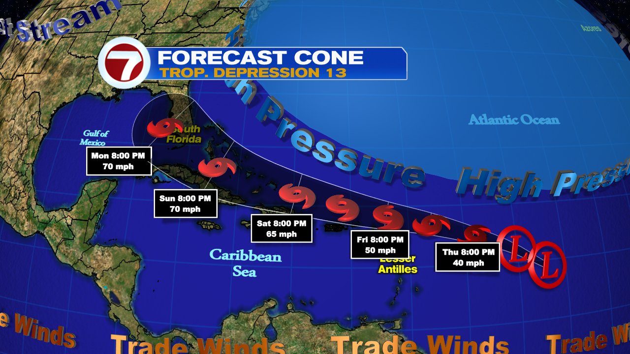
High Pressure will push it quickly to the west and track near the Leeward Islands by the end of the week. Heavy rain is expected there. It should then move close to Puerto Rico, Dominican Republic, Haiti and the Bahamas by the weekend.
Wind shear will be mostly absent as it travels over very warm waters. This could allow it to grow in strength. Intensity forecasting is very difficult so we need to monitor this closely.
Things to watch:
- If TD 13 takes a more southward track, directly over the Greater Antilles, it could stay as a weaker system. Unfortunately this could mean a greater impact for Puerto Rico and Hispaniola in the form of heavy rain that could lead to flooding.
- If the system tracks just north of Hispaniola, it has a chance to grow in strength. Maybe reaching hurricane status.
- Even if this system does not get any stronger, it could drop heavy rain over Hispaniola, Cuba, the Bahamas and South Florida over the weekend thru early next week.
No comments:
Post a Comment