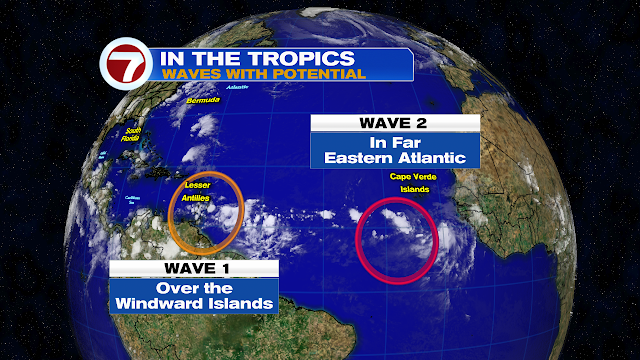
The National Hurricane Center (NHC) is following two areas in the Tropics for possible development.
Lets begin with the wave over the Windward Islands
This Wave is also known as Invest97L. It dropped plenty of rain over the Windward Islands, Trinidad and Tobago, and Northern Venezuela.
This wave is getting a moderate chance for development as it moves over the warm waters of the Caribbean Sea.
Where is it Going?
These early model runs are providing a guesstimate at this point, since a depression nor a tropical storm have developed yet. They suggest a slow northwestward track eventually taking it into the Gulf of Mexico. South Florida MAY get some rain over the weekend depending on hos close it gets to us.
The Second Wave
This disturbance has a high chance for development. Now known as Invest98L, NHC is giving it a 90% chance to become a depression or a storm over the red area over a 5 day period.
Where is it going?
Models again are just giving an estimate at this point, but they hint at a track towards the Leeward Islands. They should monitor closely as it may be near there as early as Friday. After that, everyone should monitor.


No comments:
Post a Comment