The Keys are under a Tropical Storm Watch as of Saturday afternoon. This is due to Tropical Storm Laura forecast to be near the area on Monday.

A watch means that tropical storm force winds are possible, along with heavy rain, and storm surge within 48 hours. It doesn't mean it will happen, but it is possible given the proximity of the storm. Now is a good time to prepare for any possible impacts.
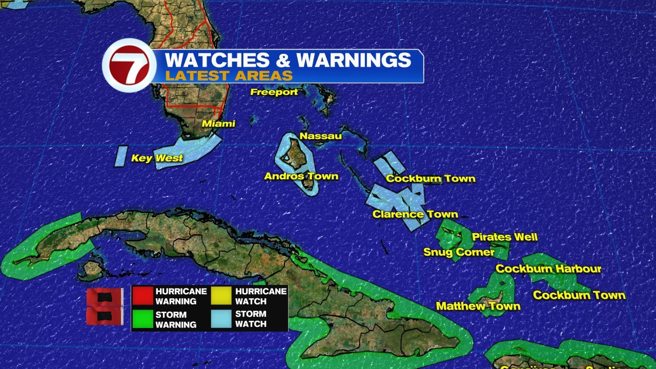
The watch is for all of the Florida Keys from Ocean Reef to Key West and the Dry Tortugas. Northern Cuba is now also under a Tropical Storm Watch. (Not shown in graphic)
Cone of Concern

Laura is expected to remain as a storm as it moves over the islands. By Monday, the center should be somewhere in the shaded area. It nom longer includes the Lower Keys.
The rain bands reach far away from the center and Tropical Storm force winds fan out up to 205 miles. This is why the Watch was issued.
What is possible

The National Weather Service says there is a small potential for on and off gusty winds, heavy rain, and an even an isolated tornado.
NOTE- NWS says if TS Marco gets any stronger in the Gulf of Mexico, it may slow down the high in the Atlantic that is supposed to steer Laura into the Gulf. This may alter its path and the impacts across South Florida.
Keep an eye on Laura until its in the Gulf of Mexico.
Island Impacts
Puerto Rico & the Virgin Islands have seen plenty of heavy rain and gusty winds from Laura. Many areas have received between 3 - 6 inches with 8" in spots.

The center of Laura is over Dominican Republic and Haiti . It will deliver heavy rain and gusty winds overnight. Haiti will see the impacts moving in early Sunday morning. Forecasts are calling for 4 to 8 inches with some areas up to 12 inches. This could lead to dangerous flooding, land and mudslides.
Turks and Caicos, Southeast Bahamas, and Jamaica are looking at the potential for 1 to 5 inches.
Laura is also producing rough seas with large swells expected across the coasts of the Leeward Islands, Puerto Rico, Dominican Republic and Haiti. The swells will push across Cuba, Bahamas, and the Keys over the next 48 hours.
Haiti

The center is roughly 600 km East from Ouanaminthe. The center will be near the Haiti/Domincan border by 2 am. The nation is under an orange alert. Please pay attention to local authorities.
Dominican Republic

All the red areas are under red alert. Expect heavy rain and gusty winds overnight .
Cuba

For the moment the entire island is under a Tropical Storm Warning. Things will begin to deteriorate from the East Coast westward by Sunday afternoon/early evening.
Bahamas

There are watches and warnings for many of the islands including the Turks and Caicos. Please prepare accordingly as you could be impacted with winds over 39 mph and heavy rain as early as Sunday afternoon.
I'll keep you up to date, on-air and on-line.
No comments:
Post a Comment