An area of clouds and rain sitting over the Bahamas is being watched by the National Hurricane Center (NHC). It could provide South Florida with a drenching thru the weekend. As of Thursday night, it has become an area of low pressure between South Florida and Andros Island in NW Bahamas.

Satellite view shows the area highlighted. This low pressure continues to get its act together as it moves NW towards Florida. NHC has deemed it Invest 98L.
Chances for development
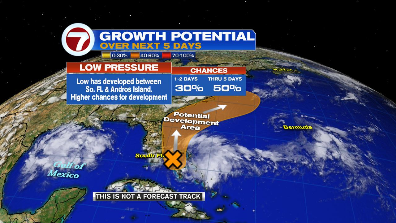
NHC says the low has a 50% chance of turning into a depression/storm in the area highlighted in orange over a period of 5 days. Even if it doesn't develop, it could still drop plenty of rain, not just in South Florida, but across the Bahamas as well.
Bahamas Rain

The low has been soaking the Central Bahamas with on and off downpours since Wednesday afternoon. This soggy pattern is expected to stay for a few days.
The Forecast

While the disturbance, now a low, will move to the NW, plenty of moisture is expected to splinter away and move over South Florida.
Rain Totals

Models show large totals of rain across the Bahamas, and anywhere between .87" to 1.41" over So FL thru 5 days. That may not be too impressive but with the ground saturated with recent rainfall, any additional downpours will lead to street flooding.
Potential for drenching rainfall

The National Weather Service says South Florida has a marginal chance to see very heavy rain on Friday. This just means the conditions are ripe for big downpours to sit over an area and flood local streets. It may not happen, but be on the lookout.
If it develops, where is it going?

Keep in mind that at this early stage, models are giving us a guesstimate. There is no good starting point for them to use, therefore, they can't provide an ending point. As of this early run, the few actually providing data, move the system over Florida. This is a good reminder that the peak of hurricane season is just a few weeks away.
I'll keep you posted
No comments:
Post a Comment