
As of mid morning Wednesday, Dorian has 60 mph winds and appears to be on a course to move across the East Coast of Puerto Rico. Heavy rain and gusty winds are expected there. On this track, Puerto Rico's land mass may not interfere too much with its structure. This may allow Dorian an easier passage back into the warmer Atlantic waters.
Forecast Track
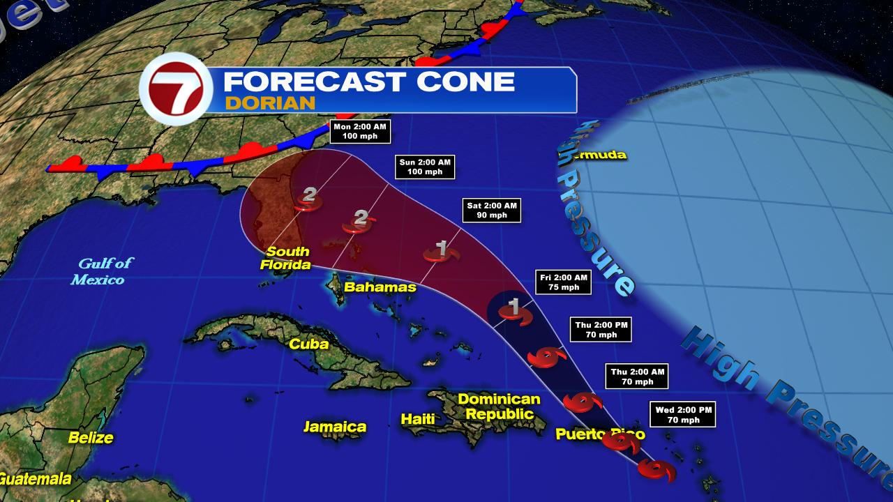
Once in Atlantic:
- The center of Dorian should miss the Turks & Caicos and most of the Bahamas. Remember the storm can impact many areas far away from the cone. Also, the forecast can change as atmospheric conditions change. Keep an eye out.
- Warm waters of the Gulf Stream can provide Dorian fuel to intensify. As of this update it may be a cat 2 with winds between 96 & 110 mph and stronger gusts.
- Dorian could be anywhere in the area highlighted red over the weekend. DO NOT FOCUS on the little numbers/icons. The center of Dorian could be between Miami Dade County and the Georgia coast.
- Where it will finally end up depends on how much the high, or blue area on the right of the map, pushes Dorian west. Forecasts change as the atmosphere changes. Please monitor until the models give us a better idea.
- Final thought: Even far away from the eye of the storm, severe weather can take place. From strong storms to gusty winds to isolated tornadoes. A hurricane's influence goes far beyond the eye wall.
We'll be watching
No comments:
Post a Comment