Finally sunny skies return to most of South Florida. We should remain mostly sunny with only a slight chance of showers through the weekend.
Not so Good: (Specially for the folks in Coastal Mexico)
In the tropics, NHC is keeping tabs on an area of disturbed weather in the SW Gulf of Mexico. This is the same area that's been causing heavy rain over the region for days. Its chances for development have been hovering between 0 and 20% since Monday.

On Thursday, NHC upped the chances for development: Here is their early statement:
Showers and thunderstorms have recently increased near a low pressure area over the southern Bay of Campeche. Despite strong upper-level winds, some further development of this system is possible over the next day or two if the low remains offshore of eastern Mexico.
scheduled to investigate this system this afternoon, if necessary.
This disturbance has the potential to produce extremely heavy rains and life-threatening flash floods and mud slides over portions of southeastern Mexico during the next few days.
* Formation chance through 48 hours...medium...30 percent.
* Formation chance through 5 days...medium...30 percent.
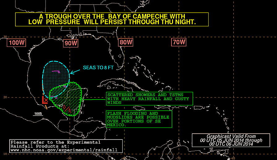
Even if this feature doesn't get any stronger, heavy rain will come down over the Yucatan Peninsula. This will lead to flood and possible land and mudslides.
Whats's Next:
Now that it appears there is more thunderstorm activity despite strong upper level winds… what is in its future?
Its not an easy nor simple answer. We look for computer model guidance and even here the results are not conclusive:
The local NWS office is focusing on two solutions. This what they are saying:
THE GFS STILL MAINTAINS AN AREA OF LOW PRESSURE ACROSS THE BAY OF
CAMPECHE PUSHING NORTHEAST...EVENTUALLY MAKING IT TO SOUTH
FLORIDA THROUGH THE LATTER HALF OF NEXT WEEK.
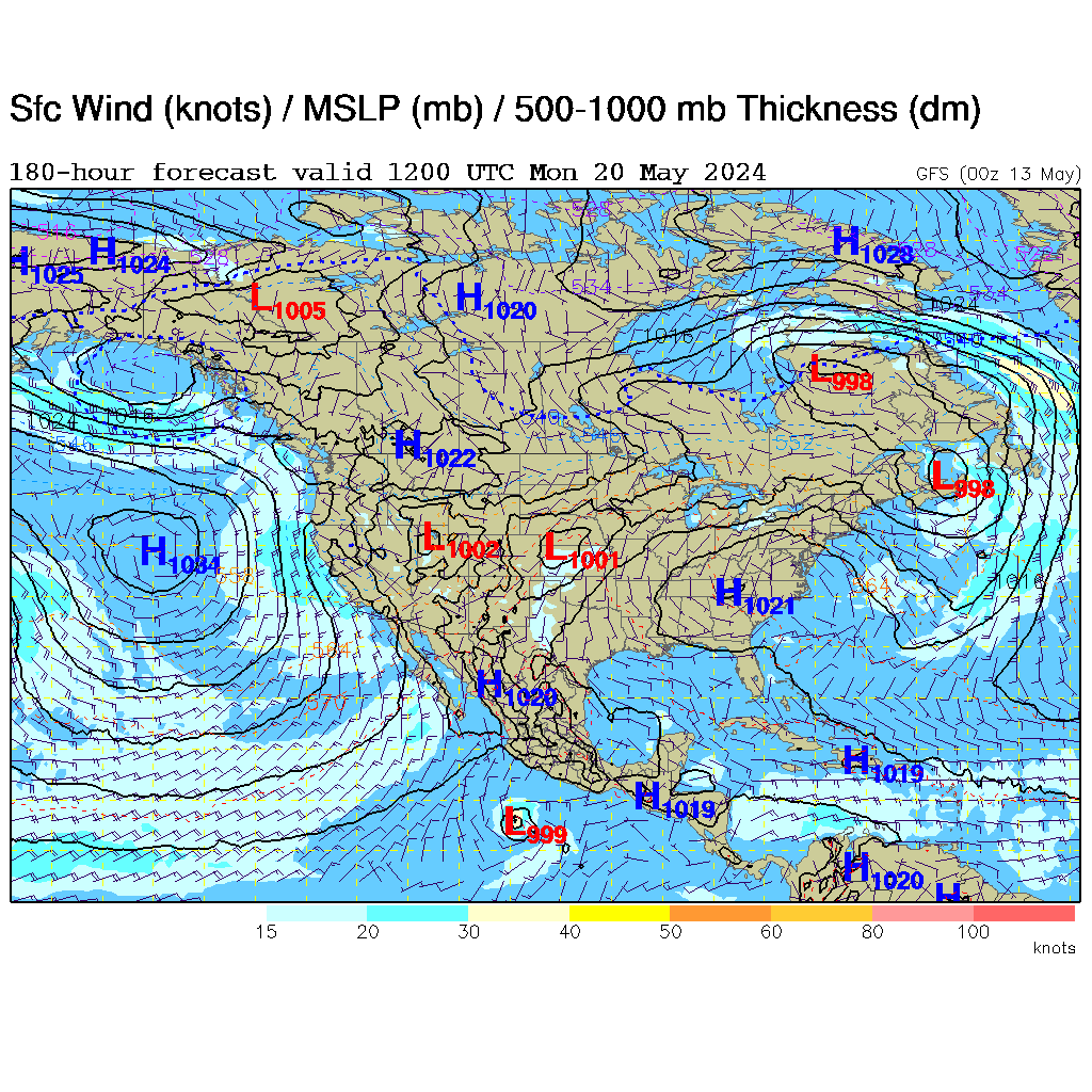
AS A RESULT...PLACED MUCH MORE WEIGHT WITH THE ECMWF SOLUTION DURING THIS TIME FRAME IN THE OFFICIAL FORECAST.

The outlook of most models keep whatever develops in the Western Gulf of Mexico

What does this mean for us?
For the moment, nothing. Enjoy the upcoming weekend and celebrate with the grads. We should see our typical rainy season pattern with heat, humidity, and a chance for afternoon thunderstorms.
Worry level: Low.
Since nothing has really developed yet, and it appears that it will be staying over the SW Gulf for a few days, all we can do is keep looking West and see what it decides to do. As always keep checking for the latest tropical outlook.
No comments:
Post a Comment