Wednesday, April 8, 2020

Does Heat Kill Covid-19?

It's a question everyone wants to know the answer. In simple terms, the response is yes and no.

Per, Consumerlab.com, heat is very effective in killing the virus but not the kind of heat provided by hot weather.

Heat can disinfect objects. They say a 2003 study showed that if the virus is exposed to very high temperatures, the virus would deactivate. Here is a list of how hot it must be and for how long in order to deactivate the organism.

         Hot hot          Exposure time

  • 167 degrees         30 min
  • 152 degrees         60 min
  • 132 degrees         90 min
Anything less than 99 degrees had no impact.

As we move in to summer, let's not let our guard down. High So Florida temps would appear to be  ineffective in neutralizing the Coronavirus.


Thursday, April 2, 2020

One of Many

Colorado State University has issued their hurricane season outlook for 2020. This is but one of many forecasts to be published by other institutions in the weeks leading up to June 1st.


I caution that not one seasonal outlook will ever tell you when and where a storm will strike, or how strong it will be.  It is just a general guideline of activity to help the insurance industry, businesses, and you to get ready accordingly.  If you prepare as if we will get hit, then you will be ready for whatever Mother Nature throws our way.

Colorado State University Forecast (CSU)


The team at CSU, once home to famed forecaster Dr. William Gray, is now headed by Dr. Phil Klotzbach. They suggest there could be as many as 16 named systems in the whole Atlantic Basin, with 8 spinning into a hurricane and out of that number, 4 could reach major hurricane status. If you compare that projection to what is typical, it suggests an above average year. Last year the total was 18, 6, and 3.

Why this forecast?

Long range outlooks are extremely difficult to put together. It's similar to planning a road trip. You fill up with gas, check your favorite traffic app and get an estimated time of arrival. Once on the road however,  congestion starts to slow you down, there's a broken vehicle blocking a lane and then you get a flat tire.  Seasonal forecasts can be subject to the same "road blocks" if you will.

One of the main ingredients that forecasters look for, is whether an El Niño event may take place. El Niño is a warming of the equatorial waters of the Pacific Ocean. This can disrupt not only marine currents but atmospheric ones as well.  Gusty winds high in the atmosphere can weaken or even impede storm formation in the Atlantic Basin during a strong El Niño. CSU says that El Niño will not be a factor this season and thus storm development should not be supressed.


Models


A quick scan of models show that since the three month period of Nov, Dec, & Jan, water temps were running about a half degree above average and are forecast to either stay at this mark, or drop even further until the end of the year. This reaffirms the lack of an El Niño presence in 2020.

Final Thought

Unlike earthquakes that can happen unannounced or tornadoes that can whip up in minutes, a hurricane will never take you by surprise. You will see forecasts sometimes weeks in advance warning you of a possible threat.  You at least have the chance to get ready or get out of the way.

This is a great time to review your plans and check with your county to see where your nearest shelter may be. Remember, not all shelters accept our furry family members, so look into that as well.

The official Seasonal outlook from the National Hurricane Center will be released in May. As mentioned above, it will just be a guideline.  Stay with us on-air or on-line for the very latest.

We'll keep watching


Saturday, March 14, 2020

Difficult Times

Rare Health Issue

The unknown is always the worst part of dealing with any situation, specially a health emergency like the Coronavirus, or Covid-19.  I have received a large number of inquiries about it and am presenting as much information for you as possible.  A reminder, I am not a doctor, I am just compiling the information for reference. I have also included the source of the data.


The Data

Let's begin with some sobering numbers: The Centers for Disease Control (CDC) estimates this flu season which ran from October 1, 2019 to March 7, 2020 to see up to:

  • 51 million cases 
  • 670 thousand hospitalizations
  • 55 thousand deaths


The Coronavirus projections?
According to the Intelligencer, the CDC projects the U.S. could see in 1 year, between

  • 160 million to 214 million cases
  • 200 thousand to 1.7 million death

The worst Pandemic in recent history was the Spanish Flu from 1918
  • The death toll is estimated to have been anywhere from 17 million to 50 million, and possibly as high as 100 million, making it one of the deadliest health crisis in human history.


The following info is from the World Health Organization (WHO)


What is Coronavirus?
Coronaviruses are a large family of viruses which may cause illness in animals or humans. In humans, several coronaviruses are known to cause respiratory infections ranging from the common cold to more severe diseases such as Middle East Respiratory Syndrome (MERS) and Severe Acute Respiratory Syndrome (SARS). The most recently discovered coronavirus causes coronavirus disease COVID-19.


What are the symptoms?
The most common symptoms of COVID-19 are fever, tiredness, and dry cough. Some patients may have aches and pains, nasal congestion, runny nose, sore throat or diarrhea. These symptoms are usually mild and begin gradually. Some people become infected but don’t develop any symptoms and don't feel unwell. Most people (about 80%) recover from the disease without needing special treatment. Around 1 out of every 6 people who gets COVID-19 becomes seriously ill and develops difficulty breathing. Older people, and those with underlying medical problems like high blood pressure, heart problems or diabetes, are more likely to develop serious illness. People with fever, cough and difficulty breathing should seek medical attention. 
 
How can I be infected?
The main way the disease spreads is through respiratory droplets expelled by someone who is coughing or sneezing.

What can I do to protect myself?
You can reduce your chances of being infected or spreading COVID-19 by taking some simple precautions:
  • Regularly and thoroughly clean your hands with soap and water
  • Maintain at least 3 feet distance between yourself and anyone who is coughing or sneezing.
  • Avoid touching eyes, nose and mouth.
  • Make sure you, sneeze or cough into your arm or tissue 
  • Stay home if you feel unwell. 
  • Keep up to date on the latest COVID-19 hotspots


At times, all this can feel overwhelming. The bottom line is that experts say this strain of the Coronavirus is pretty new. 

We know more or less what to expect from the flu, we can treat it and doctors offer a preventive shot. But with Covid-19, there are many unknown factors.  So far we know that seniors, or folks like myself with a compromised immune system, need to really monitor the situation closely. Believe me after weeks of radiation and throat surgery, I am taking all precautionary steps.  

I am preparing as if we had a hurricane coming for us. We've all been there and know how to act. Just like tropical systems, the impacts will be felt for months after the initial strike. In this case it could be longer. 

If we follow the suggestions put forth by experts from the medical community, we will get through this.  

For more on what is closed, numbers of cases and fatalities, please tune in on-air and on-line to wsvn news.


Saturday, January 25, 2020

Soggy Monday?

After a cold front moves in this weekend, gray and soggy skies are forecast for Monday.

Satellite View


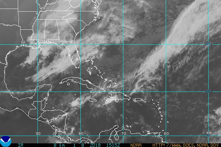
The image shows a line clouds over South Florida, this is a cold front moving in unnoticed. Tonight's lows may dip into the mid 50s, low 60s for the Keys, and mid 60s for the NW Bahamas. The average for this time of year is 60 to 64 degrees.

Other area of clouds to watch:
Check out the cloudiness over the Gulf of Mexico, this is where the models show an area of low pressure developing over the next 24 hours. A low that could move here and bring us rain for the start of next week.

Forecast Maps
Sunday looks pretty quiet with the front having passed over the area and entering the Florida Straits. We can expect mostly sunny conditions with mild temps and a nice northeasterly breeze. Chamber of commerce weather.
By late Sunday evening, the front slips into the Central Bahamas, while an area of low pressure develops in the Northern Gulf of Mexico. We may start seeing a few more clouds across the area, with rain being more prevalent across the Gulf waters.  The low will continue to track east, aiming for the Atlantic waters. If the low does not weaken, Monday will be on the wet side of things.

By Tuesday, the low swings into the Atlantic, dragging some rain across the NW Bahamas. South Florida may still see a downpour or two.

7 Day Forecast:


Cold front moves in, cool start to your Sunday. Then if the low develops, we could see a chance for pockets of heavy rain to start Super Bowl week.

We'll keep you posted

Sunday, January 19, 2020

Cold Air Blast for South Florida

Temps expected to dip this upcoming week into the 40s over many areas, 50s for the Keys.

High pressure has been dominating our weather over the last few days, keeping us warm with serene conditions, but that is about to change.

The surface weather map shows a line with triangles sitting across Northern Florida, this is a cold front and it marks the leading edge of the cold air.

The front is moving in our direction and could be very near Naples Sunday evening and possibly across the rest of South Florida by Monday morning.

Radar


The radar imagery shows where the rain associated with the front is located.  Some of those showers may reach us overnight, but the activity is falling apart. The chance for thunderstorms is diminishing but we could still see a downpour here or there before the actual cold air moves in.

Timing:

The front should clear South Florida by late afternoon or early evening on MLK day.  You will notice a sharp drop in humidity along with cooler temps, and clearing skies.

How Cold?


Models are calling for temps in the 40s across Metropolitan Miami-Dade & Broward Counties, with lows dipping into the 50s for the Keys.  But it may feel even colder.


Hour by Hour Forecast:

The red line in the panel shows the expected lows. Follow it to the right into Wednesday between 3am - 6 am. The readings should bottom out around 49 to 46 degrees.  But the wind will be picking up, shown in the lower panel, gusting at times 25 - 28 mph. This will make the temperatures feel even colder. Its known as the wind chill factor. The temps could feel as cold as 41 to 45 degrees.


It will be a cold start on Tuesday by South Florida standards so a reminder to bundle up the little ones on their way to school. Also, bring your pets indoors specially Tuesday night when those overnight temps will really drop.

Be careful with space heaters. DO NOT place them near curtains or furniture which may catch on fire. Stay warm and safe during this cold snap.

We'll keep you posted

Sunday, September 22, 2019

Caribbean Concern

The National Hurricane Center (NHC) is issuing advisories on Tropical Storms Jerry and Karen.  Jerry is in the Atlantic Ocean possibly on a track that could impact Bermuda down the road, and Karen is dropping flooding rains across parts of the Windward Islands, Trinidad & Tobago, as well as the north coast of Venezuela.


Karen Info
As of 5 pm Sunday:

  • Karen is now in the Eastern Caribbean Sea
  • USAF Hurricane Hunter finds the system with a well defined circulation, but the northern part of the storm has lost its cloud cover and rain. Unclear if this will lead to weakening.
  • Heavy rain has been impacting Trinidad and Tobago.
  • More rain and gusty winds tonight for the Windward Islands with 3 - 6 inches of rain and some areas as high as 8 inches.
  • Tropical Storm watch for Puerto Rico, and the U.S. & British Virgin Islands. This means winds over 39 mph may reach the area in 48 hours. They may also get 2 to 6 inches of rain.
Trinidad & Tobago Radar


This shows the heavy rains from Karen impacting the islands as well as the northern coast of Venezuela.


Where to next?


It will track NNW across the Eastern Caribbean Sea dogged by some strong upper levels winds known as shear. This should keep it as a storm throughout its lifetime or even weaken the system further.

By Tuesday evening Karen enters the Atlantic Ocean and the shear relaxes giving it a chance to intensify.

Towards the end of the week, the cone jogs a tad to the NW as models begin to fan out in the forecast track.

Models

Models are in agreement the system will move almost due north until the end of next week, then they fan out. When this happens, it usually means something is throwing them off, in this case it's a high pressure dome coming out of the Eastern Seaboard.

This high will act as a major roadblock keeping Karen from traveling north. Some models bounce the system off the high to the east, and others to the west. If the west bounce takes place, the Bahamas and Florida should be on alert.


Tropical Storm Jerry


Jerry is now where Karen may be next week. The high that will aim it towards Bermuda, will be the same system that will deflect Karen east or west.  Bermuda should monitor Jerry for gusty winds and heavy rain.  A Tropical Storm Watch may be issued later tonight.

System to be


Latest data
A strong wave has moved off the west coast of Africa and is poised to become a tropical system at any moment. Here is what NHC is saying.
  • Plenty of thunderstorm activity
  • Getting better organized
  • Atmospheric conditions will support development
  • Moving West at 15 - 20 mph
  • Cape Verde needs to be on alert as this disturbance may drop heavy rain there
  • This is now Invest 90L. Invest for an area NHC would like to INVEST-igate further, 90 is a tracking number, and "L" stands for Atlantic Basin.

If it develops, where may it go?


Early model run suggest this system will track NW in the short term and then curve north, northeast being a worry for the shipping lanes.

We'll be watching.


New Tropical Storm Karen

The National Hurricane Center (NHC) named Tropical Storm Karen early Sunday Morning.
Big rain maker for the Eastern Caribbean. They are also watching Tropical Storm Jerry.

Jerry will be a threat to Bermuda. Tropical storm Karen should drop plenty of rain from Northern Venezuela northward across the Lesser Antilles. Lets start with Karen.


NHC determined early Sunday morning that the low pressure area east of Tobago had organized with more thunderstorm activity around its center and classified it as a Tropical Storm.

Alerts


Tropical Storm Force winds of over 39 mph are being felt already across some of the islands. Warnings  have been issued for the following locations.

Tropical Storm Warning

  • St. Vincent & the Grenadines
  • Trinidad & Tobago
  • Grenada & its dependancies

A Tropical Storm Watch (39+ mph winds may be felt in roughly 48 hours), may be issued later this evening for Puerto Rico and other areas along the Windward Islands.

Forecast Track


The track has Karen crossing over from the Atlantic into the Caribbean Sea by Monday. There it will get spun north traveling towards Puerto Rico and nearby islands. This is all due to high pressure sitting to its East. Clockwise winds from the high will push it NNW over the next 36 hours.

Afterwards, Karen will slow down or maybe even stall for a while as it will be caught between two high pressure systems. It will slightly veer west by the end of the week as the next high comes out of the U.S.

Models:


LATE UPDATE: Long range models now hint Karen may head west. How far is yet to be determined.  East Coast should monitor.

Impacts
Rain

  • Windward Islands: 3 - 6 inches with some localized areas up to 8 inches
  • Northern Venezuela: 1 - 3 inches
  • Barbados: 1 - 3 inches
  • Leeward Islands: 1 - 3 inches with isolated amounts up to 5 inches.

This rain may lead to flooding, land & mudslides

Tropical Storm Jerry


Jerry will continue on an almost northerly track away from the Bahamas. Unfortunately it may impact Bermuda early next week as a tropical storm. Watches & warnings may be issued there as the system approaches. Last week they dealt with Hurricane Humberto. Hoping Jerry remains weak and slides past.

Another Area to Monitor


A strong tropical wave monitored by NHC for days has emerged out of Western Africa and is now in the Far Eastern Atlantic Ocean. This may quickly become a depression or tropical storm.

Here is the latest:

  • Plenty of thunderstorm activity
  • Getting better organized
  • Atmospheric conditions will support development
  • Moving West at 15 - 20 mph
  • Cape Verde needs to be on alert as this disturbance may drop heavy rain there
  • This is now Invest 90L. Invest for an area NHC would like to INVEST-igate further, 90 is a tracking number, and "L" stands for Atlantic Basin.

If it develops, where may it go?


Early model runs suggest this system will track NW in the short term and then curve north, northeast being a worry for the shipping lanes.

We'll be watching.

dsfsd

Saturday, September 21, 2019

Island Worries

A couple of tropical features could provide more than a damper on islands across the Caribbean over the next few days.

We start with a Tropical Wave East of the Windward Islands. This disturbance is now classified as Invest 99 L. Invest for an area the National Hurricane Center (NHC), would like to INVESTigate further, 99 is a tracking number, and "L" stands for Atlantic Basin.


The latest as of Saturday afternoon:

  • The wave is racing westward at 15 - 20 mph. 
  • NOAA Recon suggests the low does NOT have a well defined center. Good news as it indicates it is not getting stronger.
  • Even if it doesn't develop, heavy rain & gusty winds are still possible cross the Lesser Antilles over the next few days.
  • Everyone across the Lesser Antilles & Puerto Rico should monitor the latest developments with this system.
  • Chances for developing into a depression or a storm stand at 50% over the next 48 hours and at 60% thru 5 days, per NHC.

If it were to develop, where would it go?


Most early model runs, suggest it will cross over the Windward Islands during the weekend and then curve towards Puerto Rico by the middle of next week. It should then emerge into the Atlantic again. It is forecast to remain over open waters afterwards.

A reminder there is no such thing as the BEST model, if there were such a thing, we would only need one. There are dozens and dozens, each tasked with looking at different things in the atmosphere. Each will provide a forecast track which will be used by NHC experts, to come up with the forecast cone when and if it develops.  At this stage, since nothing has organized, the models are providing a guesstimate.

Disturbance in Caribbean


Latest info:
  • Weak area of low pressure sitting over Eastern Cuba with pockets of rain over Jamaica, Haiti & Dom. Republic.
  • As of 2 pm, NHC says ZERO chance it can turn into a depression or a storm
  • The potential for heavy rain exists and that could lead to flooding, land & mudslides, across Haiti, Dom. Republic & Eastern Cuba, through the weekend.
Wave across West Coast of Africa


It is presently night time across West Africa and thus used infrared Satellite imagery.  This allows us to see cloud cover without a light source. Notice the area of clouds right along the coast. This is the area NHC is monitoring.

2 pm Update
  • NHC is giving this tropical wave a 50% chance to become a depression or a storm once it moves over water during the next 48 hours. Chances skyrocket to 90% over a period of 5 days.
  • Models are still sketchy in this extremely early phase.
  • Need to wait once it develops to get a real good idea where it may end up.
  • It's over 2000 miles away and there's plenty of time to monitor.

We'll be watching

Tuesday, September 17, 2019

Tropical Storm Jerry?

The National Hurricane Center (NHC) is monitoring a Tropical Depression in the middle of the Atlantic Ocean poised to become Tropical Storm Jerry.


This is just one of four areas NHC is watching. They include from left to right:
  • Depression Imelda over Texas. It was quickly upgraded Tuesday at 1:00 pm Eastern time, and by 1:30 pm it had made landfall near Freeport, Texas. It has since weakened but it's expected to drop over a foot of rain in some spots and that could lead to flooding.
  • Hurricane Humberto aiming for Bermuda is now a major system category three. A hurricane warning is already in place for Bermuda. It could come close to the island on Wednesday.
  • Tropical Depression #10 - More info below
  • Tropical Wave off the West Coast of Africa, has a 20% chance for development
Tropical Depression #10
 

NHC classified this area of clouds and rain as Depression #10 on Tuesday after they said it looked slightly better organized, with more developing thunderstorms, moving over warm waters and with little shear. It has the potential to grow stronger. A recon mission is planned for Thursday.

Forecast Cone


The official cone from NHC, has high pressure pushing it northwest and becoming Tropical Storm Jerry early Wednesday morning.It is then expected to reach hurricane status by Friday, very close to the Leeward Islands. It will then continue its northwesterly track staying very close to Puerto Rico, Dominican Republic, Haiti, Turks & Caicos, and Southeastern Bahamas. All these areas need to monitor the system. The cone is also reflecting a more gradual turn to the NW once in the Western Atlantic.

Models


The forecast cone is based on an average of all the models, but in this case, the track is not a unanimous consent. The models are split with just about half turning the system away from land areas by the weekend and the rest staying the course. As of this update, NHC is keeping the cone on a Northwesterly track,

Optimism


Something else we look at, are the features surrounding the system. One of those is called shear, or very strong upper winds that help cut down the tops of developing thunderstorms inside the system. This can weaken it or destroy it all together.

It appears that over the weekend very strong shear comes out of the Eastern Seaboard and meets this tropical system head on. It could completely veer it away or debilitate it tremendously. We'll be watching.

Thursday, September 12, 2019

Potential Storm #9

As of Thursday afternoon the National Hurricane Center (NHC) began issuing advisories on the disturbance sitting over the Bahamas. They are calling it Potential Storm #9. 


It remains highly disorganized, but models are insisting it will at least reach tropical storm status this weekend. By then it will be impacting land areas.

 What is a Potential Storm?


In order to give areas that will be impacted by this system a little extra time to prepare, NHC uses the designation Potential Storm. This way they can issue watches and warnings much earlier to help warn those in the path.
Watches and Warnings


As of late Thursday night, parts of the NW Bahamas are under Tropical Storm Warnings. This means they could start seeing winds over 39 mph in 36 hours. This is so unfortunate since they are still reeling from the impacts of Dorian.

Palm Beach, Martin, St.Lucie, and Indian River Counties are under a tropical storm watch, but that is just for the Coastal Waters. This means winds over 39 mph can impact the offshore waters in 48 hours.

However, from Jupiter to Titusville, a Tropical Storm watch is in effect for the land area.

Where is it going?


High pressure will start to push the system NW Friday morning and by evening it should be moving over Nassau and Marsh Harbor.  By Saturday morning it's expected to turn fully tropical and be named Humberto. It will continue to move northwest making landfall somewhere along Florida's East Coast. The cone starts by Dania Beach. Be prepared for the possibility of heavy rain and gusty winds on and off through Sunday for all South Florida.


Storm Advisories May be Issued Later today

The National Hurricane Center (NHC) is closely monitoring a disturbance over the Central, and Southeastern Bahamas. They may start issuing advisories on this system later today.


Latest Data:

  • The disturbance, better known as Invest 95L, continues to drop in pressure and is looking better organized on satellite imagery. NHC adds that conditions are becoming favorable for a depression or a storm to form within 48 hours. 
  • If it continues to show signs of further development, NHC may start issuing advisories before the system actually comes together. This will give people in the path of the system, extra time to prep.
  • It is moving to the NW at around 5 - 10 mph. On this track it will travel towards the NW Bahamas and the Florida Peninsula
  • The NW Bahamas should expect heavy rain and gusty winds through Friday.
  • Florida may see rain and gusty winds starting on Friday. It will all depend on where the disturbance finally ends up.


Models


Tricky forecast

When you see models fan out like this, it means there are too many variables presently for them to get a good handle on what is happening in the atmosphere and how all those features may play out over a period of 5 days..

Lets take a look at a few, starting with the GEM:


This models places the system over South Florida by Saturday.

The Euro:


This model takes the system over the NW Bahamas late Saturday into Sunday morning.

The GFS


Places a weaker system in the Gulf of Mexico late Sat/early Sun.

With all these different outcomes, NHC may have to issue Potential Storm Advisories, which means they know something will develop, they just can't get a handle on where or how strong it may be.

The NW Bahamas will be drenched again even if nothing pans out from this disturbance. If it intensifies, then you can add strong winds to the mix.

For South Florida, and the rest of the state, the Best Case Scenario will be some heavy downpours this weekend and breezy conditions. Worst case could be a named system.

As soon as we get info from NHC, we'll pass it along.

We'll be watching


Wednesday, September 11, 2019

Wave to Watch

A vigorous wave is sitting over the Southeastern Bahamas and Turks & Caicos with plenty of rain. It has the potential to develop further as it moves WNW over the following days. This is just one of three areas being monitored by the National Hurricane Center.


As of late Wednesday night, Wave number 1, has high chances for growth, number 2, has fizzled out, and number 3, is holding on with a better chance for organization over the weekend. We will concentrate on the first.

Wave #1


What we know
 The wave extends from the SE Bahamas north into the Atlantic waters.
  • It has plenty of moisture and is causing heavy rain in many areas. 
  • For the time being, an area of low pressure in the upper levels of the atmosphere is sitting over Florida. It will keep the wave from growing. These strong winds act as a blade cutting down the high cloud tops from developing thunderstorms. As long as this is present, the wave will not develop into something stronger. However, that upper low is moving away and it will open the door for the wave to possibly become a depression/storm by the end of the week.  
  • Where can the wave develop?  The graphic above shows an area highlighted in red (this is NOT a cone) this is where NHC thinks it could come together during the next 5 days. The bottom line is that it could organize anywhere from the Bahamas to the Gulf of Mexico.
  • A recon plane is on stand-by on Thursday to check out this wave.
  • The wave has been designated Invest 95L. Invest for an area NHC would like to INVESTigate further, 95 is a tracking number, and "L" stands for the Atlantic Basin.

Models


Most of the very early model runs show high pressure to the East of the wave pushing it towards the northwest. It will be moving over the warm waters of the Gulf Stream and that could allow it to strengthen at anytime.  Keep an eye on a front moving to the southeast, it could trap the system over the Gulf of Mexico pouring rain for a few days. Even if it doesn't develop, many areas across the state will see soggy weather..

Rain Totals


A look ahead over 5 days, suggests the NW Bahamas receiving between 2 and 4 inches of rain. This will surely add to their woes.South Florida could get between 1 and almost 4 inches.

The Bottom Line


Monitor the wave, it may become a depression by the end of the week. It is poised to drench parts of the Bahamas & South Florida as it crosses into the Gulf of Mexico sometime over the weekend. It may stall along Florida's Big Bend and drench the state.

We'll be watching