As of 11 am Friday, the small, unimpressive tropical storm "Beryl" has reached hurricane intensity. With all the models suggesting it was in an area not favorable for such growth or that an air wall was ahead in its path set to mow it down... "Beryl" has defied the odds and grew in strength.

On the satellite image which spans night and day, the storm is seen in the lower right hand corner. Notice during the day imagery, how there is a brownish color above the storm, that is Saharan dust. Typically this helps to keep systems in check, but it is not bothering "Beryl" too much.
The system is very small and compact with hurricane force winds of 74 mph+ extending outward from the center only 10 miles and tropical storm force winds of 39 mph+ reaching out about 35 miles. Looking back, Tropical Storm Marco from 2008 just had gale force winds, around 30 mph, that spanned out only 12 miles from center.
The steering winds remain the same pushing the hurricane west and aiming for the Lesser Antilles. Everyone there should be getting prepared. As of this morning, it is not expected to weaken as it moves over the islands sometime this weekend. Even if it doesn't grow in size, it could still pack a mighty punch.
I said on air Thursday, that "Beryl" is "the little storm that can", and it appears it will. The reason for "Beryl's" bravado, is high pressure sitting above it. This allows warm, moist air to rise giving birth to new thunderstorms inside the storm.
Where is it going?
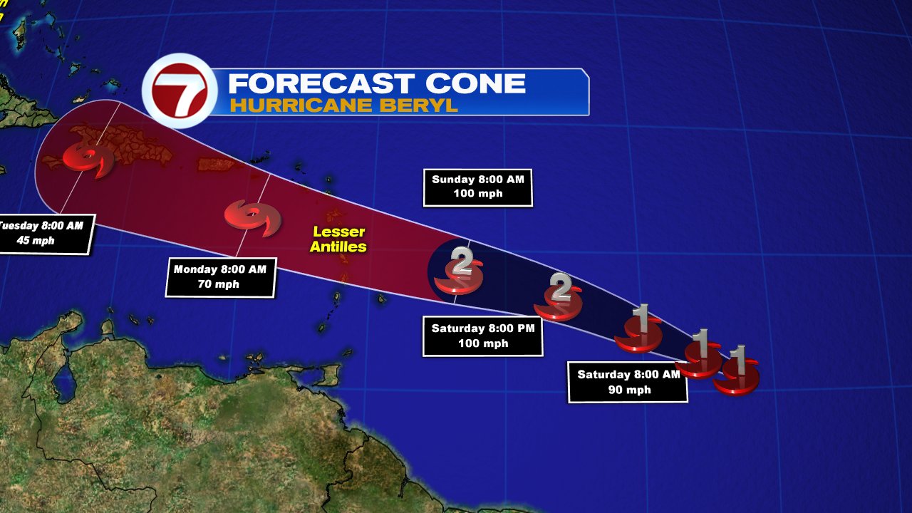
Normally when a system picks up some forward speed, as should happen in the next few days, it keeps storms from intensifying too much. This may happen. There is also some shear, or strong upper level winds by the islands, that act as a blade cutting the system down. The question is, will they have a huge impact on "Beryl". NHC says that this system will keep it's hurricane force winds past the Lesser Antilles by Sunday or Monday and it could be near Puerto Rico, Dominican Republic, and Haiti on the following day.
Because "Beryl" is so small trying to forecast exactly what impacts may be seen where, is difficult. It's diminutive size is also a concern to forecast intensity. It can grow quickly or weaken just as fast. Storm watches and warnings may be issued by tonight.
I'll keep you posted.
No comments:
Post a Comment