It has a global reach...rainy where's it typically dry and vice versa. It also helps keep hurricane formation in check in the Atlantic basin. Strong upper level winds ride out of the Eastern Pacific only to cut down the tops of any developing system on our side of the world. For us in South Florida,"El Niño" is our Tropical Friend.
Forecasts have been calling for a very strong "El Niño" this year, maybe even a record setting event.
NOAA says:
The three-month, June-August average of sea surface temperature ran 1.22°C (About 2 degrees F) above normal.
This is the third-highest June-August value since records started in 1950, behind 1987 (1.36°C) and 1997.
 The "El Niño" event of 1997 was one of the strongest on record. This image shows a side by side comparison on 1997 and now.
NOAA adds that:
“There is a greater than 90% chance that El Niño will continue through Northern Hemisphere winter 2015-16, and around an 85% chance it will last into early spring 2016.”
The red tones indicates hotter temps, while the blues show cooler water temps. Typical temps are in yellow.
So what does this mean?
A strong "El Niño" during the winter typically means wetter weather for the West Coast. This could mean much needed rain for California and its drought.
It could also mean land and mudslides with very strong gale force winds.
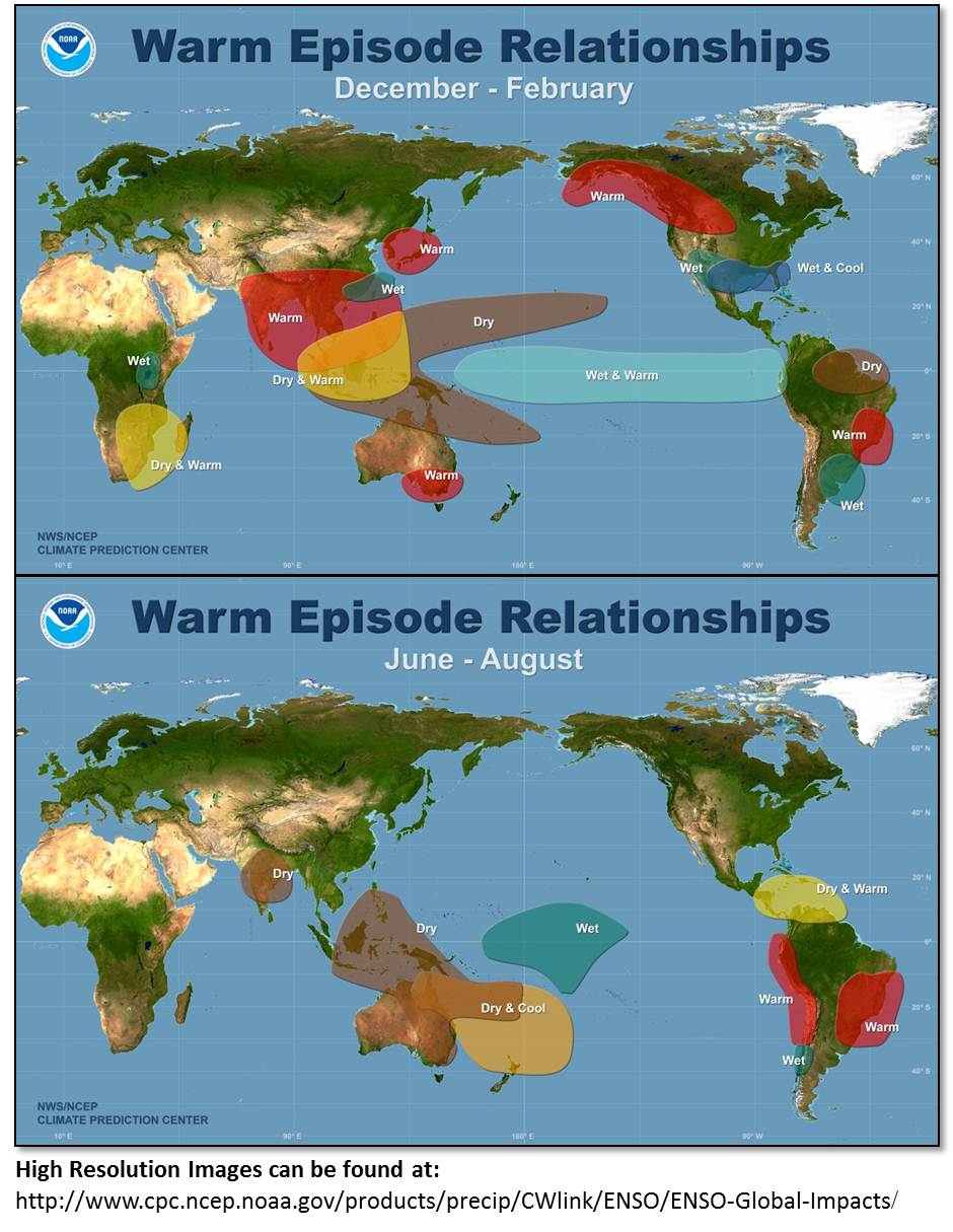
For South Florida?
El Niño conditions usually bring cool and wet conditions to our region, specially from December through February.

These are the possibilities of a Freeze for the counties in Florida during an "El Niño" year.
We'll keep you posted on the progress of this Possible Record Setting El Niño.
No comments:
Post a Comment