This area of disturbed weather is basically sitting in the middle of the Gulf. Thunderstorm activity has become a little more concentrated over the last few hours, and because of this, a recon plane is flying right now into the system to determine its strength.

As of early Tuesday morning, there is a huge cluster of t-storm activity (Reds and oranges) growing around the low.
If this holds up it will be a very soggy event for the Gulf States.
Satellite data suggests that tropical storm force winds (39 mph plus) are in a region east and northeast of the alleged center.
The recon mission should help identify once and for all if we indeed have a depression or a tropical storm in the Gulf. If we have a storm, it will be called "Bill". NHC places a high chance of 80%, on this feature developing over the next 5 days.
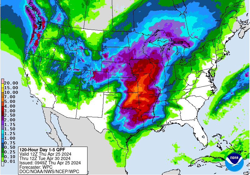
Check out what the models are indicating as far as rainfall is concerned over the next 5 days. Over 8 inches in Texas, and even seven inches over Missouri. Some of this rain could reach the Northeast.
Most models are in fair agreement it will continue to aim for Texas.

Whether it becomes a storm, the system could drop plenty of rain over already soaked areas of Texas leading to flooding concerns
No comments:
Post a Comment