Hurricane Michael is poised to become a major System with winds over 111 mph sometime on Tuesday.
Health Check
The latest satellite loop is showing further intensification despite some shear in the upper levels of the atmosphere. Monday night the forecasters at the National Hurricane Center (NHC) said, this strengthening under the present conditions "defies traditional logic". Typically shear or strong upper level winds. help keep systems from developing or at least keep them in check.
That hasn't happened with Michael. You can even see the eye forming northwest of Cuba. As of late Monday night it was roughly 35 miles wide.
The Forecast Cone
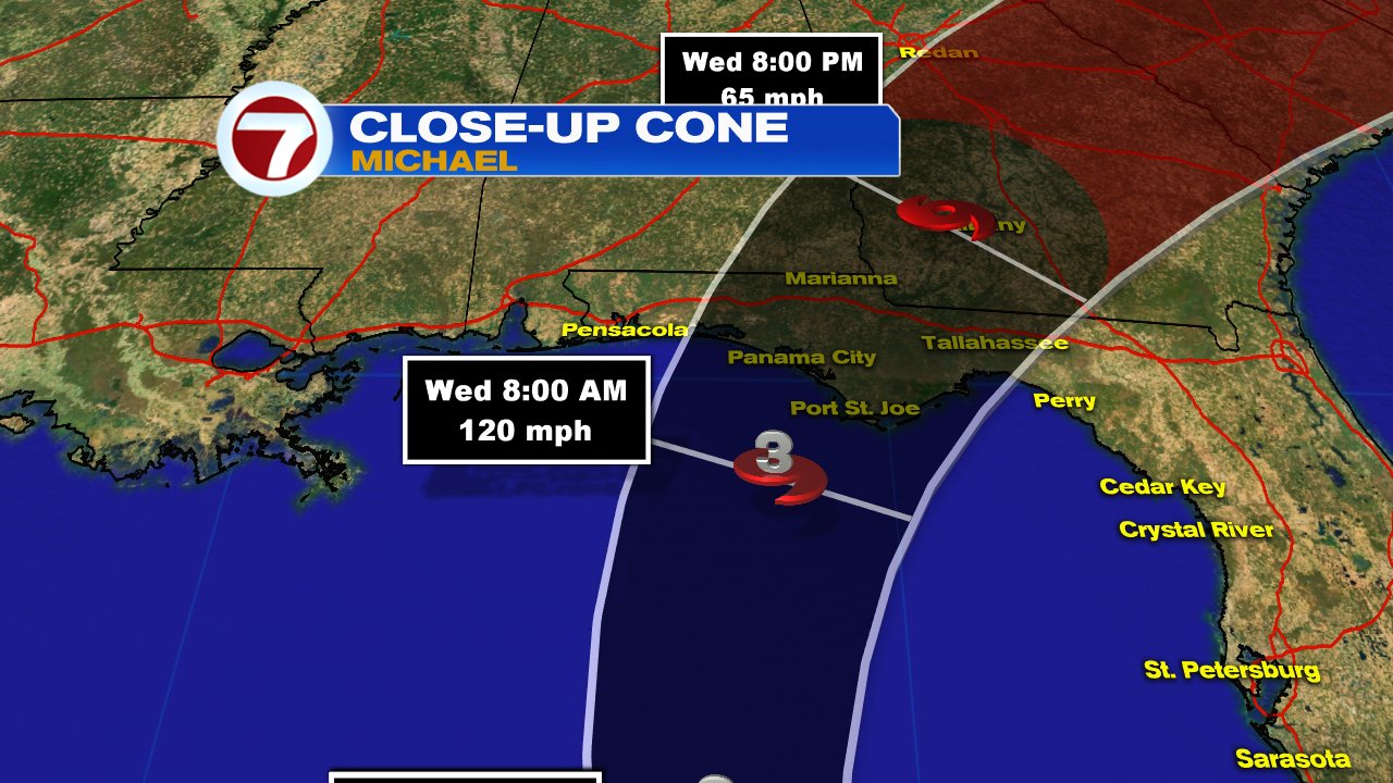
Michael will get steered into the Gulf of Mexico by high pressure in the Western Atlantic. Most models weaken the shear over the next 24 hours. That fizzling of the shear along with very warm Gulf waters, will provide enough fuel for Michael to grow stronger. It could very well be a category 3 just before landfall across the Panhandle. Hurricane Warnings are in place for that area.
Wind Field
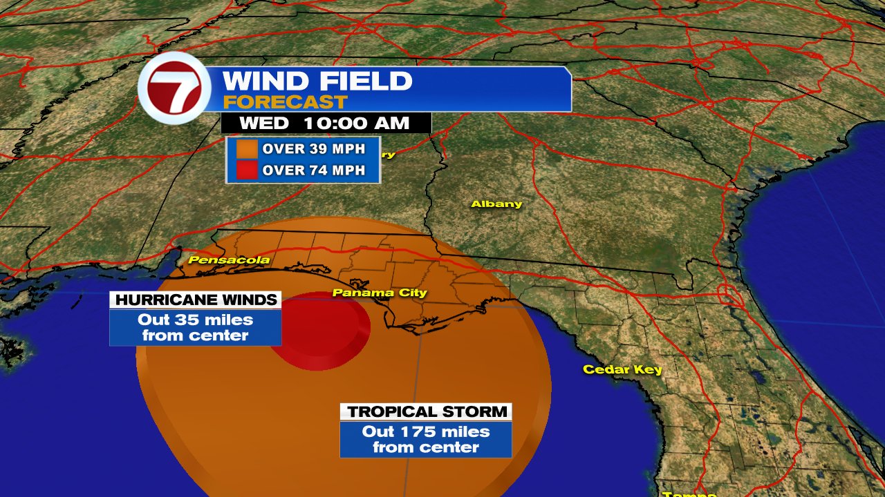
Hurricane force winds (74 mph +) extend out from the center 35 miles. Tropical Storm force winds, reach out from the center as far 175 miles.
If nothing were to change with its intensity, forward speed, or direction, the strongest winds should be near Panama City around noon Tuesday. Tropical storm force winds could possibly reach as Far East as Tallahassee and as far west as Pensacola.
Heavy Rain
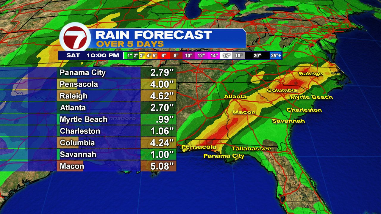
Michael is also capable of heavy rain. The highest amounts over 5 days will stretch from Pensacola Northeast into the Mid Atlantic States. The Carolinas do not need any more rain or flooding as they are just starting to clean up after Hurricane Florence.
South Florida Forecast
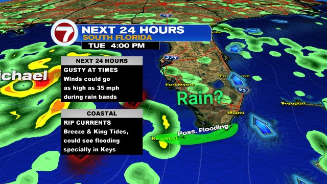
Michael's impacts on our area will be a tad difficult to forecast. As the storm gets stronger, its spin will pull moisture towards the center. This inward pull could drag all the rain away from South Florida. and thus keep us drier. But, moisture south of Cuba could make it all the way here and bring us on & off heavy downpours.
Our in-house model is not calling for much rain, but any that does make it here might be heavy enough to cause some street flooding. If we get any squally weather, winds could briefly kick up to 35 mph.
At the beaches rip currents will be an issue.
Because it may be breezy, the wind could help our already high King Tides, get even higher. This will keep the threat of coastal flooding in place for the Beaches with a higher chance for the Keys.
We'll keep you posted


No comments:
Post a Comment