Michael was upgraded to hurricane status at 11 am Monday morning by the National Hurricane Center (NHC), and is on pace to grow stronger as it aims for Florida's big bend.

While the general motion of the system is towards the Eastern Gulf of Mexico, hurricane hunters continue to indicate the center is still drifting East. The Florida Keys should continue to monitor the track of the storm. Even if it stays on a northward track, you will still feel its impacts.
Health Status:

An eye is beginning to appear
Plenty of warm water for it to intensify further
Where is it headed?

The official cone from NHC, takes Michael into the Gulf of Mexico, then late on Tuesday, turns it into North Florida. It could make landfall anywhere between the Big Bend and the Panhandle. There is also a chance it could become a major hurricane, category 3 (111 mph winds), just before moving onshore. Everyone there should be preparing now.
Once it makes landfall, the misery will not be over as models keep it somewhat organized as it moves across the Carolinas dropping more rain, something they do not need. They are still dealing with Florence's aftermath.
So why this track?
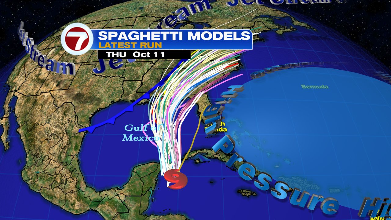
Tropical systems do not move on their own, they need something else to push it around. These are called steering winds. High pressure in the Atlantic, has winds flowing clockwise, while the jet stream over the nation's midsection with a trailing front, has winds flowing counterclockwise. The combination of these, will push Michael north and then northeast. A reminder the atmosphere is not stagnant and any deviation of the above can have a direct impact on the future track.
- The following are the Most Important Points NHC wants you to know:
- Michael is forecast to get stronger
- Life threatening surge is possible along the West Coast of Florida regardless of where it makes landfall
- Heavy rainfall may lead to dangerous flash flooding from the Big Bend to the Carolinas
All of the above can be expected
across Western Cuba and NE Yucatan.

South Florida impacts:
While the system may track to our west, its impacts will be felt hundreds of miles away from the center.
- Coastal Flooding: High tides are already running higher due to the seasonal King Tides. Add to that gusty onshore winds from Michael, and minor coastal flooding is possible.
- Rain: Most of the rain is situated on the Eastern Side of the storm. If nothing changes on the track, the Keys, the Mainland and even the Bahamas could see on and off stormy weather. If the rain sticks over one area, it could lead to street flooding. The Keys may see 2 - 4 inches of rain through Tuesday.
- Wind: There is a possibility that the wind could briefly gust up to 30 - 40 mph during any rain bands that move in.
- Tornadoes: The ingredients will be present in the atmosphere for twisters to form through Tuesday.
We will be monitoring.
No comments:
Post a Comment