Labor Day Monday begins with a Traffic Jam in the Tropics and two depressions to watch. The National Hurricane Center (NHC) is now issuing advisories on Tropical Depression 17 which formed Sunday night at 11 pm and Tropical Depression 18 which organized Monday at 5 am Monday.

Presently there are 4 areas in the tropics being monitored by NHC.
- One yellow area with a very low chance for organization
- Orange area with a medium chance for growth
- New TD 17.
- New TD 18.

We are almost at the peak of hurricane season and have already see storms A-O. We may run out names this season and may have to resort to the Greek Alphabet to track additional systems. The last time this happened was the record setting year of 2005.
Satellite Loop

You can see the double spins in the Satellite Loop. Both will be moving to the west/northwest.
Where is TD 17heading?
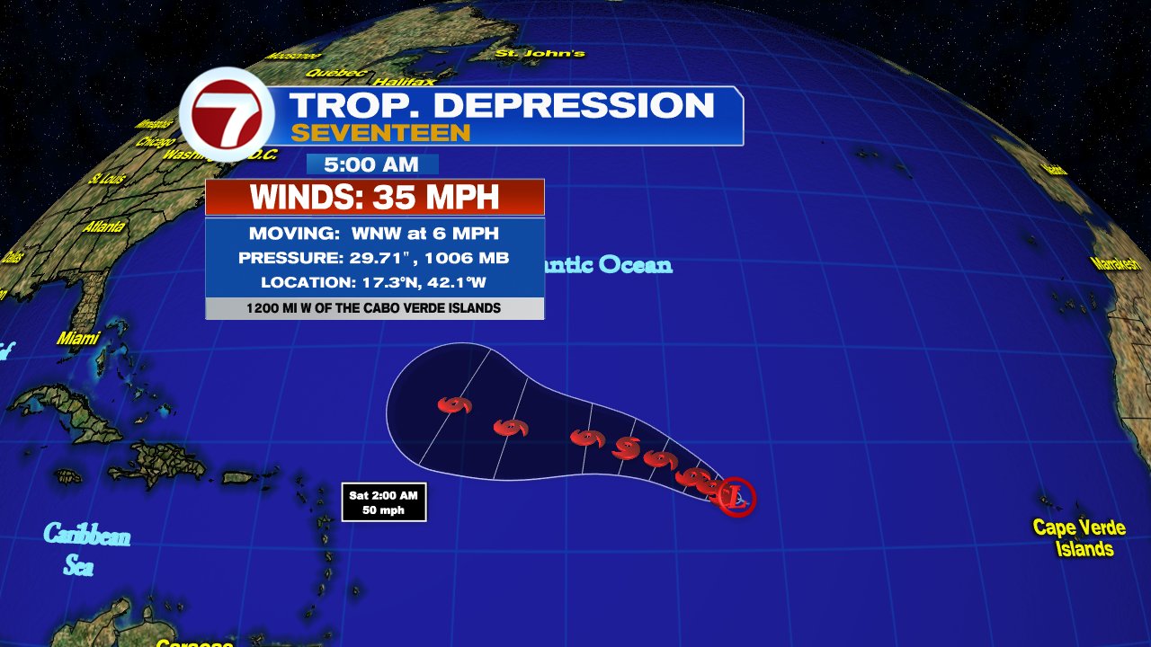
NHC says there could be some issues in the track due to possible interaction with TD 18 by the Cape Verde Islands. This may prevent TD 17 from traveling too far north.
TD 17 is also forecast to remain as a Tropical Storm. NHC suggests dry air in its path will be responsible for keeping it in check over the next four days, possibly topping off at 65 mph winds in 72 hours. But by day 5, they say strong southerly upper winds known as shear is forecast to weaken the system further.
New TD 18
Where is it Going?

The system will look for a weakness in the Bermuda High, and start turning northward by day 5 in its trajectory. It may reach hurricane status in a few days.
We'll be watching
No comments:
Post a Comment