The last El Niño was during 2015-16. Scientist say it was one of the most powerful weather events of the last 145 years. They add, that winter beach erosion along the west coast was 76% above typical with most beaches in California erodeding beyond historical extremes.
While El Niño creates havoc in many areas around the globe, for us, it tends to make for more hostile conditions in order for hurricanes to grow.
The 2015 season was below average, with 11 named systems, out of which 4 turned into hurricanes, and out of that number, 2 became major hurricanes. (Cat 3 and above) . An average season calls for 12,6,and 3.
Is there a return of "El Niño" for this year?
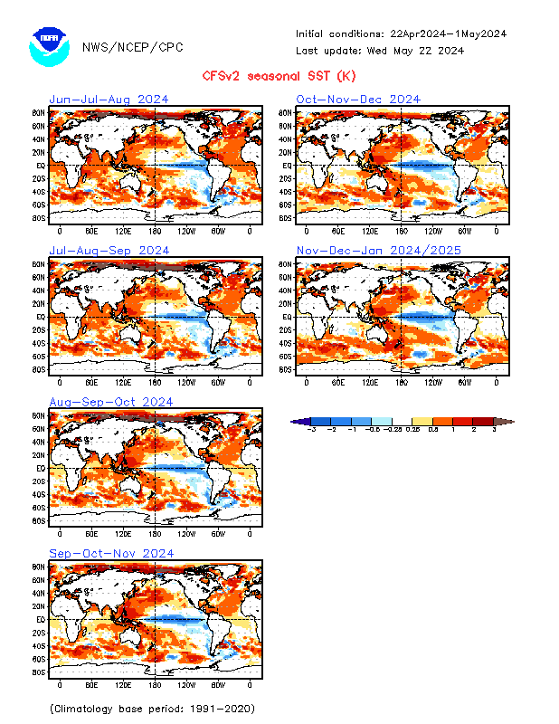
There are many factor to consider, but NOAA's outlook is calling for warmer ocean conditions starting in July.
The graphic shows warmer ocean temps in red. The Pacific is looking pretty good into the months of Match, April, and May as illustrated in the first upper left hand panel. But by July, August, and September, in the upper right hand panel, the red streak in the Pacific off South America seems to be growing.
Could this be the start to an El Niño event? We'll have to wait and see.
No comments:
Post a Comment