In the past, NHC needed something, a sub tropical system or a depression to form in order for tracking to begin and for locations in its path to start getting ready. There was a risk to the old method. What if something is aiming for you for days and doesn't develop until just before landfall. It could be devastating. It doesn't even need to be of storm or hurricane strength to cause problems. Remember all the rain here about a week ago, without a tropical system?

We have the very first one just East of the Windward Islands and it could impact the region by Monday night.
It carries the number 2 with it for consistency since we've already had "Arlene" which became a Tropical Storm in the Atlantic between April 19th and 21st.
Once this low in the Atlantic reaches maturity it will then carry the second name on the hurricane list, Bret.
Radar and advisories:
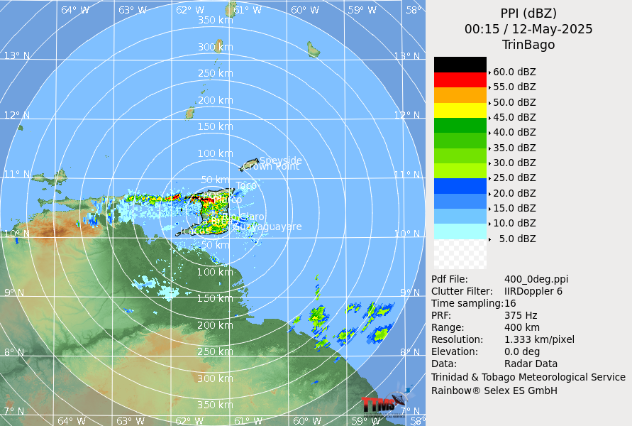
A Tropical Storm Warning is in effect for...
* St. Vincent and the Grenadines
* Trinidad
* Tobago
* Grenada
The government of Barbados has discontinued its Tropical Storm
Warning.
This system will continue to move west through the Southern Caribbean and models suggest it may fall apart in the middle of the Caribbean Sea in about 5 days.

More rain for South Florida?
We may have a similar situation developing closer to us. NHC is following an area of disturbed weather with a very high chance for development. Its been this way for awhile now and has yet to form.
 It remains as a huge area of clouds and rain in the Western Caribbean Sea drenching the region. It is forecast to eventually move into the Gulf.
 Because of its proximity to land, advisories may be started here as well even before the system develops.
For South Florida and even the NW Bahamas, some of this rain could get spun in our direction. It may be soggy for a few more days.
Please check back every so often for updates regarding this disturbance. Even if nothing happens, its a good way to check your supplies.
No comments:
Post a Comment