Monday, June 19, 2017

Potential Tropical Cyclone...what?

We start the week with a new term in the world of hurricane tracking, a Potential Tropical Cyclone. Once understood, its a basic and simple idea. Its more of a procedural thing actually. This now allows the hurricane center to issue advisories on a system that has yet to develop.

In the past, NHC needed something, a sub tropical system or a depression to form in order for tracking to begin and for locations in its path to start getting ready.  There was a risk to the old method. What if something is aiming for you for days and doesn't develop until just before landfall. It could be devastating. It doesn't even need to be of storm or hurricane strength to cause problems. Remember all the rain here about a week ago, without a tropical system?

So the National Hurricane Center came up with a way of initiating advisories even before a system develops and they call it "Potential Tropical Cyclone".

We have the very first one just East of the Windward Islands and it could impact the region by Monday night.

It carries the number 2 with it for consistency since we've already had "Arlene" which became a Tropical Storm in the Atlantic between April 19th and 21st.

Once this low in the Atlantic reaches maturity it will then carry the second name on the hurricane list, Bret.

Radar and advisories:

Tropical Storm Warnings are in place for the following:

A Tropical Storm Warning is in effect for...
* St. Vincent and the Grenadines
* Trinidad
* Tobago 
* Grenada
The government of Barbados has discontinued its Tropical Storm
Warning.


This system will continue to move west through the Southern Caribbean and models suggest it may fall apart in the middle of the Caribbean Sea in about 5 days.


More rain for South Florida?
We may have a similar situation developing closer to us. NHC is following an area of disturbed weather with a very high chance for development. Its been this way for awhile now and has yet to form.

It remains as a huge area of clouds and rain in the Western Caribbean Sea drenching the region. It is forecast to eventually move into the Gulf.

Because of its proximity to land, advisories may be started here as well even before the system develops.

For South Florida and even the NW Bahamas, some of this rain could get spun in our direction. It may be soggy for a few more days.

Please check back every so often for updates regarding this disturbance. Even if nothing happens, its a good way to check your supplies.


Sunday, June 18, 2017

UPDATED Tropical System in the Gulf?

As of 5 pm Sunday:
Potential Tropical Storm Advisory issued for the Windward Islands. 
A TROPICAL STORM WARNING has been issued for Barbados, St, Vincent, and the Grenadines for the possible impact of tropical storm force winds over the next 36 hours. 
This is new this year. NHC can start issuing advisories even before a system organizes. This can give communities the extra time they need to prepare. 


The area of disturbed weather is roughly 815 miles ESE of the Windward Islands and moving rapidly towards them at around 23 mph. It is expected to get stronger and could reach tropical storm status on Monday as it nears the islands.
All interests across the Windward Islands and Northern Venezuela should prepare accordingly.

2 PM UPDATE: Latest satellite observations show the broad area of low pressure in the Western Caribbean Sea DOES NOT have a well defined center. The Recon mission for this afternoon has been cancelled.  This area of clouds and rain is still producing heavy downpours and still has a high chance for development over the next few days.  Hurricane hunters remain on stand-by for Monday.

Sunday morning post:
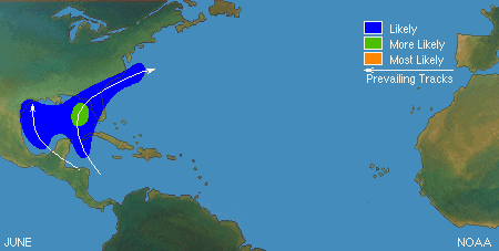
There is a high chance we may be tracking something in the Gulf this coming week.  As of Sunday morning, the National Hurricane Center (NHC) is following a broad area of low pressure sitting in the Northwestern Caribbean Sea. It is slowly moving into the Gulf of Mexico and regardless of development, it will dump plenty of rain.  NHC is giving this feature a 90% chance for development over the next 5 days. A hurricane Hunter plane is scheduled to fly into the area Sunday afternoon if needed.


This enhanced satellite loop detects the areas of highest rainfall in bright yellows, oranges, and reds.

It is centered over Western Cuba, Gand Cayman, and the Yucatan Peninsula with plenty of rain coming down over the region.

We are looking for the possibility of a counterclockwise spin with this low. It has been trying to do that for the last 24 hours.

What we really need is to get the vital signs, specially surface winds and pressure readings. The only way we can do the is with a recon mission. Because NHC wants to Investigate this area further, it has been named INVEST93L.

FLOODING

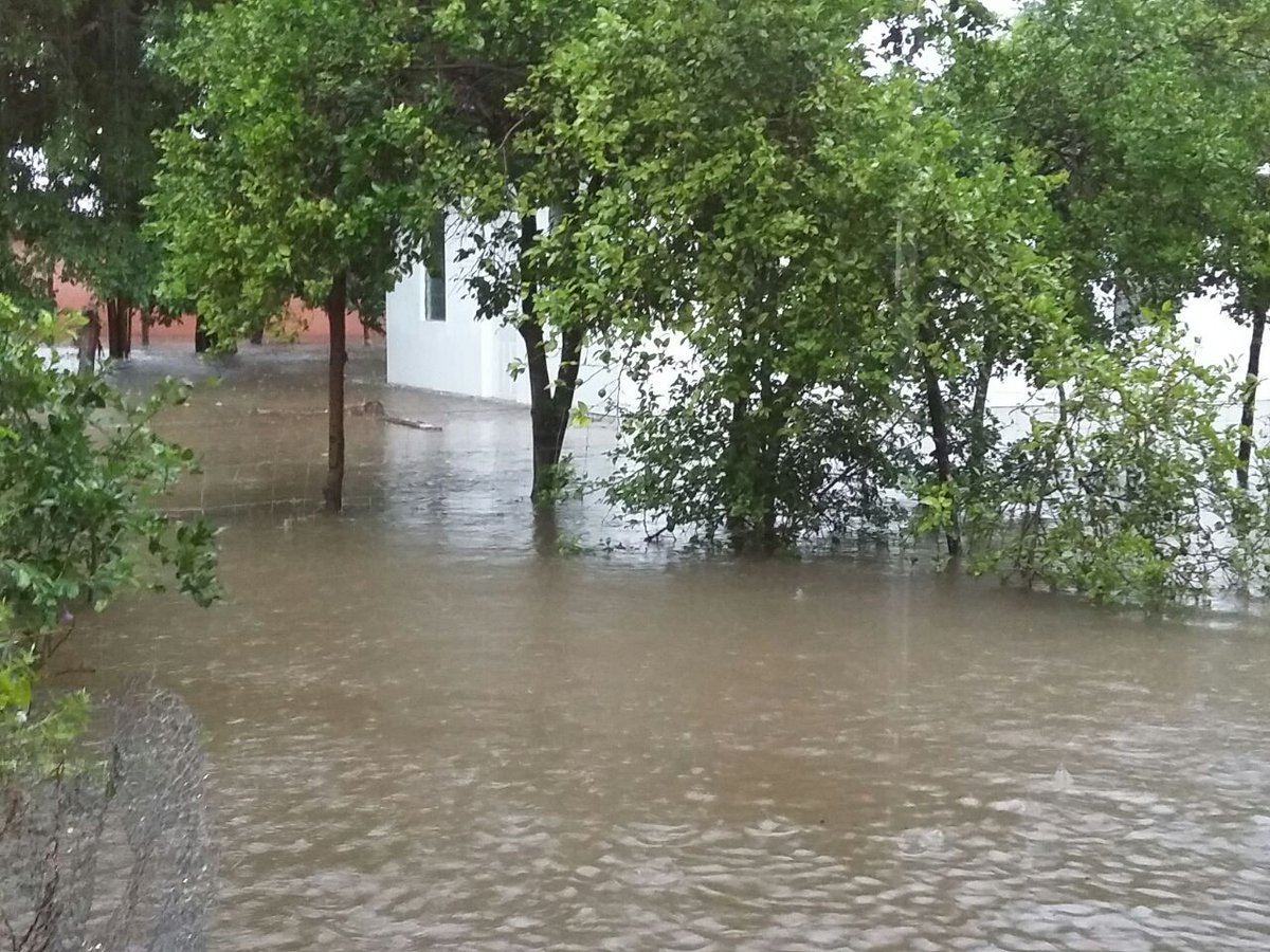
Image posted on Twitter by Jamaica Gleaner. Follow them for more pictures
Rain continues to be a big factor throughout the Western Caribbean Sea. 

Jamaica had been under flood advisories throughout Saturday, and those may get extended if the downpours persist. The Jamaica Gleaner News tweeted pictures of flooded areas like this one showing the Milk River in Clarendon. 
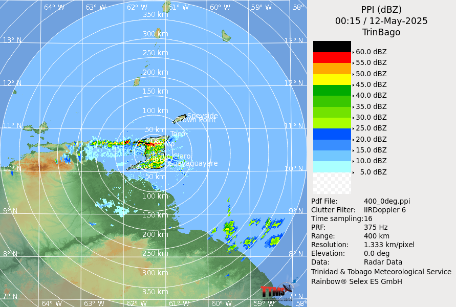
REGIONAL RADAR
Grand Cayman, Western Cuba, and parts of Central America are also under the threat of rain as the system organizes and moves into the Gulf. The weather will continue to go down hill for them as well.   


Models:
More models are issuing forecast tracks today, and at least on the short term, they are taking whatever develops into the Gulf, and then possibly aiming it anywhere between Texas. Louisiana, and Florida. 

Keep in mind that models need a good starting point to issue their forecast tracks and since nothing has developed yet, no good starting point means no good ending point.


South Florida:
Our long range outlook depends on whatever happens in the Gulf during the next few days. Even if a system develops and aims for Louisiana or Texas, we may get some downpours. 

If it takes a turn towards Northern Florida, more rain may be expected. This is a good time to review your plans and make sure you have everything you need in case Mother Nature throws us a curve ball.  We'll keep you posted.


Another Worry?

Another area of low pressure is sitting roughly 1000 miles ESE of the Windward Islands and aiming for the are at around 20 mph. It has a 50% chance of becoming a depression or a tropical storm over the next few days. A recon mission has been planned for Monday to get a better idea of the development process within this low.
Models:
As mentioned above, these are preliminary outlooks and until we get a fix on a possible center they are not set in stone. These early tracks show a consistent movement to the middle of the Caribbean Sea. If it develops, it could impact everyone from the Windward Islands to Jamaica, Haiti, Dominican Republic, Cuba and Grand Cayman.  Its impossible to tell how strong or weak this may be as it tracks through the region so please monitor closely.


I'll be hoping for the best.


Saturday, June 17, 2017

Recon on Stand-by

An area of low pressure sitting in the Western Caribbean Sea is looking healthier.  A hurricane hunter plane is now on stand by to check the disturbance on Sunday.  Satellite imagery suggests a broad low has formed and t-storm activity is showing the start of organization. NHC is giving it an 80% chance for development over the next 5 day.

This is an enhanced satellite loop centered just East of the Yucatan Peninsula. The brighter orange and red colors represent the higher cloud tops.

The higher cloud tops is where you will find the strongest storms.

The storms are trying to rotate counterclockwise and form a closed circle. When that happens, its a sure sign we have an organized system.

As of Saturday afternoon, a strong upper wind to the north was stopping that from happening.

NHC says:   Regardless of development, heavy rains are likely over portions of Central America, the Yucatan Peninsula, Jamaica, Cayman Islands, and Western Cuba over the next few days.

Jamaica Advisories:
Flood advisories have been in effect for much of the country. They will probably be extended in some way through Sunday.
  • A Flash Flood Warning for low-lying and flood-prone areas of St. Mary, Portland, St. Thomas, Kingston and St. Andrew, St. Catherine, Clarendon, Manchester, Trelawny and St. Ann.
  • A Flash Flood Watch for low-lying and flood-prone areas of St. Elizabeth, Westmoreland, Hanover and St. James., Clarendon, Manchester, Trelawny and St. Ann.

Grand Cayman will see a chance for on and off downpours as the low intensifies and moves northwest. This is the Cayman radar.


Forecast Models:
Model runs at this stage are very unreliable. They need a good starting point or a good spin, in order to forecast a track. Right now they are just providing an educated guess.


This is what the first few projections are showing. The black triangle forecast is a simplistic track... it shows, whichever way the low is moving now, is where it will continue to go.

But many things can influence a trajectory, fronts, upper winds, even other nearby lows.
Some of the other models here take that into account.

Formation Areas:
One reason why we are watching this low carefully is because of the area it is being born. System that are spawned here tend to, on average, move into the Gulf impacting areas from Mexico to Cuba and Florida.

Hopefully nothing much comes from this and at most its just a good way to make sure you are ready in case something threatens South Florida. Stay tuned.

The figures show the zones of origin and tracks for different months during the hurricane season. These figures only depict average conditions. Hurricanes can originate in different locations and travel much different paths from the average. Nonetheless, having a sense of the general pattern can give you a better picture of the average hurricane season for your area.

fdgdfgdf

Tuesday, June 13, 2017

Caribbean Development?

The National Hurricane Center (NHC) is keeping its eyes on an area of the Caribbean that could sprout a low pressure system in the days ahead. Nothing is there now but models are hinting at something developing that may drop plenty of rain across parts of the Yucatan Peninsula,  Central America, and maybe Western Cuba.

The "Worry Meter" is very low on this for South Florida & the Bahamas, but it is worthy of watching since it will be sitting over an area extremely favorable for storms to form.

In the month of June, the Caribbean Sea & Gulf of Mexico are the primary spots for emerging tropical activity. Typical tracks are to the Gulf States and Florida.

NHC says:
A broad area of low pressure is expected to form over the
northwestern Caribbean Sea and adjacent land areas by the weekend.
Some gradual development of this system is possible thereafter while
it moves slowly northwestward.
* Formation chance through 48 hours...low...near 0 percent.
* Formation chance through 5 days...low...20 percent.
 

Other Activity:
There are a handful of tropical waves moving East to West in the Atlantic Basin. While it may look impressive, most are proving much needed rain through the region. This is average and nothing to worry about. In the Pacific, the remnants of Tropical Storm "Calvin" is still dumping rain across Southern Mexico.


What to do now:
Keeping checking back over the next few days for further developments.
 

Friday, June 9, 2017

More Tropical Rain?

Much of South Florida has seen more rain these last 9 days, than what is average for the entire month of June. The ground is saturated and any additional rain will lead to more flooding.

It appears Saturday and Sunday will get its fair share of downpours, so this soggy mess may not be over.

The reason for the rain is a disturbance basically sitting as a line of clouds extending from Western Cuba, through South Florida, over the Bahamas, and into the Western Atlantic.

This line of clouds is like a magnet drawing in plenty of moisture from the Gulf and dumping it over us.

I am hoping this constant "Train of Rain" weakens a bit by Sunday to give us a break.

Long Range Outlook:
It may be wet for awhile. The National Weather Service Climate Prediction Center, is in charge of looking at long range trends and issuing a once a week weather outlook. It is based on broad scale conditions

They are looking at possible development of a tropical system either in the SW Gulf of Mexico or NW Caribbean Sea, between June 14-20th.


  • On the graphic above, look at the map that says "Week 2". There are two areas highlighted with red and white stripes. 
  • The  ECMWF, GFS, and Canadian model guidance indicate potential formation of a tropical system near those areas.   
  • NWSCPC tweeted Friday afternoon they were moderately confident such a feature would develop.


Moderate confidence of the second Atlantic tropical cyclone of the year forming between June 14-20 near the Yucatan

The reason why I am mentioning this, is that the areas indicated for possible formation,  are areas where most systems develop during the month of June. The typical tracks taken by these system are into Mexico, the Gulf States and even Florida.

We've all seen the problems copious amounts of rainfall can cause without a tropical system.

We surely don't need anymore.  I will keep updating you on this possible formation in the tropics.

All we can do is watch & wait and see what finally happens.